
A rider never thinks of a road as impossible, a rider is made of the journey, the ups and downs and the undeniable attraction for the roads. There is a famous saying by Tony Robbins,
"The only impossible journey is the one you never begin”
Isn't it so? While the highest motorable roads in the world can be the most difficult ones as well, but what keep the fire alive is the need to conquer the thirst.
Imagine driving on theses road where the clouds are your companions, and the peaks of the mighty ancient Himalayas are just an arm's length away. The thrill of navigating through some of the most rugged terrains, the vistas that stretch as far as the eye can see, and the sheer joy of standing at the pinnacle of motorable paths—this is the experience of conquering the highest motorable roads in the world.
Here each pass tells a story of perseverance against the odds, of landscapes so surreal they seem almost otherworldly, and of adventures that leave an indelible mark on every traveler who dares to take on the challenge.
Toast to the highest motorable roads in the world. Let the journey begin through words now, later through the roads.
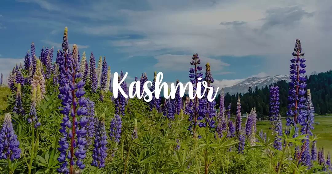
Top 10 Highest Motorable Roads in the World
1. Umling La, Pass of the Highlands - 5,799 Mtrs or 19,024 Feet
2. Dungri La (Mana Pass), Pass of the Valley - 5,610 Mtrs or 18,406 Feet
3. Marsimik La, Red Pass - 5,582 Mtrs or 18,314 Feet
4. Photi La, Pass of Photographs - 5,524 Mtrs or 18,124 Feet
5. Semo La, Quiet Pass - 5,565 Meters or 18,258 Feet
6. Dongkha La, Pass of the Eastern Gate - 5,486 Mtrs or 17,999 Feet
7. Kaksang La, Pass of the Snow Peaks - 5,438 Mtrs or 17,841 Feet
8. Suge La, Pass of the Wind - 5,430 Meters or 17,815 Feet
9. Chang La, Pass to the South - 5,360 Meters or 17,586 Feet
10. Khardung La, Pass of the Lower Castle - 5,359 Meters or 17,582 Feet
1. Umling La (Umlingla Pass) - 5,799 Mtrs or 19,024 Feet
When you embark on a journey to Umling La, the highest motorable road in the world, know that you're in for an unparalleled adventure.

Situated in the Ladakh region of India, this pass towers at an altitude of 5,799 meters (19,024 feet). The road conditions here are rugged, with steep inclines and hairpin bends that test the skills of even the most seasoned drivers. The landscape is stark and barren, yet stunningly beautiful, offering panoramic views of the snow-capped peaks and arid valleys of Ladakh.
Nearby Attractions: As you traverse Umling La, you can explore the remote villages of Ladakh, such as Hanle, which is known for its astronomical observatory.

The pristine beauty of the Tso Moriri Lake and the wildlife sanctuary around it are also worth a visit.
Preferred Route Map To Reach Umling La:
Leh → Hanle → Umling La
- Leh to Hanle: 255 km, approx. 8-9 hours drive.
- Hanle to Umling La: 87 km, approx. 4-5 hours drive.
2. Dungri La (Mana Pass) - 5,610 Mtrs or 18,406 Feet
Dungri La, also known as Mana Pass, is another high-altitude marvel located on the border between India and Tibet. Stationed at 5,610 meters (18,406 feet), Dungri La Pass is located in the Chamoli district of Uttarakhand, near the village of Mana, which is famously known as the last village of India.

The pass is accessible via the road leading from Mana village, which is about 24 kilometers from the renowned pilgrimage site of Badrinath. It is in the Zanskar range of the Himalayas, known for its rugged terrain and breathtaking vistas. One key highlight of this region is you can spot snow leopards and Himalayan blue sheep here as well.
Nearby Attractions: Don't miss a visit to the sacred Badrinath Temple, just a few kilometers from Mana village.

The Vasudhara Falls and the confluence of Alaknanda and Saraswati rivers are other natural wonders in the vicinity.
Preferred Route Map:
Joshimath → Mana Village → Mana Pass
- Joshimath to Mana Village: 50 km, approx. 2 hours drive.
- Mana Village to Mana Pass: 24 km, approx. 1.5-2 hours drive.
3. Marsimik La - 5,582 Mtrs or 18,314 Feet
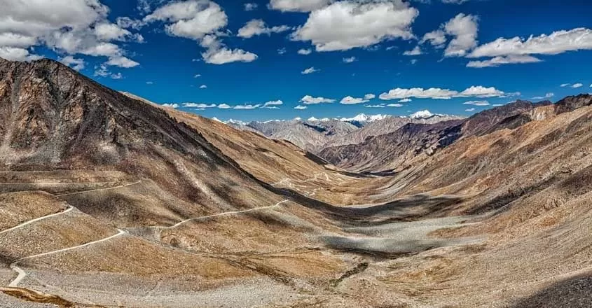
Marsimik La, standing at 5,582 meters (18,314 feet), is one of the highest passes in the Ladakh region of India and is also one of the highest motorable roads in the world. The road leading to this pass is rocky and steep, and demands a lot of high endurance and determination.
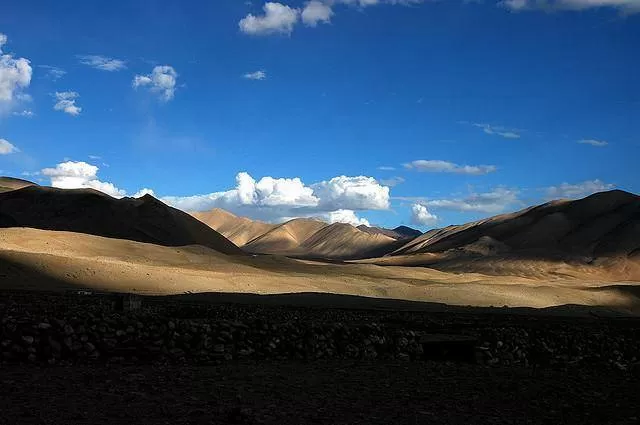
Access to Marsimik La is generally from Leh via the Pangong Lake route and it holds strategic importance due to its proximity to the border with China. You will be surely mesmerised with the awe-inspiring view of the Changthang Plateau and the distant peaks of Tibet from this pass.
Nearby Attractions: Marsimik La is close to the famous Pangong Lake, known for its ever-changing hues.

The Changthang Wildlife Sanctuary, home to rare species like the Tibetan wild ass and black-necked cranes, is also nearby, a perfect stop to enjoy the Ladakhi terrain.
Preferred Route Map:
Leh → Pangong Lake → Phobrang → Marsimik La
- Leh to Pangong Lake: 160 km, approx. 5-6 hours drive.
- Pangong Lake to Phobrang: 22 km, approx. 1 hour drive.
- Phobrang to Marsimik La: 42 km, approx. 3-4 hours drive.
Check out the Complete Leh Ladakh Itinerary For 2024
4. Photi La - 5,524 Mtrs or 18,124 Feet
Photi La is a lesser-known yet spectacular pass in Ladakh, situated at 5,524 meters (18,124 feet). Photi La is located near the Changthang plateau, south of the town of Hanle and northeast of the famed Tso Moriri Lake. The journey to Photi La typically starts from Leh, the largest town in the region, which is about 250 kilometers away.

The route involves traveling through the picturesque landscapes of Ladakh, passing through villages like Nyoma and Loma. The road conditions here are rough, with loose gravel and steep slopes, making it quite difficult for a smooth ride. It is part of the Trans-Himalayan range and is made up of rugged terrain, high-altitude desert landscape, and stunning panoramic views. However, you will not be disappointed, your efforts will be highly rewarded with stunning vistas of the surrounding mountains and valleys.
Nearby Attractions: Explore the quaint village of Photoksar, which lies in the vicinity. The Zanskar River and its scenic gorges are also accessible from this region, offering opportunities for river rafting and trekking.

Visit nearby Hanle which is home to one of the world's highest astronomical observatories, the Indian Astronomical Observatory.
Read more about the Hemis Festival in Ladakh
Preferred Route Map:
Leh → Hanle → Photile
- Leh to Hanle: 255 km, approx. 8-9 hours drive.
- Hanle to Photi La: 50 km, approx. 2 hours drive.
5. Semo La - 5,565 Meters or 18,258 Feet
Located in the central part of the Tibetan Plateau in the Tibet Autonomous Region of China, Semo La rises to an altitude of 5,565 meters (18,258 feet). The road here is relatively well-maintained but can be challenging due to its high altitude and thin air.

The pass is accessible from Lhasa, the capital of Tibet, which is about 540 kilometers away. Semo La connects the town of Lhatse with the remote regions of western Tibet. It lies in the northern section of the Nyenchen Tanglha Mountains. Visiting ancient monasteries, interacting with nomadic herders, and witnessing traditional practices will surely add a different flavour to the trip.
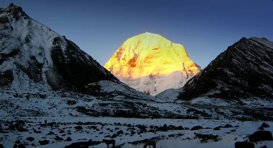
Nearby Attractions: Visit the sacred Mount Kailash and Lake Manasarovar, both revered by pilgrims.
The nearby town of Saga offers a glimpse into Tibetan culture and traditions.
Preferred Route Map:
Lhasa → Nakchu → Semo La
- Lhasa to Nakchu: 320 km, approx. 6-7 hours drive.
- Nakchu to Semo La: 150 km, approx. 3-4 hours drive
6. Dongkha La - 5,486 Mtrs or 17,999 Feet
Although one of the highest motorable roads in the world, the Dongkha La, also known as Donkia La, is still a remote and less frequented pass, offering a peaceful but challenging ride.

Dongkha La is part of the Eastern Himalayan range and is characterized by its high-altitude terrain, glacial landscapes, and stunning mountain scenery. he pass connects the Lachen region in Sikkim with Tibet. The nearest major town is Gangtok, the capital of Sikkim, which is about 150 kilometers away. Key highlight of riding through this pass is that it offers breathtaking views of the surrounding peaks, including the majestic Mount Khangchendzonga, the third highest mountain in the world.
Nearby Attractions: The scenic Gurudongmar Lake, one of the highest lakes in the world, is a must-visit.

The picturesque Yumthang Valley, known for its hot springs and vibrant flower meadows, is also nearby.
Preferred Route Map:
Gangtok → Lachen → Dongkha La
- Gangtok to Lachen: 125 km, approx. 6-7 hours drive.
- Lachen to Dongkha La: 90 km, approx. 3-4 hours drive.
7. Kaksang La - 5,438 Mtrs or 17,841 Feet
Nestled in the breathtaking landscapes of the Trans-Himalayan region, Kaksang La is another high-altitude pass in the Ladakh region, standing at 5,438 meters (17,841 feet). It is in the southeastern part of Ladakh, near village of Mahe and close to the Tso Moriri Lake.

The pass is a part of the route connecting Mahe to the famous Tso Kar Lake and the broader Changthang plateau region. The journey to Kaksang La typically starts from Leh, the largest town in the region, which is approximately 240 kilometers away.
The road to this pass is rugged, with breathtaking views of the surrounding mountains and valleys. The serene beauty and tranquility of the area make it a favorite among adventure enthusiasts.
Nearby Attractions: The nearby Tso Kar Lake, known for its brackish water and rich birdlife, is worth a visit.

The ancient monasteries of Thiksey and Hemis are also within reach, offering a peek into the region's spiritual heritage.
Know more about the lakes of Ladakh with Tripoto
Preferred Route Map:
Leh → Mahe → Chushul → Kaksang La
- Leh to Mahe: 115 km, approx. 4 hours drive.
- Mahe to Chushul: 80 km, approx. 3 hours drive.
- Chushul to Kaksang La: 40 km, approx. 1.5-2 hours drive.
8. Suge La - 5,430 Meters or 17,815 Feet
Suge La, located in Tibet, is on the route to some of the most sacred sites in Tibet, including Mount Kailash and Lake Manasarovar. It reaches an altitude of 5,430 meters (17,815 feet) and offers panoramic views of the Tibetan Plateau, with snow-capped peaks, vast plains, and pristine glacial rivers. It is among the top 10 highest motorable roads in the world.

The pass is approximately 300 kilometers west of Lhasa, the capital of Tibet. The journey to Suge La involves traveling through some of the most spectacular landscapes of the Tibetan Plateau, passing through high-altitude deserts, serene lakes, and remote Tibetan settlements. The road conditions here are variable, ranging from paved sections to gravel and dirt tracks.
Nearby Attractions: The historic city of Lhasa, with its iconic Potala Palace, is relatively close.

The serene Namtso Lake, one of the largest saltwater lakes in Tibet, is also nearby, offering stunning scenery and a tranquil environment.
Preferred Route Map:
Lhasa → Gyantse → Shigatse → Suge La
- Lhasa to Gyantse: 260 km, approx. 6-7 hours drive.
- Gyantse to Shigatse: 90 km, approx. 2 hours drive.
- Shigatse to Suge La: 150 km, approx. 4-5 hours drive.
9. Chang La - 5,360 Meters or 17,586 Feet
The pass is named "Chang La," which means "Pass to the South" in the local language. Known as the gateway to the Changthang Plateau in Ladakh, it stands at 5,360 meters (17,586 feet). The pass lies on the route that connects Leh to Pangong Tso Lake, one of the most popular tourist destinations in Ladakh.

The journey to Chang La involves a scenic drive through the rugged and stunning landscapes of Ladakh, passing through picturesque villages like Sakti and Tangtse.. Needless to say, the road it full will turns, narrow passages and hairpin bends.
Nearby Attractions: Pangong Lake, with its crystal-clear waters, is a short drive away.

The Hemis Monastery, one of the largest and wealthiest monasteries in Ladakh, is also within easy reach.
Preferred Route Map:
Leh → Karu → Shakti → Chang La
Leh to Karu: 35 km, approx. 1 hour drive.
Karu to Shakti: 20 km, approx. 45 minutes drive.
Shakti to Chang La: 35 km, approx. 2 hours drive.
10. Khardung La - 5,359 Meters or 17,582 Feet
One of the most popular motorable road in the world, Khardung La is located in Ladakh at 5,359 meters (17,582 feet). Khardung La pass is situated about 39 kilometers north of Leh, the largest town in Ladakh.
The pass lies on the important route that connects Leh to the Nubra and Shyok Valleys. This route was historically significant as part of the ancient Silk Road, facilitating trade between India and Central Asia. The key highlight of this pass is definitely the Nubra Valley, known for its unique landscapes, including sand dunes, lush green villages, and the famous double-humped Bactrian camels.
Nearby Attractions: Leh, the largest town in Ladakh, is the starting point for the Khardung La journey.

The Nubra Valley, with its unique sand dunes and Bactrian camels, is accessible from the pass. The Diskit Monastery, with its massive Maitreya Buddha statue, is also a highlight.
Preferred Route Map:
Leh → South Pullu → Khardung La pass
- Leh to South Pullu: 24 km, approx. 1 hour drive.
- South Pullu to Khardung La: 14 km, approx. 1.5-2 hours drive.
These high-altitude passes offer not just the thrill of adventure but also a glimpse into some of the most remote and breathtaking landscapes in the world. These top 10 highest motorable roads in the world are waiting for your arrival. What is stopping you?
Share your experiences with Tripoto in form of comments, articles and photoblogs.
Together let us revolutionize traveling!


' fill='%23359391'%3e %3cpath d='M46.1538462%2c43.5714286 L41.5%2c50 L36.8461538%2c43.5714286 L36.8670256%2c43.5714286 C36.3173077%2c42.7142857 36%2c41.6851429 36%2c40.5714286 C36%2c37.4854286 38.4535641%2c35 41.5%2c35 C44.5464359%2c35 47%2c37.4854286 47%2c40.5714286 C47%2c41.6851429 46.6826923%2c42.7142857 46.1329744%2c43.5714286 L46.1538462%2c43.5714286 Z M41.4294872%2c39 C40.6150641%2c39 39.9487179%2c39.675 39.9487179%2c40.5 C39.9487179%2c41.325 40.6150641%2c42 41.4294872%2c42 C42.2439103%2c42 42.9102564%2c41.325 42.9102564%2c40.5 C42.9102564%2c39.675 42.2439103%2c39 41.4294872%2c39 L41.4294872%2c39 Z' id='Location-white'%3e%3c/path%3e %3c/g%3e %3c/svg%3e)