4.6 / 5

Bumla Pass
📍 Bum La PassView map ›

🗓 Best Time To Visit:May to October

⏰ Open Hours:N/A

🧗 Things To Do:Sightseeing, Photography, Exploring military history

💰 Budget:Entry free, but requires special permit from Indian Army

👥 Traveller Types:Adventure Seekers, Nature Lovers, History Buffs

🏆 Known For:Indo-China Border, war memorial, breathtaking views

🚉 Distances:37 km from Tawang, 290 km from Tezpur Airport, 295 km from Rangapara Railway Station

📜 Permit:Required from Indian Army

🚗 Accessibility:Only by road

❄ Weather:Extremely cold with heavy snowfall during winters

🚩 Tips:Carry warm clothing and proper ID for permit

Have questions about Bumla Pass?Ask the Tripoto Community ›

Bumla Pass: A Guide To The Stunning Border Between India And China

Are you looking for a unique and adventurous destination in India? Do you want to witness the beauty and the contrast of two of the world’s most powerful nations? Do you want to experience the thrill and the challenge of a high-altitude trek? If yes, then Bumla Pass is the place for you.

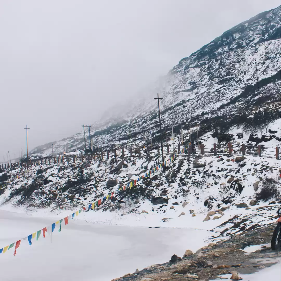
Bumla Pass is a mountain pass that connects India and China at an altitude of 4,572 meters. It is located in the Tawang district of Arunachal Pradesh, about 37 km from Tawang town. Bumla Pass is not only a scenic spot, but also a strategic and historical one. It was the site of a fierce battle between India and China during the 1962 war, and it is also the place where the Dalai Lama crossed over to India in 1959.

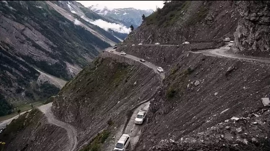
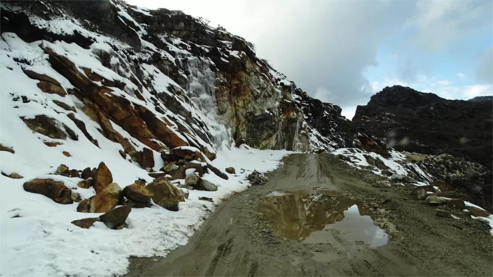
Bumla Pass is a must-visit destination for anyone who loves adventure, nature, and history. However, visiting Bumla Pass is not an easy task. You need to obtain a special permit from the Indian government, hire a local SUV, and trek along a rough and steep road. You also need to be prepared for the cold weather, the low oxygen levels, and the security protocols.

In this article, we will explore everything you need to know about Bumla Pass, from the best time to visit, the things to do, the places to see, and the travel tips to follow.

Best Time To Visit Bumla Pass

The best time to visit Bumla Pass is during the summer months, from May to October. During this time, the weather is clear and pleasant, and the pass is open for visitors. You can enjoy the stunning views of the Himalayas, the valleys, and the lakes, and witness the border meeting point between India and China.

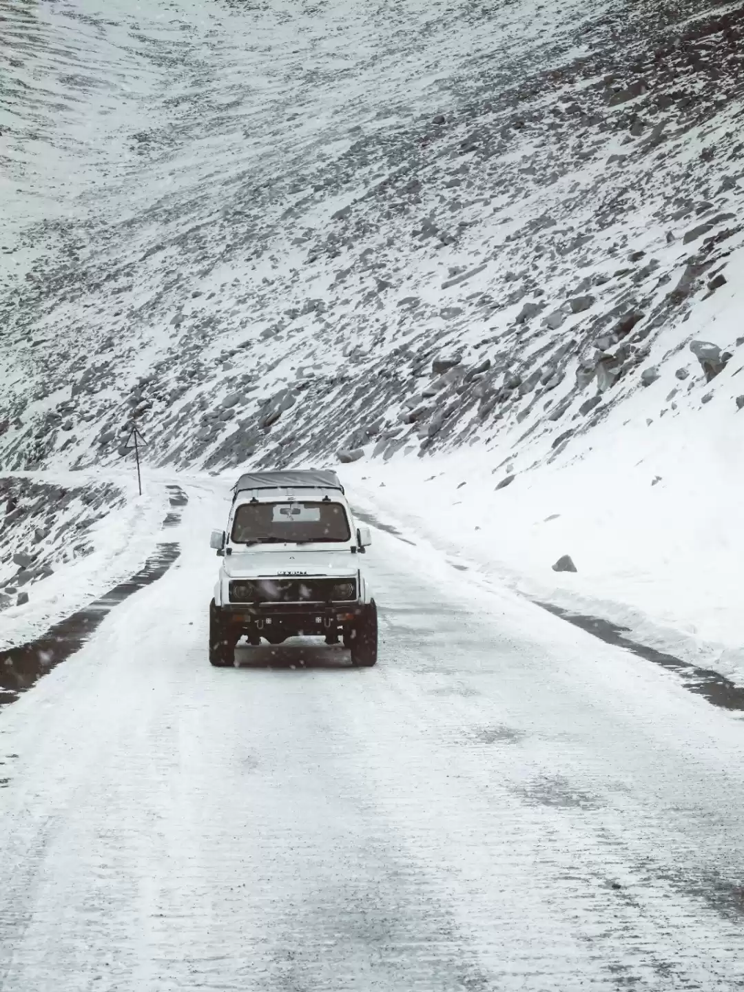
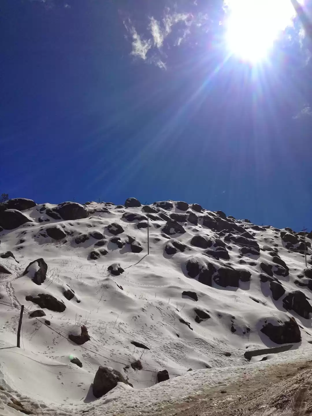
The worst time to visit Bumla Pass is during the winter months, from November to April. During this time, the pass is closed due to heavy snowfall, and the road conditions are dangerous. You may not be able to reach the pass, or you may get stuck there. The temperature can drop below zero degrees, and the visibility can be poor.

Things To Do At Bumla Pass

There are many things to do at Bumla Pass, depending on your interests and preferences. Here are some of the activities that you can enjoy at Bumla Pass:

Trekking:

If you love trekking, then Bumla Pass is a perfect destination for you. You can enjoy the scenic views of the Himalayas and the valleys as you trek along the rugged terrain of the pass. The trek is not very difficult, but it is challenging due to the high altitude and the low oxygen levels. You need to be physically fit and mentally prepared for the trek.

Camping:

If you want to experience the thrill of camping at one of the highest passes in the world, then you can try camping at Bumla Pass. You can pitch your own tents and sleep under the stars, surrounded by snow-capped mountains and serene lakes. However, you need to bring your own tents, sleeping bags, and other camping equipment, and follow the safety guidelines. You also need to respect the local culture and customs, and do not litter or make noise.

Photography:

If you are a photography enthusiast, then Bumla Pass is a paradise for you. You can capture the stunning beauty of Bumla Pass and its surroundings, from the colorful prayer flags, the border meeting point, the frozen lakes, and the wildlife. You can also take some amazing selfies and group photos with the backdrop of the mountains and the border. However, you need to use a good camera and a tripod, and respect the local culture and customs. You also need to follow the security protocol and do not take photos without permission.

Witnessing the border meeting point:

One of the most fascinating things to do at Bumla Pass is to see the place where the Indian and Chinese soldiers meet for friendly exchanges and ceremonies. You can observe the protocol and etiquette of the border personnel, and see how they greet each other, shake hands, and exchange gifts. You can also see the line of control that separates the two nations, and the barbed wire that marks the boundary. However, you need to respect the security protocol and do not cross the line of control or touch the barbed wire.

Places To Visit Near Bumla Pass

Bumla Pass is not the only attraction in the Tawang district of Arunachal Pradesh. There are many other places to visit near Bumla Pass, that can enhance your trip and make it more memorable. Here are some of the nearby places that you can visit from or near Bumla Pass:

Photo of Bumla Pass 1/2 by

Tawang Monastery:

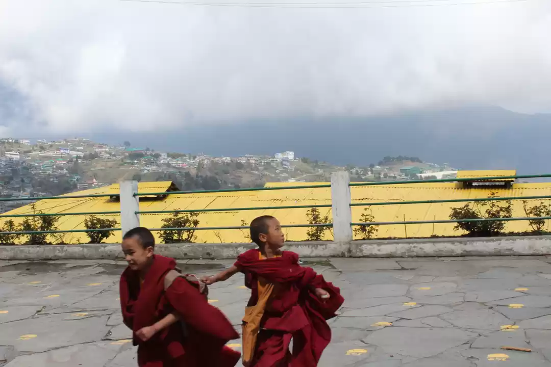
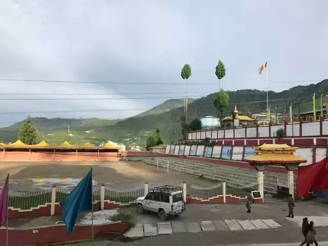
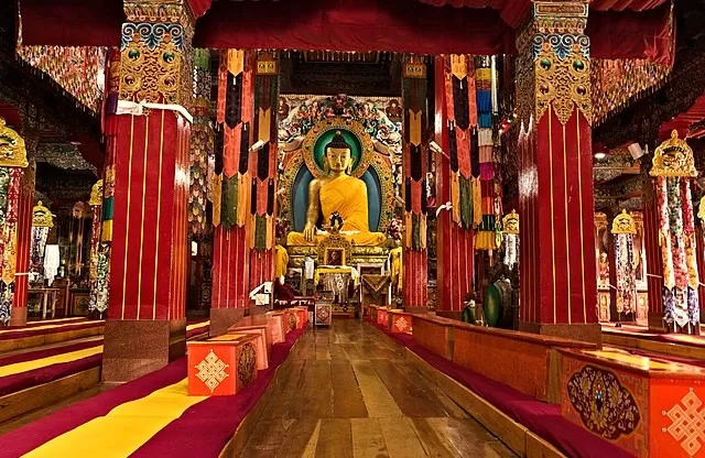
Tawang Monastery is the largest monastery in India and the second largest in the world, after the Potala Palace in Tibet. It is home to more than 500 monks and a rich collection of Buddhist scriptures, statues, and artifacts. The monastery was founded in the 17th century by the fifth Dalai Lama, and it is also the birthplace of the sixth Dalai Lama. The monastery is located about 10 km from Tawang town, and it offers a panoramic view of the Tawang Valley. You can visit the monastery to see the impressive architecture, the golden statue of Buddha, the library, the museum, and the prayer hall. You can also witness the daily rituals and ceremonies of the monks, and participate in the festivals and events that are held at the monastery.

Nuranang Falls:

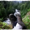
Nuranang Falls is a spectacular waterfall that cascades from a height of 100 meters into a crystal-clear pool. The waterfall is also known as Jang Falls or Bong Bong Falls, and it was featured in the movie Koyla, starring Shah Rukh Khan and Madhuri Dixit. The waterfall is located about 40 km from Tawang town, and it is accessible by a short hike from the road. You can visit the waterfall to admire its beauty, take photos, and enjoy the sound of the water. You can also take a dip in the pool, but be careful as the water is very cold and deep.
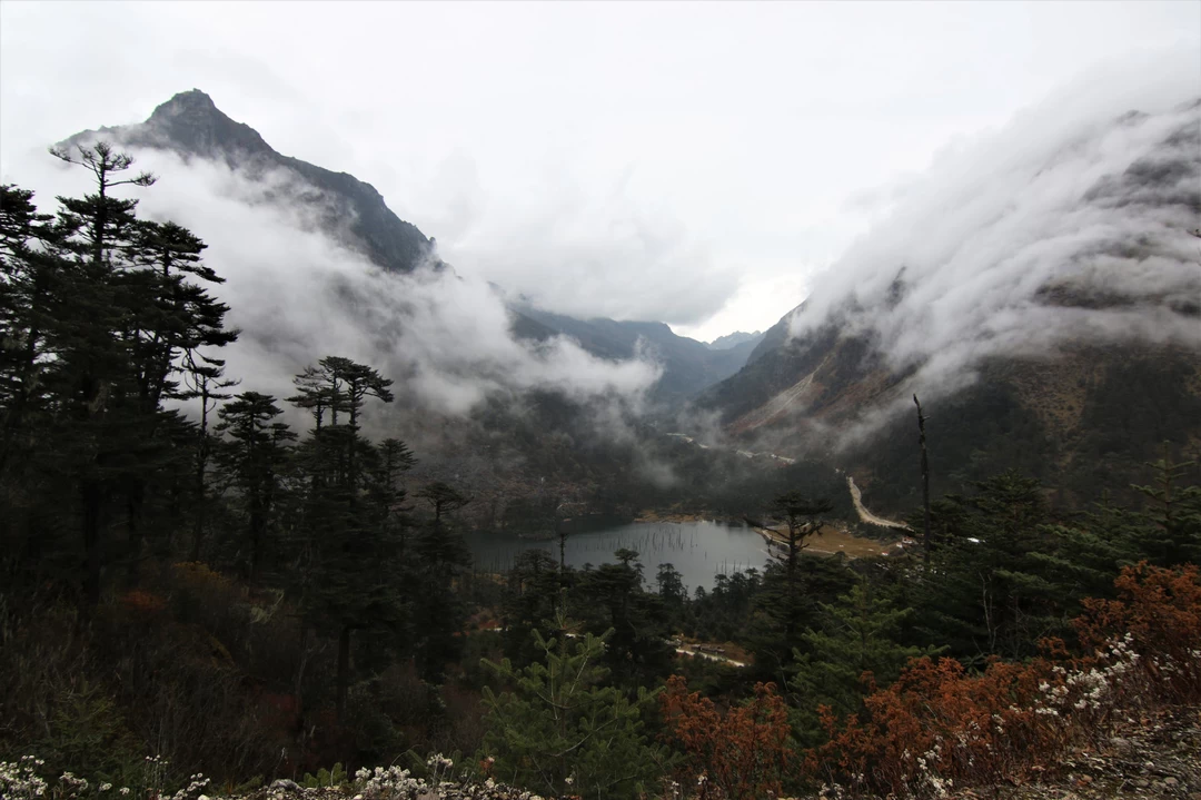
Sangestar Tso Lake:

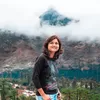
Sangestar Tso Lake is also known as Madhuri Lake, as it was named after the actress Madhuri Dixit, who shot a song for the movie Koyla at this lake. The lake is a beautiful lake that was formed after an earthquake in 1950. The lake is surrounded by green meadows and pine trees, and it offers a serene and peaceful ambiance. The lake is located about 25 km from Bumla Pass, and it is accessible by a SUV. You can visit the lake to enjoy the scenic views, take photos, and relax. You can also see some yaks and horses grazing near the lake, and some birds flying over the lake.

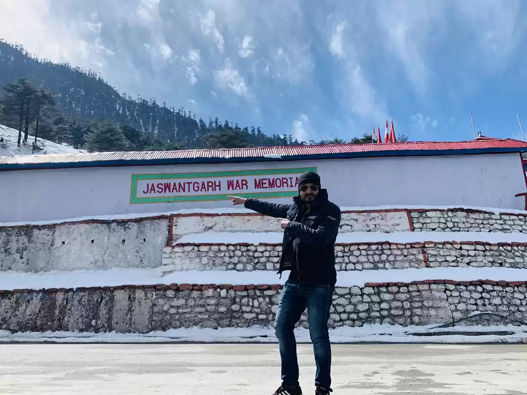
Jaswant Garh War Memorial:

Jaswant Garh War Memorial is a place where you can pay your respects to the brave Indian soldier Jaswant Singh Rawat, who single-handedly fought against the Chinese army during the 1962 war. The memorial has a statue of the soldier, a museum, and a cafeteria. The memorial is located about 21 km from Tawang town, and it is accessible by a SUV. You can visit the memorial to learn about the heroism and sacrifice of the soldier, who is also known as Baba Jaswant Singh. You can also see the weapons, the uniforms, and the personal belongings of the soldier, and hear the stories of his courage and valor.

Sela Pass:

Sela Pass is a high-altitude mountain pass that connects Tawang with the rest of Arunachal Pradesh. The pass is known for its scenic views of the Sela Lake, the snow-covered peaks, and the colorful rhododendrons. The pass is located about 78 km from Tawang town, and it is accessible by a SUV. You can visit the pass to enjoy the stunning views, take photos, and feel the chill of the wind. You can also see some army bunkers and check posts along the way, and salute the soldiers who guard the pass.

Gorichen Peak:

Gorichen Peak is the highest peak in Arunachal Pradesh, which stands at an elevation of 6,488 meters. The peak is considered sacred by the local Monpa tribe, and it is also known as Sa-Nga Phu, which means the Kingdom of Deity. The peak is located about 164 km from Tawang town, and it is accessible by a SUV. You can visit the peak to see the majestic mountain, take photos, and admire the nature. You can also trek to the peak, if you are an experienced and adventurous trekker. The trek is very difficult and risky, and it requires proper equipment and guidance.

Pankang Teng Tso Lake:

Pankang Teng Tso Lake is also known as PT Tso Lake, and it is another picturesque lake that is located near the Gorichen Peak. The lake is frozen during the winter months, and it becomes a haven for migratory birds during the summer months. The lake is located about 17 km from Tawang town, and it is accessible by a SUV. You can visit the lake to see the beautiful lake, take photos, and watch the birds. You can also enjoy some boating and fishing at the lake, but you need to get permission from the local authorities.

Taktsang Gompa:

Taktsang Gompa is also known as Tiger’s Nest Monastery, and it is a stunning monastery that is perched on a cliff overlooking the Tawang Valley. The monastery is accessible by a steep hike or a cable car, and it offers a panoramic view of the surroundings. The monastery was built in the 8th century by the Tibetan king Trisong Detsen, and it is one of the oldest and most sacred monasteries in Arunachal Pradesh. You can visit the monastery to see the ancient architecture, the statues of Buddha, the paintings, and the relics. You can also witness the daily prayers and rituals of the monks, and feel the spiritual atmosphere of the place.

Tawang War Memorial:

Tawang War Memorial is also known as Namgyal Chorten, and it is a 40-feet high stupa that commemorates the martyrs of the 1962 war. The memorial has a museum, a library, and a sound and light show that narrates the history of the war. The memorial is located about 2 km from Tawang town, and it is accessible by a SUV. You can visit the memorial to learn about the bravery and sacrifice of the Indian soldiers, who fought against the Chinese army in the harsh conditions of the Himalayas. You can also see the names, the photos, and the stories of the martyrs, and pay your tribute to them.

Travel Tips For Bumla Pass

Visiting Bumla Pass is not a walk in the park. You need to be well-prepared and well-informed before planning your trip. Here are some useful tips for travelers who want to visit or explore Bumla Pass or its surroundings:

Photo of Bumla Pass 2/2 by

1. Carry adequate woolen clothes, gloves, hats, sunglasses, and sunscreen for the cold weather and the bright sun. The temperature at Bumla Pass can vary from 5 degrees to -15 degrees, depending on the season and the time of the day. The sun can also be very harsh and cause sunburns or snow blindness.

2. Bring water bottles, snacks, medicines, and oxygen cylinders for the high altitude and the low oxygen levels. The altitude at Bumla Pass is about 4,572 meters, which can cause altitude sickness, headache, nausea, or breathlessness. You need to drink plenty of water, eat light food, take rest, and carry some medicines or oxygen cylinders in case of emergency.

3. Obtain a special permit from the Office of the Deputy Commissioner in Tawang at least a day before visiting the pass. The permit costs Rs. 200 per person and requires two passport size photos and an identity proof. You can apply for the permit online or offline, but you need to collect it in person from the office. You also need to show the permit at various check posts along the way to the pass.

4. Hire a local SUV from Tawang town, which can cost around Rs. 5000 for a round trip. The road to Bumla Pass is rough and steep, and requires an experienced driver and a sturdy vehicle. You cannot drive your own car or bike to the pass, as it is not allowed by the army. You also need to book the SUV in advance, as there are limited vehicles available for the trip.

5. Start your journey early in the morning, preferably before 7 am, to avoid traffic and reach the pass before noon. The pass is open from 9 am to 3 pm, and the journey takes about 3 to 4 hours one way. You need to reach the pass before noon, as the weather can change suddenly and become cloudy or foggy. You also need to return from the pass before 3 pm, as the road can become dark and dangerous.

6. Do your research about the weather conditions, the road conditions, and the security situation before planning your trip. Avoid visiting during rainy or snowy days, or during times of political or military tension. Check the weather forecast, the road status, and the security advisory before leaving for the pass. You can also contact the local authorities or the army personnel for the latest updates and information.

7. Respect the local culture, customs, and sentiments of the people and the army personnel. Do not litter, make noise, or take photos without permission. Do not cross the line of control or touch the barbed wire. Do not argue or disobey the instructions of the army personnel. Do not carry any weapons, drugs, or alcohol to the pass. Do not wear any offensive or provocative clothing or accessories. Do not indulge in any anti-national or anti-social activities.

Bumla Pass is a place where you can witness the beauty and the contrast of two nations, and experience the thrill and the challenge of a high-altitude trek. It is a place that will leave you spellbound and speechless, and make you appreciate the nature and the history of the region. It is a place that will make you proud and humble, and inspire you to explore more of the hidden gems of India.

So, what are you waiting for? Book your trip to Bumla Pass today and get ready for an unforgettable journey.

Bumla Pass Reviews

Bum La pass The Bum La pass is a mountain pass that connects India and China by road. Tourists are allowed upto the reception centre at the pass and to visit the Bum La Gompa. Venturing further is off-limits and is the privilege of army personnel. This place is best visited during September - October. During other times of the year, the weather is really tricky, raining and snowing at whim. Unlike Sela pass, which is used heavily by civilians, the army has no committed reason to keep the road to Bum La in top shape. They will clear the snow just enough for a 4-wheel drive army vehicle with chains to its tyres to move reasonably well. Tawang Arts and Crafts Emporium Tawang craft centre is a place where craftsmen weave cloth and artistes make Monpa masks in a traditional way. This is one of the very places in India where authentic and traditional Tibetan crafts are made and can be bought. If you are looking for a souvenir from the trip, this will probably be your best bet to get something that's unique and local. What to eat You will get to eat Tibetan style snacks such as soup, momo, thukpa, etc. Meat eaters are more at an advantage here with different types of items ranging from chicken to pork available. If you visit during Losar (new year on Tibetan calendar), you will get several types of local savoury and sweet delicacies, usually made of local grains or rice, sugar, jaggery, sesame and cinnamon. Souvenirs Tawang has several handicrafts of wool, local wood and gemstones. You can visit the main Tawang market to shop for pouches, gloves, mittens, sweaters, masks and fashion accessories. Getting to TawangAir travel Tawang does not have any railways or airports. The nearest commercially active airport is at Guwahati. Tezpur, the nearest Assamese city to Tawang at 320 km away and an air-force city, is getting a commercial airport under the government's Udaan project. However, there is a special air service in the form of Pawan Hans, a helicopter shuttle between Guwahati and Tawang. Even if the helipad at Tawang is unserviceable, there is a backup helipad at Bomdila.Railways and road The nearest railway station is at Bhalukpong, a town at the border of Assam and Arunachal. Tezpur city also has a railway station. However, neither stations is serviced by regular trains with a reliable schedule. The nearest railway station with frequent trains from all over India is Rangia. While Guwahati is transport-wise the most connected city in Assam, it is on the southern side of the Brahmaputra river, whereas Tawang is to the north. Thankfully, all trains that halt at Guwahati also halt at Rangia, a town to the north of the river. So Rangia is a good tipping point to considerably reduce the commute time to Tawang, without having to touch Guwahati. There are several state buses that ply from Rangia to Tezpur. From Tezpur, you can take an SUV service to Tawang (read next section).Road only The only transportation from Assam to Tawang is from air-force city of Tezpur, a city at the confluence of Brahmaputra and Kameng rivers. The highway from Tezpur to Tawang narrows considerably after passing the village of Tippi. Also there is heavy movement of large army vehicles on the highway. As a result, there is no bus service on the highway. You should take a public transit SUV vehicle to Tawang. These vehicles leave very early in the morning to start a 10-hour journey to Tawang. They start near the Tezpur market. In peak season, you should book your seats a day in advance.
Bum La Pass, Sangetsar (Madhuri Dixit) Lake, PTSO Lake Distance: 90 km (5 hours) Overnight: Tawang This is the day we discovered best of Tawang, I can say best of Arunachal Pradesh. We started early and aimed to reach Bum La by around 10 am and Sangetsar Madhuri (Dixit lake) by 12 pm. However, the road was pretty bad, worsened with an inclement weather throughout, reducing visibility to near Zero as we climbed uphill to 15,500 feet. Still, we managed to reached Y-Junction in time. Y-Junction is the point where one path diverged towards Madhuri lakewhile another one diverged towards Bum La pass(Indo-China border). The main reason of starting early is to reach Y-Junction before cut-off time as the Army might disallow your journey if you reach here late. This, we were told, is part of the caution as the weather up at Bum La can worsen in the afternoons. Stop 1: Bum La Pass(15,200 ft Indo-China border) Bumla Pass is the most scenic Indo-China border above 15,200 ft above sea level. Army is God, and so is omni present in this area. If you get stuck somewhere, they will happily help you out. Jai Hind! This is the pass from where Dalai Lama entered India escaping from Tibet. This is the same pass from which people's liberation army of China invaded India during the fiercest 1962 Sino-Indian War. Indian Army Jawaan has installed the bincocular here so that the tourists can use it to see the radar that chinese have installed on hill-top on their side, facing the Indian side. You will actually get WiFi signal of China and you can see the chinese electric poles on the other side. This is an awe-inspiring tourist spot which gives a true picture of the challenging conditions in which soldiers of the Indian Army are defending the nation's borders. Stop 2: Sangetsar (Madhuri Dixit) Lake Sangetsar lake and its backdrop look completely different every two months. Purple & Blue Rhododendrons were covering the mountain base on the way to this lake, just to welcome me, cough! Plucked few for the photoshoot. According to what the locals have to say, initially the lake was approximately 1 km away from its current spot but during the earthquake, a shift in tectonic plate caused the move of the lake to its current location. It submerged a great part of a pine forest too and if you visit the beautiful lake, you will see tree trunks of pine tree pop out of the lake which makes it a unique, offbeat picturesque travel destination. Well, do you remember the song Tanhai Tanhai from ShahRukh and Madhuri Dixit starred Koyla? Stop 3: Pangateng Tso Lake Although PTSO Lake comes first when you start from Tawang, it is always recommended to cover it, at last, considering the challenging weather at Bumla. Blessed with serene surroundings and wonderful scenery, Pangateng Tso lake is a hidden paradise with splendid beauty. The calm water, silently moving clouds, the earth with its wetness, chirping of birds and warmth is all that one gets while visiting PTSO Lake. The lake is well maintained by the Indian Army and offers a soothing and tranquil atmosphere to its visitors. The path towards the lake is laden by bright rhododendron flowers that add to the exquisiteness of the place. One can also find colorful birds on the lakeside and engage in wonderful nature photography.
Day 6: A Day Trip to Bum La and Sangestar Tso Today our car was sent to a local garage for checkup and the puncture repair. We were driven in a local cab for our day tour by a very cheerful local named Tashi. Before I go into the journey details, let me give a quick background of our destination for the day. Bum La, right at the India- China border, at a height of more than 15,000 feet holds accounts of the fierce battles during the Indo-Shino war of 1962. This is also the route of 14th Dalai Lama's great escape to India. On our way to Bum La, we heard stories of war and folklore of the people of this region from Tashi. We reached a military post called, Y-Junction at an altitude of 14,600 feet, from where the routes are divided in two - the right side goes to Bum La and the other to Sangestar Tso, a lake created during an earth quake. Bum La has restrictions in visiting time and we chose to go there first and then to the lake. It took us a half an hour of treacherous driving through bad or no road to reach till the last point where public vehicles are allowed. Ahead of us, we saw few army camps and military settlements beyond which is the McMohan line, the border between India and China. Though tourists are allowed to go till the McMohan line on foot, they are controlled, guided and cordoned by military personnel. Bum La is a flat corridor flanked between small mountain peaks on both sides, which makes winds pass through the area intensely, making the place extremely cold; at 11 am in the morning that day, the recorded temperature was -11 degree Celsius which dips down to less than - 20 degree during the night . Salute to our Jawans who are posted at Bum La to keep an eye on Chinese movements 24*7. An army man gave us briefing about the place, about their life and relationship between their Chinese counterparts (which seem to be cordial enough). We stayed at Bum La for around 45 mins and started our journey for Sangestar Tso - Tso means lake in Tibetan. The lake is also called "Madhuri" by some locals and tourists, as bollywood star Madhuri Dixit shoot there for the bollywood movie "Koyla". Amidst the high rocky mountains sits a frozen body of water, with scattered tree trunks protruding out from all over the surface of ice, small number of birds flocking in the water puddles created from meting ice - "Madhuri Lake" was picture perfect. We had some snacks from a military canteen by the side of the lake which serves hot soup and momos, puri sabzi and tea. We took some great snaps in and around the area - rocky mountains at a distance, snow on the road, frozen lake Sangestar, our day tour itinerary was complete. We came back to Tawang and had late lunch. The rest of the day we went around the town of Tawang on foot to have a closer look a the local life of the town. Tomorrow we start our return journey - destination Bomdila. Day 7: Return journey - Destination Bomdila
Yay the D day had finally arrived!! Wondering what special was that day? Bumla pass!!We would have seen hell number of pictures, read hell lot of blogs about Bumla and were so eager to get there. For Bumla, separate pass and vehicle is required which is arranged from local Tawang community. Our hotel host was generous enough to have arranged it earlier for us.We started at 7am as the road to Bumla was rough because rains had cut it at most of the places and one had to get in there by 11am , not beyond that. Also, Sangetsar lake fondly known as Madhuri lake was also on the way to Bumla and you needed to spend some time before returning because you have no other option than to spoil yourself by its beauty. By the way,Tawang has 108 lakes. Anyways it was always a great idea whenever you are travelling to a new place to get on time everywhere so that you can enjoy the best timings and take best shots.Our driver was an uber cool guy.He was too fun and gave us thorough knowledge about the local people,cuisine and how the monks have stopped the killing of animals there on the philosophy of "jeeyo aur jeene do" to which he cursed them in his language. But what struck me most was his awesome collection of Bollywood songs.Man his choice was so similar to ours and we were so happy to know that we won't have to say him to change songs.We reached Bumla by 10am,it was raining and the place was covered with blanket of fog.Oh and how can I forget to write about the way to pass which was filled with red and pink roses like somebody had sprinkled them all around it.We were greeted by the Indian Army Jawans at the pass whose first question to us was,"Where you not scared at all coming this long way all alone?To which we replied, "No , sir it's because of you we are safe and we are always thankful to you for that"!At that time Bihar regiment was serving at the battalion. There is a rotation period of two years after which the regiment changes. The army jawans took us to the pass, which is India China border and briefed us about it's historical significance. The pass was a way through which China attacked India in 1962 India china war and we were extremely proud to know that Indian army maintains world's highest artillery there. At the border, Indian and Chinese people met 8 times a year on each other's respective special days with India's 26 january and 15 August being one of them. As a part of meeting cultural shows and lunch/dinner was organized which was equally enjoyed by army as well as local monpa people.
Having spent a couple of days in Tawang, we decided to get on the last leg of this journey, the ride up to the Bumla, one of the four India-China border posts open for public visits. The pass has a history of its own, it witnessed the Chinese forces invading Arunachal in the 1962 war. Dalai Lama took the same pass to escape Tibet and enter India. It hosts flag meetings between the officials of both the sides. Although, being rainy, we were advised not to go, as visibility would be limited and we would end up spoiling the day. Going against the odds, we asked a sumo driver to arrange the pass and start next day morning at 6am. Tawang - P T Tso - Bumla - Sangetsar Tso: Reserved SUV or Sumo, costs around 4500-5000 INR. To get there, you would need a permit issued by the DC office and signed by brigade commander. The driver will get that for you, keep few Identity card and ILP copies handy with you. It is best to get it done a day prior to your travel as it takes sometime to get it issued and hand it over to the brigade office. They sign it in the night and you are good to pick it up in the morning, on your way to Bumla. Well, as we gained altitude, to our surprise, the sun was peeking through a small window in the clouds and the bluish mountains were welcoming this streak of pale yellow sun rays.
Photos of Bumla Pass
Planning a trip soon?
Unlock the Perfect Getaway with us
See Packages for Tawang