
Before you start reading, please follow me on Instagram to checkout my latest activities: @gypsyonvoyage
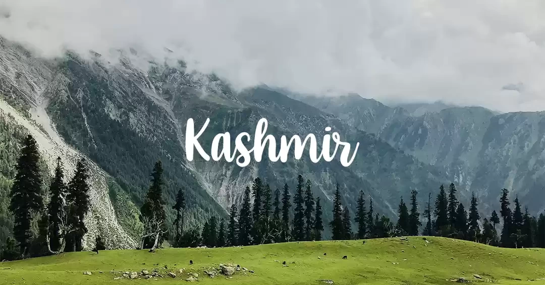
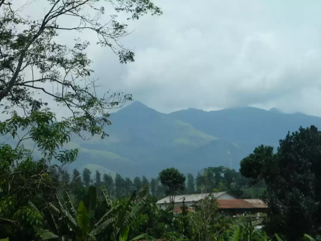
Wayanad, the place where the love lies on the top, is the most prominent hill station in Northern Kerala. It lies in the region of Western Ghats of India with the abundance of Flora and Fauna. It is home to a few of the existing tribals of India. The lush green forests, astonishing waterfalls, clean rivers & marvelous earth dams add a lot to the tourism of this district.
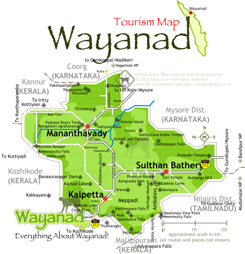
It is surrounded by many National Parks such as by Nagarhole National Park in the North-East which lies in Karnataka and by Bandipur National Park in the East which again lies in Karnataka and by Madumalai National Park in the South-East which lies in Tamil Nadu.
We started our journey from Mysore on a beautiful Saturday morning, the sun had just come out in the clear sky. We took a small break for breakfast and covered the total journey of nearby 130 km within 3.5 hrs.
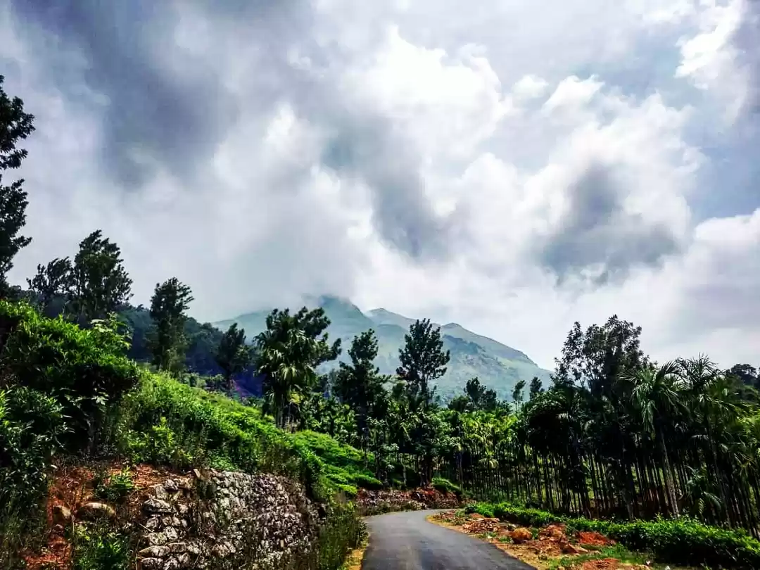
We directly headed to trek up to the Chembra Peak which is another 25 km from the main town. We parked our car, had some energy bars and paid the entry fees. After collecting the passes, we started our trek with only the needful items in our backpacks and a bottle of water per person. There's a refundable deposit of Rs. 100 for each plastic bottle. The amount will be refunded back on carrying back the bottle with you on return.
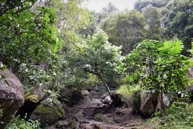
The total length of the trek is nearby 4.5 km one side for which we took around 3 hrs uphill. The initial stretch of the trek is covered with green tea estates and then moving forward, the forest area starts. The trek is easy to moderate in difficulty level as there's no part where it is steep. After covering a distance of about 2.5 km, the view is quite open and the clouds hovering over the hills can be seen.
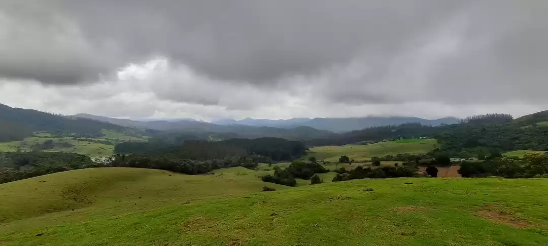
The ascend of another 2 km was very beautiful with a wide view of green valley and hills on both sides. As we reached the top, we saw a small lake in the shape of love and this is the reason that I said that it is the place where love lies on the top. We spent 20-30 mins there and it started drizzling. There is no place to take cover on the top so we started descending. Midway, the intensity of the rain increased and it started raining heavily. We had no other choice but to carry on, the rain started ceasing when we had completed 2/3rd of the whole.
During this descend, we were drenched, we slipped many a times and laughed about all that was happening. After reaching downstairs, we showed the water bottles we had taken with us and collected back the refundable deposit which we had submitted. We were freezing, so we directly headed to our car and put the heater on.
After some time, we started feeling normal and drove to the Soochipara Waterfalls which is around 9 km from there. It is a three-tiered waterfall encompassed by thick forests. One has to hike for around 2 km from the Parking space to reach there, the hike of 2 km is worth it if the falls have a good amount of water and we were in good luck. We had already played a lot with water for the day, so we just searched for a place where we can sit with our legs drowned in the flowing water.
We enjoyed a good amount of time at the falls and then we headed to Phantom Rock, a natural metamorphic rock formation resembling a human skull. It was about a 37 km journey with a plenty of coconut trees on the way, we clicked some photos there, had some hot tea to keep ourselves warm and rushed to Edakkal Caves as we had very less amount of time left before sunset.
Edakkal Caves are two natural caves believed to be camping shelters of the Neolithic community. The cave walls contain a collection of Neolithic rock engravings and images. Except for Edakkal, no concrete evidence for the existence of true Neolithic culture in Kerala has so far been discovered.
After spending a good amount of time at the caves, we headed to the hotel which we had booked online in advance. We took a shower in the hot water and took rest for an hour or so. We gathered some energy and came out of our rooms before we would've gone to the hibernation mode. We had dinner and went out for a walk in the market to buy some local stuff.
Post walk, we came back to the hotel, sat and played Dumb Charades, we literally laughed our hearts out at a few of the acts. Everyone was fagged, so we called it a night to gain some energy for the next day.
The beautiful morning welcomed us with the calm and soothing sun rays and the heavenly greenery everywhere.
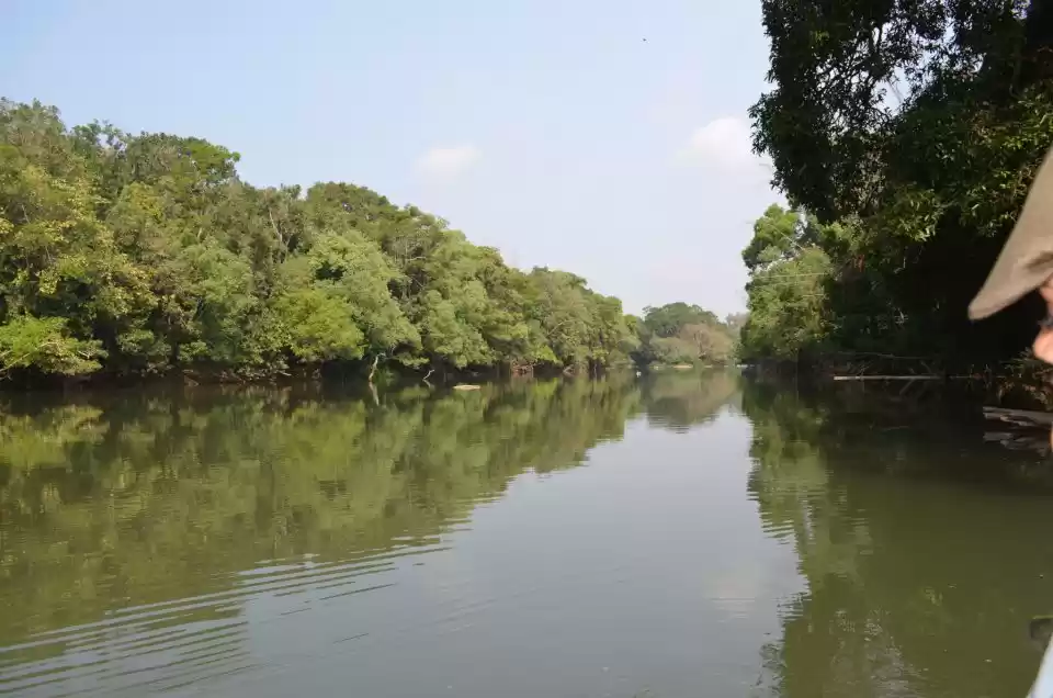
We freshened up and had breakfast before we set out for the Kuruvadweep, the river island which lies on the banks of the tributaries of Kabini River. We drove around 36 km to reach there from our hotel.
The island surrounded by streams and rivers is accessible by rafts, bamboo boats or fiber boats run by Kerala Tourism Department. Entrance to the island is restricted and monitored by the Forest Department of Kerala, an initiative to protect the forest.
We bought the entrance tickets and the boat tickets, it took only 5 mins to cross the river and reach the island. Its unique geographical characteristics make it a place where not only the leaves but also silence is evergreen. We strolled around, clicked some photos, spent some time in the lap of nature before we took the boat out from the island.
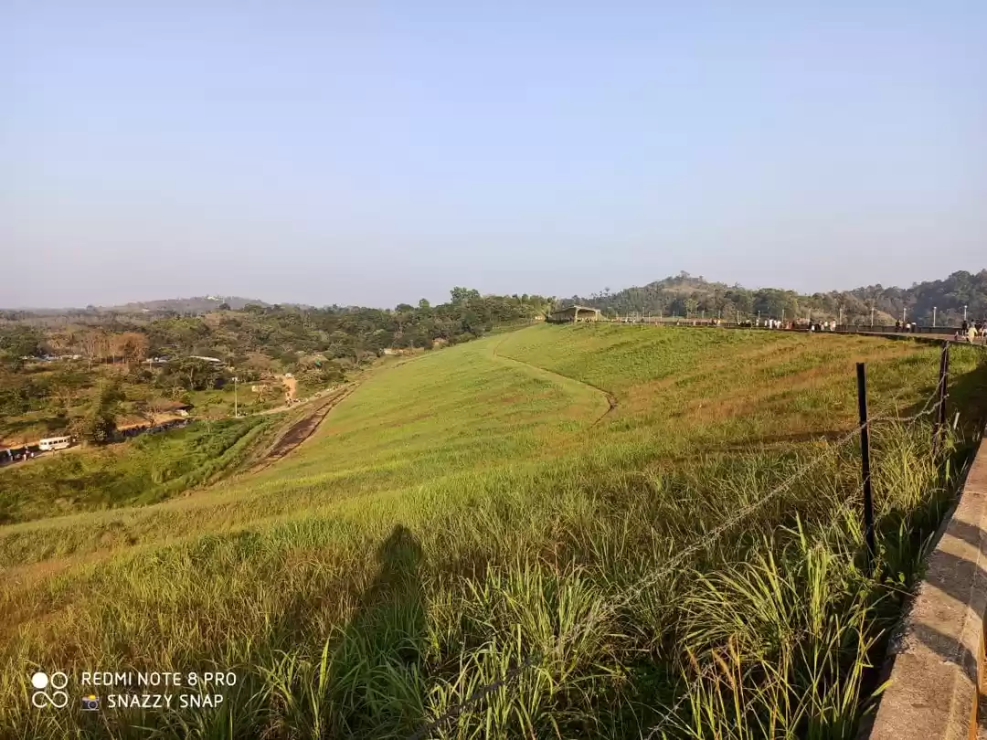
We then drove to the Banasura Sagar Dam, the largest earth dam in India and the second largest of its kind in Asia. The dam is made up of massive stacks of stones and boulders. This dam is a part of the Indian Banasura Sagar Project consisting of a dam and a canal project started in 1979. The goal of the project is to support the Kakkayam Hydroelectric power project and satisfy the demand for irrigation and drinking water in a region known to have water shortages in seasonal dry periods.
The reservoir of the dam is very serene and clean with a mesmerizing view of the green hills on the backside. One can go for boating in the water, there are many types of boats there. We went for a speed boat which was a 15-20 mins ride. Post-ride, we realized that it's lunchtime already, so we looked for a nice restaurant with a good view and filled our tummies for the rest of the day.
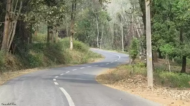
After lunch, we headed out for Lakkidi View Point which is around 30 km from the dam. The viewpoint, situated on the peak of the Thamarassery Ghat Pass at Kozhikode-Mysore Highway, offers the breathtaking views of lush green slopes, streams and valleys. The panoramic view that Lakkadi View Point offers is so mesmerizing that the serpentine road winding down the mountainside looks like a coiled snake.
We spent a very wonderful time there, had some hot food like Maggi, Sweet Corn, etc. and then we set out for our journey back to Mysore.
Please follow me on Instagram to checkout my latest activities: @gypsyonvoyage

' fill='%23359391'%3e %3cpath d='M46.1538462%2c43.5714286 L41.5%2c50 L36.8461538%2c43.5714286 L36.8670256%2c43.5714286 C36.3173077%2c42.7142857 36%2c41.6851429 36%2c40.5714286 C36%2c37.4854286 38.4535641%2c35 41.5%2c35 C44.5464359%2c35 47%2c37.4854286 47%2c40.5714286 C47%2c41.6851429 46.6826923%2c42.7142857 46.1329744%2c43.5714286 L46.1538462%2c43.5714286 Z M41.4294872%2c39 C40.6150641%2c39 39.9487179%2c39.675 39.9487179%2c40.5 C39.9487179%2c41.325 40.6150641%2c42 41.4294872%2c42 C42.2439103%2c42 42.9102564%2c41.325 42.9102564%2c40.5 C42.9102564%2c39.675 42.2439103%2c39 41.4294872%2c39 L41.4294872%2c39 Z' id='Location-white'%3e%3c/path%3e %3c/g%3e %3c/svg%3e)