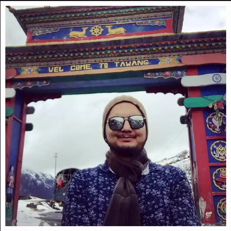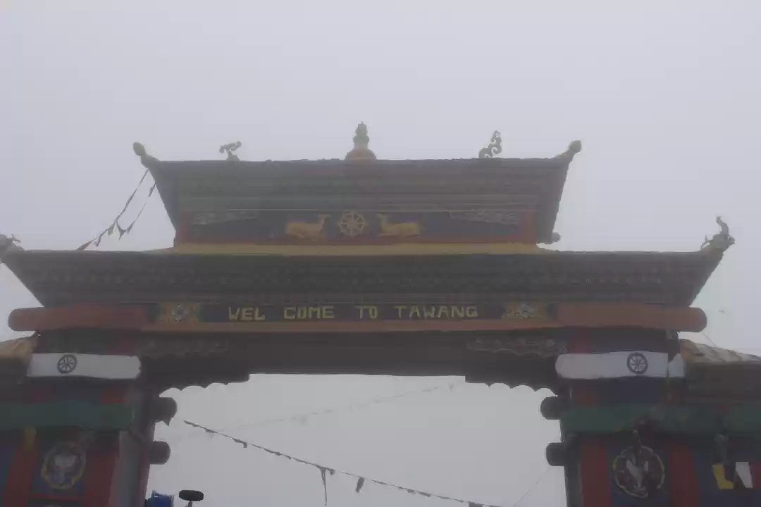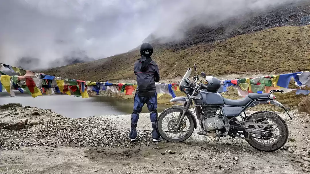
NORTH EAST ARUNACHAL AND ASSAM BIKER’S SOJOURN 2023
“Riding through the Himalayan mystique: A motorcycle adventure in Tawang, Arunachal Pradesh”
Dear Friends, Join us on a thrilling motorcycle adventure through the Himalayan mystique in Tawang, Arunachal Pradesh. Our journey begins in Guwahati and takes us through winding roads that reveal hidden vistas, serene lakes, thick forests, and high mountain passes. We are a spirited group of riders from Tamilnadu, christened as MILE MUNCHERS, who were once strangers but are now bound by the thrill of adventure. Our adventure began in 2022 with an 8-day ride to Sikkim, leaving us yearning for more. Fuelled by Whats App discussions and a shared passion, we set our sights on an exotic bike expedition through the North East for 2023. Don’t miss out on this unforgettable journey!
As a biker, I have always been drawn to the open road and the freedom it offers. My recent trip to Tawang was no exception. The journey was filled with twists and turns, both literally and figuratively. From the stunning landscapes to the unexpected challenges, every moment was an adventure. The scenic beauty of the place was breathtaking, and the winding roads and inclement weather made for an exciting ride.
I am excited to share my experiences with you and hope that you will enjoy reading about my journey as much as I enjoyed living it.
I am grateful to my friends who encouraged me throughout the trip to write a travelogue. I tried my best in a maiden attempt and hope it is memorable to you.
You can find more details about my trip in my video at
I would love to hear your feedback on my travelogue and hope you have an excellent reading experience 😎.
Yours truly, KMA
https://www.youtube.com/watch?si=6gKnkY1H2pkoiR-6&v=RgzVH963VYQ&feature=youtu.be
Leaders of the Pack:
• Dr. Mohamed Ali, a seasoned rider with conquests in Leh Ladakh, Manali, North Kashmir’s Gurez valley, and Sikkim apart from his several adventure rides in South Indian hill stations.
• Mr. Laxman and Mr. Venkat, trusted companions who had explored similar terrains in different groups.
• The rest of the crew—Mr. Sukumar, Mr. Sunder, Mr. Raju, and our diligent Accountant and photographer, Mr. Dinesh—all had their maiden rides during our Sikkim Sojourn 2022.

The Route Unfolds:
• Our band of 12 riders initially planned a 10-day odyssey from Guwahati. However, life’s twists meant only 7 of us could embark on this epic adventure.
• Months of meticulous planning, Whats App deliberations, and permutations led to a harmonious 10-day itinerary. Our journey would culminate in Guwahati, with two distinct routes.
• On October 21, 2023, we revved our engines, weaving a tapestry of memories. From the banks of the mighty Brahmaputra to the lofty heights of Bumla via Tawang, we rode with the Himalayas as our backdrop.
• Along the way, we encountered the mystical one-horned rhinos of Kaziranga, their presence etching itself into our souls.

Guiding Light:
Mr. Santanu Banerjee, the maestro behind XKMPH trips, orchestrated our biking extravaganza. His expertise in navigating these rugged terrains ensured our safety and amplified our thrill. For more about XKMPH trips, visit kMphtrips.com. Due to durga pooja he couldnt join us. Alongside us was our road captain, Anubhav Singh, a young veteran of rides through the Himalayan ranges who ensured our safety and comfort throughout the trip. We highly recommend this trip to anyone looking for an adventure of a lifetime! Our team was backed up by an Innova to carry our luggage, and we were accompanied by a trained mechanic with basic spares. The Innova also provided sweeper cover at the back.

The Ride of a Lifetime:
• Our tires kissed winding roads, each curve revealing breathtaking landscapes.
• The air crackled with anticipation as we pushed our limits, conquering both terrain and self.
• And amidst it all, we found camaraderie—the kind forged by shared sunrises, star-studded nights, and the pulse of adventure.
• This was more than a bike ride; it was an odyssey—an indelible chapter etched in our hearts.

Tough terrain matching Machine: If you’re an adventurous biker looking for a bike that can handle rough terrains, the Royal Enfield Himalayan is the perfect choice. With a 424 cc engine, high ground clearance, and front telescopic and rear mono shocks, this bike is ideal for off-roading, mountainous, and high altitude rides. The bike’s half-duplex split cradle frame and spoked wheels provide better grip and stability on off-road terrain. The dual-purpose tyres offer good traction on both on-road and off-road surfaces. The bike’s scrambler type design adds to its rugged look and feel.
Arunachal Pradesh, a state adorned with breathtaking landscapes and awe-inspiring sights, beckons adventurous souls. Despite the presence of army camps and barracks along the Tawang circuit, set up to safeguard the Indian-China border due to ongoing territorial disputes, this region remains a popular destination for bikers and adventure enthusiasts alike. The historical backdrop includes the Sino-Indian war of 1962, yet the allure of Arunachal Pradesh persists.
Inner Line Permits : If you are planning to visit Arunachal Pradesh, you will need an Inner Line Permit (ILP) to enter the state. The permit is required for visitors who are not natives of Arunachal Pradesh and is issued by the Secretary (Political), Government of Arunachal Pradesh, respective Deputy Commissioner and Additional Deputy Commissioner of the Districts . The permit is granted as a routine for tourists and is valid for 15 days, which can be extended.
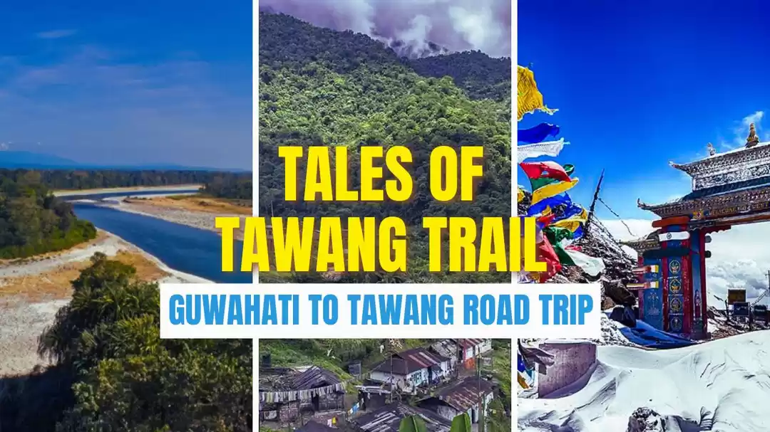
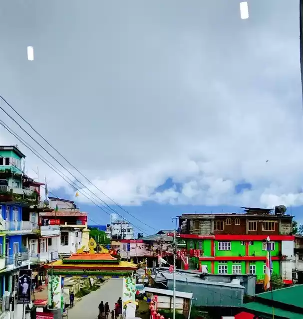
Tawang, a picturesque town nestled in the northeastern Indian state, awaits those seeking both thrill and serenity. Whether you’re an avid biker or simply yearn for an unforgettable journey, the bike trip from Guwahati to Tawang promises an exhilarating adventure. As we geared up to embrace the unknown roads, the remoteness, pristine wilderness, and lack of mainstream motorcycling made Tawang an alluring destination. The North East region, with its Seven Sister States, beckons adventure enthusiasts.
Riding a motorcycle in Tawang takes you through breathtaking landscapes, challenging terrains, and cultural wonders. Imagine winding roads that reveal hidden vistas, serene lakes, thick forests, and high mountain passes. The diversity of tribes, dialects, cultures, and traditions within Arunachal Pradesh creates a mini-India—a captivating blend of experiences.
May the winds carry your memories, and the roads beckon you back to the Himalayan embrace. Join me as we unravel more chapters of this odyssey, where every mile holds a story, and every vista whispers of eternity
“A Biker’s Guide to Safe and Healthy Traveling”.
I suggest all riders should have a complete medical examination by a Physician and physically fit for the long rides. Those with Heart Disease, Diabetes , back pain , COPD and other chronic illness better get a clearance from your respective specialists for the trip.
Please carry all your regular medications including nebulizers and for Diabetes , Blood Pressure and other chronic illness. Please avoid medicines which give sedation in day time. If Needed Please Take In Evening Or Before Bed. Also Diamox may be needed to be taken to prevent high altitude sickness and hence check if you are already getting it so that there will be no doubling of dosage .

Make sure there is a first aid kit along with Oxygen canisters / cylinders in your back up vehicle and if you are travelling alone in your bags.

Pulse Oxymeter : These are very handy and can be used to monitor our oxygen and pulse rate levels in our blood regularly . They are fairly accurate and costs only around Rs.2,500. They operate by 2 AAA batteries and can fit in your first aid kit
In addition these medications are handy for your immediate relief since medical care will be hard to get by in remote areas. Also better to have your family doctor informed and if needed he can contacted by phone for Teleconsultation to tide over any acute condition till we get medical attention.
In addition please keep this handy apart from your regular medications.
1. T. Para 650 ( Fever , Head ache and Body ache) – 20 tablets.
2. T. CIPLOX – TZ ( Food poisoning, Traveller’s Diarrhoea) – 10 tablets
3. T. Chymoral Forte – Body pain 10 tablets
4. T.DIAMOX 250 mg – To be taken twice a day in High Altitude – 2 times a day – 20 tablets
5. T. Emeset – Nausea and Vomitting – 10 tablets.
6. C. Razo – L – ( Gastritis , Reflux Esophagitis ).
7. VOLINI SPRAY – Muscle Pain , Cramps.
8. T. Certrizine - Anti Allergic for running nose and due to cold weather. 10 tablets .
9. Lip Guard with Suncreen protection SF 30
10. SUN SCREEN at least 50 SF .
Your Riding Kit
Due to inclement weather and the risks involved in riding you need to have these basic riding gear. Make sure you have adequate clothing which can withstand inclement weather and temperature.
Beware that the effect of cold weather will be increased multifold when you are driving a bike since wind will be blowing on your face and it will make your hands , face and body numb in addition to asphyxia of high altitude. Make sure you take a short break every hour or two for a cup of tea. This give rest to your mind and body and also to your bike.

Riding Jacket 2. Thermal inner suit . 3. Knee guard 4. Elbow guard 5. Riding gloves with knuckle guards 6. Rain coat upper and lower 7. Spine guard and protector 8. Shoe guard for rain . 9. Face mask full size 10. Luggage Double Elastic Rope for rear luggage hold.
Driving etiquettes:
Ensure you follow the driving etiquettes in a mountain ride. Maintain appropriate speed – Remember to enjoy your Journey and not speed. Follow all the rules and regulations . Dont overtake on the wrong sides and on curves. Always use lower gear when descending and don’t use your brakes often , instead rely more on engine breaking. It will save your brake pads and also you will have more control over your bike.
Remember Alcohol reduces your capacity to react in split second decisions like sudden breaking , controlling the bike in bumps and slippery roads etc . So never drive under the influence of Alcohol .
Make sure your Driving License is valid for a geared bike and valid. Also carry one Photo ID card along with your Driving Licence. It’s a good sense to have a personal Insurance Coverage with coverage for medical treatment including Accidents and shifting by air to your home town incase if there is any contingency arises.
Mobile coverage :
Don’t expect mobile coverage in remote areas . While most hotels offer Wifi , there s very little coverage in Nammeri , Sangti Valley and remote areas . Any way that gives an opportunity for us to be away from our Mobile phones and enjoy the pristine nature.
Vodafone and Jio have better coverage in these areas.
“Biking the Brahmaputra: Sunset Serenity and War Memorial Reflections”
Oct 21 2023- CHENNAI TO GUWAHATI – BRAHMAPUTRA RIVER CRUISE.
Accommodation : Hotel Luit Vista


On October 21, 2023, our six-member crew embarked on an exhilarating journey from Chennai to Guwahati and the seventh person boarded from Bangalore. The anticipation was palpable as we touched down in Guwahati on the morning of October 20. Our destination? The Hotel Luit Vista, perched atop a hillock, offering panoramic views of the mighty Brahmaputra River and the Governor’s Bungalow. However, a word of caution: the hotel’s location requires expert guidance, as Google Maps occasionally leads astray to other similarly named properties in Guwahati.

Our arrival in Guwahati was enchanting. We boarded the Brahmaputra Cruise Alfresco Grand, where the setting sun painted the sky in hues of gold and crimson. After sunset, there is a live DJ playing music while you enjoy mocktails and cocktails on the dance floor
Joined by our road captain, Anubhav Singh, a seasoned rider of Himalayan ranges, we received a quick briefing that fueled our excitement for the adventure ahead. As night fell, we rested, preparing for the odyssey awaiting us. Early in the night our bikes arrived, and all eyes were fixed on the steeds that would carry us through the rugged terrain. Little did we know, a surprise awaited us. But I’ll save that twist for later.


The Brahmaputra River, one of the largest rivers in the world, is a popular destination for river cruises. There are several options available for cruising the Brahmaputra River, including Alfresco Grand and M.V. Mahabaahu . Alfresco Grand offers daily sunset and dinner cruises, sightseeing tours, corporate events, and private charters . M.V. Mahabaahu is a 9-cabin cruise boat that operates along the Brahmaputra River and is ideal for group travelers

Taking a breather after our early morning flight from Chennai, we explored the Durga Puja celebrations near the Governor’s office and paid our respects at the Guwahati War Memorial. The stage was set, the sun had bid adieu, and our hearts raced in anticipation of the road that lay ahead—a road that promised both challenge and wonder, winding along the majestic Brahmaputra. As bikers, we embrace both the beauty of nature and the weight of history, weaving our own tales along the banks of the Brahmaputra.


The Guwahati War Memorial is a popular landmark in the heart of Guwahati, the largest city in northeastern Assam, India. It was built to honor the brave soldiers from Assam who sacrificed their lives in various wars and conflicts, including World War I, World War II, and the Sino-Indian War of 1962. If you’re interested in visiting the memorial, it’s open to the public every day from 8:00 AM to 5:00 PM during summer and 8:00 AM to 4:00 PM during winter.
“Wheels and Wilderness ”
Day 2 - Guwahati to Nammeri via Mangaldoi and Tezpur Oct 22 , 2023 - GUWAHATI TO NAMEERI VIA MANGALDOI – TEZPUR. (203 km) via NH 27 and NH 15 , Nammeri Eco Camp Altitude : 225 meters Accomodation : Lalimau Camp.
On the second day of our thrilling motorcycle odyssey, October 22, 2023, we embarked on a captivating ride from Guwahati to the enchanting Nammeri National Park. Our route spanned 203 kilometres, tracing the scenic NH 27 and NH 15. The modest altitude of 225 meters promised an exhilarating adventure.
As dawn painted the horizon, we stood mesmerised by the majestic Brahmaputra River from our hotel. Its sprawling expanse set the tone for our ride. Dr. Ali, our seasoned leader, distributed keys randomly, and two fortunate riders secured their preferred bikes.

Our chosen path diverged from the beaten track as we crossed the iconic Brahmaputra Bridge in Guwahati. The road led us through the charming town of Mangaldoi, en route to Nammeri. Highways unfolded before us, punctuated by occasional stops for tea and photo sessions.

The journey was not without its challenges. Broken roads tested our mettle, and every 500 feet, a speed bump jolted us. To spare our spines, we rode standing up! A hearty lunch awaited us in Tezpur, but fate had other plans for one of our bikes—it refused to start. Our skilled mechanic diagnosed a fuel pipeline blockage, swiftly rectified it, and soon, the engine roared back to life.

Beyond Tezpur, the road improved, revealing picturesque landscapes that delighted our eyes. As the sun dipped early, around 4:30 PM, we entered the enchanting Nammeri forest area. Our individual cottages awaited us, providing the perfect haven to rest, relax, and prepare for an evening bonfire under nature’s embrace.


Day two was a blend of adrenaline, camaraderie, and the raw beauty of Assam. We eagerly anticipated what the next leg of our journey would unveil.
The Brahmaputra River is a major river in Asia that flows through China, India, and Bangladesh.Guwahati, the largest city in the Indian state of Assam, is located on the banks of the Brahmaputra River. There are several bridges over the Brahmaputra River in Guwahati, including the Saraighat Bridge and the Guwahati-North Guwahati Bridge.The Saraighat Bridge is the first railway-cum-road bridge built over the Brahmaputra River in Guwahati. It was inaugurated for goods trucks in 1962 and opened to public traffic in 1963.The Guwahati-North Guwahati Bridge is a six-lane high-tech extradosed bridge over the Brahmaputra River, connecting Guwahati and North Guwahati. The length of the bridge is 8.4 km, with an approach road on both sides of the Brahmaputra. The length of the actual bridge over the river is 1.24 km, and the width of the bridge is 33 meters.
Nameri National Park is a national park located in the foothills of the eastern Himalayas in the Sonitpur District of Assam, India, about 35 km from Tezpur . The park is home to a variety of flora and fauna, including Bengal tigers, Indian leopards, clouded leopards, marbled cats, leopard cats, hog deer, sambar, dhole, gaur, barking deer, wild boar, sloth bear, Himalayan black bear, capped langur, Indian giant squirrel, and many species of birds . The park is also known for its white-winged wood duck, great pied hornbill, wreathed hornbill, rufous-necked hornbill, black stork, ibisbill, blue-bearded bee-eaters, babblers, plovers, and other birds . The Nameri River flows through the park, and the park shares its northern boundary with the Pakhui Wildlife Sanctuary of Arunachal Pradesh . The park was declared a reserve forest on October 17, 1978, and was set up as a Nameri Sanctuary on September 18, 1985, with an area of 137 km as a part of Naduar Forest Reserve. Until then, the Nameri National Park was heavily used for logging .
“Riding into Tranquility”
Day 3 : Oct 23 , 2023 Nammeri to Sangti Valley via Bhalukpong and Bomdila” –165 kms Altitude : 2900 meters Accomodation : Home Stay Norbu Ghat Sal

On the third day of our exhilarating journey, October 23, 2023, we veered toward the captivating Sangti Valley, nestled near Dirang. Anticipating breathlessness due to asphyxia at high altitude , we started taking Diamox (Aceazolomide) Tablets 250mg twice a day for our body to be acclimatised to avoid high altitude asphyxia.

This hidden gem promised a sensory feast with its natural beauty. Our adventurebegan by crossing the Balukpong border, transitioning from Assam to ArunachalPradesh. The road unfolded, curving through mountains, tracing the path of ameandering river. Our trusty Himalayan motorcycles conquered the terrain effortlessly.

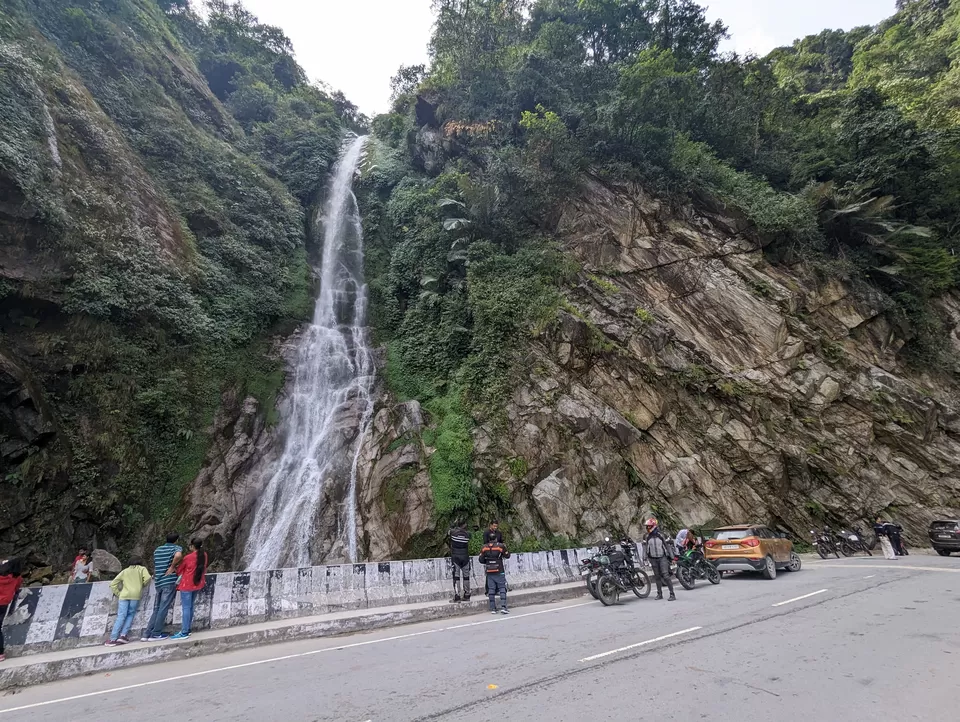
As we ascended, the Himalayan peaks adorned our surroundings, their tranquil beauty leaving us spellbound. We journeyed through the Nechipu tunnel and Bomdila, each turn revealing more of Arunachal’s rugged charm. At dusk, we arrived in the serene Sancti Valley, where our hosts welcomed us with open arms. The chilly temperature, hovering around 6 degrees Celsius, prompted a cozy bonfire and a lively music party by the riverside.



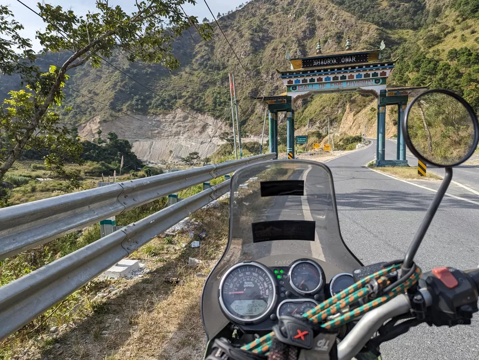
“Ball of Fire Division” is a name given to the 5 Mountain Division of the Indian Army. The insignia of the division is a ball of fire, which is synonymous with energy, vitality, and drive. The insignia of the division is a ball of fire, which is a divine weapon known as a chakra, lifted from Hindu mythology. Brahma is the first of the powerful Hindu Trinity of Creator-Preserver-Destroyer, and the chakra is one of his weapons (1). The name “Ball of Fire Division” is a reference to the division’s reputation for being a highly active and energetic unit “Ball of Fire Division” is a name that is synonymous with energy, vitality, and drive (2,3)


Our stay at Norbu Ghat Sal Homestay was nothing short of golden warmth—a perfect respite after a day of mountainous adventure. The Sangti Valley beckoned, promising more wonders for the road ahead.

Sangti Valley is a picturesque valley located in the Tawang district of Arunachal Pradesh, India. It is nestled in the Eastern Himalayas at an elevation of approximately 2,900 meters above sea level. The valley is known for its stunning natural beauty, with snow-capped mountains, lush green meadows, crystal-clear rivers, and dense forests .The valley is a hidden gem in the mountains of Arunachal Pradesh, with the Sangti river running through it. It offers peace and quiet, stunning views, and the chance to meet the local Monpa people and their sheep . If you want to uncover some of nature’s secrets here in Arunachal Pradesh, there is one hidden location that you need to visit. The gorgeous and secluded Sangti Valley. An emerald paradise that’s tucked away in the mountains with the flowing Sangti river snaking through it. It’s the very definition of serenity .
“High Altitudes and Himalayan Vistas”
Day 4 : Oct 24 , 2023 –165 kms : Riding from Sangti Valley to Tawang via Dirang and Sela Pass Sela Pass – Altitude 13700 ft , Accomodation: Hotel Vajra , Tawang
As the sun climbed higher, our motorcycle convoy wound its way through the rugged terrain of Arunachal Pradesh. The air grew thinner, and the landscape more dramatic. Our destination: Tawang, a mystical town nestled in the Himalayas.

On the fourth day of our intrepid journey, October 24, 2023, we fueled up with breakfast in the valley’s embrace, readying ourselves for the exhilarating ride to Tawang. Our route would lead us through the majestic Sela Pass, perched at an awe-inspiring altitude of 13,700 feet. Each stop along the way would unveil vistas that seemed plucked from a dream.
As we left the Sangti valley, we were greeted by rough and unpaved roads (see the video) filled with sand and gravel that tested the rider’s skills and the bike’s capabilities. To avoid the shocks and vibrations that were transmitted to our spines, we often had to ride while standing up. It was a memorable ride that we will always remember!
Sela Pass isn’t merely a lifeline for the people of Arunachal Pradesh; it’s a gateway to wonder. As we raced along bumpy, winding roads, rain and mud accompanied our ascent. The Himalayan views were spellbinding, yet our eyes remained glued to the road. Delays, challenges, cozy tea houses, and triumphant moments awaited us on the path to Sela Pass and beyond.The winding roads, carved into mountains with a virtual roof, offered a feast for our eyes. With each hairpin bend, we ascended to higher altitudes, the crisp chill of the air adding to the thrill of our bike adventure.


“The Ultimate Mountain Challenge: Conquering the Serpentine Path”
The road to Tawang is a serpentine path that winds through the majestic mountains. The road is narrow and twisty, with sharp turns and hairpin bends that require the rider to be alert and focused. The road is surrounded by lush greenery and towering trees that provide a cool shade from the blazing sun. The scenic beauty of the road is breathtaking, with panoramic views of the rolling hills and deep valleys. As the rider navigates the road, they feel the wind rushing past them, and the engine of their bike roaring beneath them. The smell of the fresh mountain air fills their nostrils, and the sound of the crunching gravel beneath their tires echoes in their ears. The rider feels alive and free, as they conquer the challenging terrain and explore the untamed wilderness.
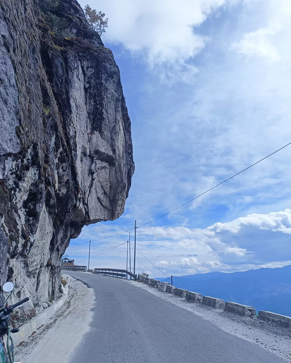
This road is a test of the rider’s skill and courage, but it is also a rewarding and fulfilling experience. The rider feels a sense of accomplishment as they reach the end of the road, and they know that they have conquered one of the most difficult and beautiful roads in the world.The twists and turns of the mountain roads are a thrill for any adventurer.

Yaks are synonymous with life at high altitudes, like in the Himalayas . They are used as carriers on the trail and can carry up to 220 lb (100 kg) of load over the dangerous trails and snow-covered high Himalayan passes .The yaks are easy to spot – they can be up to two meters tall and up to a metric ton in weight . Anyone who travels in the Himalayan region is sure to see yaks sooner or later . They’re a part of everyday life .


Baisakhi Army Cafeteria: A Serene Pitstop for the Adventurous
And amidst this rugged beauty, a pit stop beckoned—one that transcended mere sustenance. But this wasn’t just any pit stop; it was the BAISAKHI Army Cafeteria. A humble outpost amidst the grandeur of the mountains, it offered more than just sustenance. where dosas and snacks are served alongside steaming cups of tea and coffee. But this isn’t just any cafeteria; it’s a brief pause in our adventure.

As we rode toward Tawang, the promise of adventure hung in the air. Sela Pass would test us, reward us, and etch its mystic beauty into our memories.
As sun sets in early our beasts are lighted up to face the challenge of darkness in the horizon with reduced temperature and increasing altitude they too felt hypoxic and reduced power as we ascend to higher altitudes.
After a day of exhilarating riding for more than 12 hours , we settled into the cozy comforts of Hotel Vajra in Tawang. The adventure continued, but for now, sleep beckoned – dreams filled with winding roads and mountain vistas.
BAISAKHI Army Cafeteria. : Here’s what awaited us at this high-altitude oasis:
1. Quick Break: The cafeteria provided a convenient spot for a toilet stopover. We stretched our legs, took deep breaths, and prepared for the next leg of our journey.
2. Tea and Snacks: The tea served here was extra sweet – a necessary boost for the military personnel stationed in this challenging environment. We sipped our cups, recharging both body and spirit.
3. Warm Clothes: The mountain air had a chill, and the cafeteria had a surprising array of military-grade warm clothing. We stocked up on jackets and gloves, ready to face the elements.
4. Scenic Views: As we sipped our tea, we gazed out of the wide French windows. Golden paddy fields stretched to the horizon, a breathtaking contrast against the snow-capped peaks. The Baisakhi Army Cafeteria offered glimpses of the awe-inspiring landscapes that characterise Arunachal Pradesh.
Sela Pass, also known as Se La, is a high-altitude mountain pass situated on the border between the Tawang and West Kameng districts in the Indian state of Arunachal Pradesh. Here are some key details about this breathtaking pass:
Elevation: Sela Pass stands at an impressive . 4,170 meters (13,700 feet) above sea level Connectivity: It serves as a crucial link, connecting the Indian Buddhist town of Tawang to Dirang and Guwahati. The pass carries National Highway 13, previously known as NH 229, which connects Tawang with the rest of India.Scenic Beauty: The pass offers mesmerizing views of the surrounding Himalayan landscapes. It is usually snow-covered to some extent throughout the year.Sacred Lake: Near the summit of Sela Pass lies Sela Lake, one of approximately 101 lakes in the area that hold sacred significance in Tibetan Buddhism.Historical Significance: During the 1962 Sino-Indian War, Maha Vir Chakra awardee Jaswant Singh Rawat held off the Chinese Army at this mountain pass with the help of two local Monpa girls named Sela and Noora. Sela was tragically killed, but her sacrifice is commemorated through the Jaswant Garh war memorial, and the pass, tunnel, and lake were named after her. Geography: Sela Pass separates the Tawang District from the rest of India. It is situated at a distance of 78 km from Tawang town and 340 km from Guwahati. Summers here are not very cold, but winter temperatures can dip down to -10 degrees Celsius. Sela Lake: This large lake, located on the north side of the pass at an elevation of 4,160 meters (13,650 feet), often freezes during winter and drains into the Nuranang River, a tributary of the Tawang River. Yaks graze around the lake during the summer and we had the opportunity to take a few snaps of them .
“Conquering Heights: From Tawang to Bhumla Pass”
Day 5 : Oct 25 , 2023 – Tawang to Bhumla Pass – 37 kms – 2 hours drive Elevation – 15700 ft . – Sangetsar Lake ( Madhuri Lake ) – 20kms – 2 hours drive – 12700 ft. Accomodation : Hotel Vajra .
On the fifth day of our epic journey, we ascended to the Bumla Pass, perched at a breathtaking altitude of 15,700 feet. This pass straddles the border between India’s Tawang district and China’s Tsona County in Tibet. The road leading to Bumla is no ordinary path; it’s a historical route that witnessed one of the fiercest battles during the 1962 Sino-Indian War.
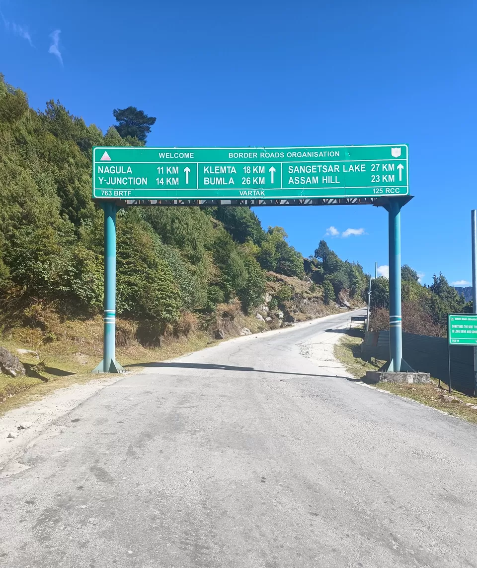
As we rode through the rugged Himalayan terrain, we felt the thrill of adventure coursing through our veins. The majestic peaks and pristine landscapes that surrounded us were awe-inspiring. The thin air and high altitude only added to the excitement. Despite fuel shortages, we pushed on, determined to conquer the heights. We could feel the hypoxia taking its toll both on man and machine, but we were driven to reach our destination.
There is a huge demand for petrol in Tawang, so you may have to wait in a queue in freezing cold to fill up your tank .
This is border between India and China and we could see and greet the Chinese soldiers on the Chinese side.

The journey was arduous, but the reward was worth it. We had conquered the Bumla Pass ! However, please note that being very close to the China border, your phone may get connected to Chinese networks. It is recommended that you opt-out of roaming to avoid any international roaming charges .

As we placed pebbles in the Heap of Stones Monument, gratitude filled our hearts. These stones stood as a tribute to the mighty Himalayas and the guardians of our northern frontiers. A Sino-India friendship sign reminded us that borders could be bridges too.The Indo-China Border Personnel Meeting (BPM) point was our next stop. Here, rival armies held meetings in a humble hut on the Indian side. The track was treacherous, and only SUVs dared to tread, especially on clear weather days with no snowfall or rainfall.

"Sangestar Tso: A Hidden Gem in the Himalayas"
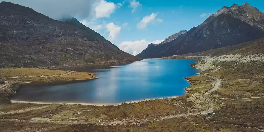
And then, there it was – the serene Madhuri Lake, also known as Sangestar Tso. Created by falling rocks, boulders, and trees during an earthquake, this lake had even graced the silver screen in the Bollywood movie Koyla, earning it the nickname Madhuri Lake. It lay about 20 kilometers beyond the bifurcation of the road leading to Bumla Pass.


This journey wasn’t just about reaching a destination; it was about experiencing the raw beauty, the history, and the spirit of adventure that echoed through the Himalayas.

And as we settled into our accommodations at Hotel Vajra, we knew that the memories of this day would forever be etched in our hearts.
The Bum La Pass serves as a border crossing between China’s Tsona County in Tibet and India’s Tawang district in Arunachal Pradesh. It lies 37 kilometers away from the town of Tawang in India and 43 kilometers from the town of Tsona Dzong in China. Here are some key details about this remarkable pass:
Historical Significance: The road to Bumla Pass follows an old traders’ route. It once connected Tawang to Tibet via the Milakatong La Pass. During the 1962 Sino-Indian War, this area witnessed significant conflict as the People’s Liberation Army of China invaded India and and one of the fiercest battles, the Battle of Bum In 2006, Bum La Pass was re-opened to traders after 44 years, allowing traders from both sides to enter each other’s territories. Subedar Joginder Singh Sahnan, PVC, was a true hero who guarded the Bhumla Pass with bravery and tactics against a much larger enemy force. He was awarded the Param Veer Chakra for his heroics 1. Even the Chinese, upon learning of his bravery and sacrifice, repatriated his ashes with full military honors on May 17, 1963 .
1. Road Conditions: Brace yourself for a bumpy, back-breaking drive. The road winds through snow and mud, challenging even the most seasoned travelers. But fear not; the Border Roads Organization (BRO) has done an impressive job maintaining the route.
2. Distance: Bumla Pass lies approximately 37 kilometers away from Tawang. While the distance may seem short, the winding roads and elevation changes make the journey more time-consuming.
3. Scenic Beauty: As you ascend, the landscape unfolds before you. Rhododendron flowers set the mountains aflame with color. You’ll pass pristine lakeshores, adding to the enchantment of the journey. Take a moment to absorb the breathtaking views and the sense of history that surrounds you.
Heap of Stones Monument: Visitors place pebbles here as a gesture of gratitude to the mighty Himalayas and the guardians of our northern frontiers. A Sino-India friendship sign stands at this spot.
Indo-China Border Personnel Meeting (BPM) Point: Bum La Pass is one of the five officially agreed BPM points between the Indian Army and the People’s Liberation Army of China. Border meetings are held in a hut on the Indian side.
Permit Requirement: A special permit is necessary to visit Bum La Pass, which can be obtained from the Office of the Deputy Commissioner in Tawang District. In summary, Bum La Pass is not only a geographical boundary but also a place steeped in history, natural beauty, and strategic significance.
Panga Teng Tso Lake: Along the way, you’ll encounter the Panga Teng Tso lake. Its pristine waters mirror the surrounding peaks, creating a serene and picturesque scene.
Climate and Terrain: Bum La Pass is situated at an elevation of 15,200 feet (4,600 meters).The pass is often covered with heavy snow throughout the year, making it one of the most off-beat passes in the world.The road to Bum La is treacherous, and only SUVs are advisable, especially on clear weather days with no snowfall or rainfall.
Permit Requirement: A special permit is necessary to visit Bum La Pass, which can be obtained from the Office of the Deputy Commissioner in Tawang District. In summary, Bum La Pass is not only a geographical boundary but also a place steeped in history, natural beauty, and strategic significance.
Sangestar Tso (Madhuri Lake): About 20 kilometers from Tawang town, beyond the bifurcation of the road leading to Bum La Pass, lies the Sangestar Tso lake.This lake, also known as Madhuri Lake, featured Bollywood actress Madhuri Dixit in the movie “Koyla”.It was created by falling rocks, boulders, and trees during an earthquake. The road leading to Sangestar Tso, also known as Madhuri Lake, is an adventure in itself. Let me describe this remarkable journey:
Location and Geography: Sangestar Tso lies on the way from Tawang to Bum La Pass in the Tawang district of Arunachal Pradesh, near the Indo-China border. It sits at an elevation of 3,708 meters (12,165 feet) above sea level. Approximately 22 miles (35 kilometers) north of Tawang, it is about 4 miles (6.4 kilometers) west of Bum La Pass, which serves as a border trading point between India and China. The Taktsang Chu river, originating below the Takpo Shiri glacier to the north, flows through this region, eventually joining the Nyamjang Chu river downstream.Within the area, you’ll find the Taktsang Gompa, located about 1.5 miles (2.4 kilometers) to the west of the lake.
Road Conditions: Brace yourself for an adventurous and treacherous track. This road is not for the faint-hearted!The route is narrow, winding, and lacks guardrails. Only 4x4 vehicles are suitable for this journey.The track demands caution, especially during inclement weather—preferably on clear days with no snowfall or rainfall.
Permits and Access: Indian nationals can visit Sangestar Tso with permission from the Indian Army.To explore this pristine wilderness, set out from Tawang around 7 am and carry all your essentials. Remember that without the army stamp, you won’t pass the numerous check posts along the way.Popular Culture: The lake gained fame when it featured in a dance sequence by Bollywood actress Madhuri Dixit in the movie “Koyla”. Hence, it’s affectionately known as the Madhuri Lake.
“A Spiritual and Patriotic Day in Tawang”
Day 6 : Oct 26 , 2023 – Tawang Local Sight seeing tour – Tawang Monastery , Birth place of Dalai Lama , Chaksam Bridge , Tawang Giant Buddha,Tawang War Memorial
On the sixth day of our journey, the riders were treated to a leisurely day filled with spiritual enrichment and patriotic embellishment. We explored Tawang’s treasures, including the Tawang Monastery, the birthplace of the Dalai Lama, the ancient Chaksam Bridge, the Tawang Giant Buddha, and the poignant War Memorial in memory of 2420 officers and soldiers who laid down their lives during the 1962 war and Tawang’s Market. Each of these places is a chapter in our North East saga.

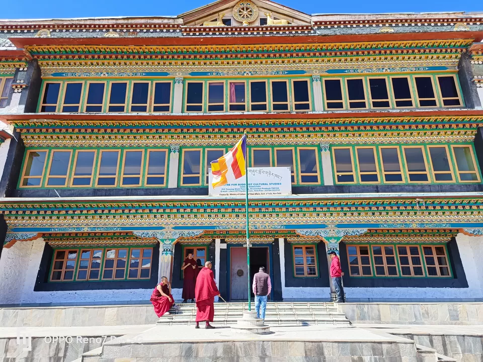


The Birth Place of 6th Dalai Lama: Tawang, the birthplace of the 6th Dalai Lama, continues to be a place of historical and spiritual significance, nestled amidst the stunning landscapes of the Himalayas.
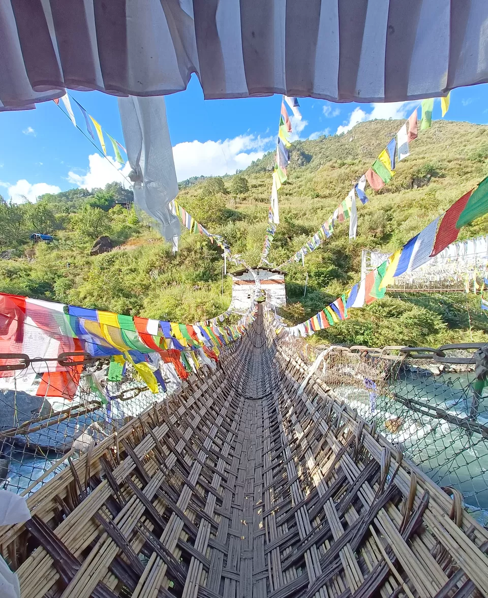
Chagzam Bridge This bridge is a remarkable architectural achievement. Chaksam bridge was constructed in the 14th century, by a disciple of the Dalai Lama Tangton Gyalpo. It was designed to provide a safe crossing over the Tawang Chu river and the fact you can still cross it now is a testament to its success. What’s more amazing is that with this being the only one in India, you’re in for a really unique experience. Of course, there’s a safety net, but that doesn’t make it any less wobbly or scary! If you don’t fancy braving the old bridge, there is a modern steel one to the side that’s more sturdy.
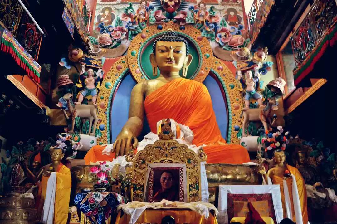
Giant Buddha of Tawang : One awe-inspiring sight is the giant statue of Shakyamuni Buddha. The statue is situated near the Tawang circuit, perched on a small hill that offers breathtaking views of the surrounding landscape. This magnificent golden statue stands at an impressive 28 feet tall. The Buddha is depicted in Padmasana (lotus position), with his left hand in Bhumisparsha mudra. This gesture symbolizes the moment when he called upon the Earth Goddess to witness his triumph over Mara, the supreme God of the world, during his enlightenment.

Tawang remains a significant pilgrimage site for Tibetan Buddhists and attracts curious travelers seeking both tranquility and cultural exploration. If you ever find yourself in Tawang, don’t miss the chance to marvel at this colossal Buddha statue and immerse yourself in the spiritual ambiance of the region.
Although it is now peace time, the reality at the border is otherwise. The riders saw huge army convoys, rocket launchers moved on the road, and many times they had to cross through army camps. They could also hear live ammunition and missile test firing in the border areas. They were stopped many times to check their credentials at the army checkpoints.
Let’s take a moment to salute our Jawans and officers who guard our borders, build roads in the harshest conditions we can imagine in extremes of temperatures.
“We all live in our comfort zones since they have sacrificed theirs.”
Let’s salute them for their ultimate sacrifice for our nation.

Tawang Monastery : Tawang Monastery, also known as Gaden Namgyal Lhatse, is the largest monastery in India. It is situated in the picturesque Tawang district of Arunachal Pradesh, close to the borders of China and Bhutan.
Let me share some fascinating details about this remarkable spiritual sanctuary: Founding and Significance: Founded in 1680–1681 by Merak Lama Lodre Gyatso, Tawang Monastery was established at the behest of the 5th Dalai Lama, Ngawang Lobsang Gyatso. It belongs to the Gelug school of Vajrayana Buddhism and shares a religious connection with Drepung Monastery in Lhasa, even during the British colonial era. The full name of the monastery is Tawang Galdan Namgye Lhatse, which translates to “the site chosen by the horse is the divine paradise of complete victory.”
Architectural Marvel: Perched atop a mountain at an elevation of approximately 10,000 feet (3,000 meters), Tawang Monastery commands a breathtaking view of the Tawang Chu valley—a landscape adorned with snow-capped peaks and coniferous forests. The monastery is enclosed by a 925-foot (282-meter) long compound wall and comprises 65 residential buildings. Its library houses valuable ancient scriptures, including the Kangyur and Tengyur.
Etymology: The name “Tawang” itself carries significance. It combines “Ta” (meaning “horse”) and “Wang” (meaning “chosen”), signifying “the location selected by horse.” The complete meaning of “Tawang Galdan Namgye Lhatse” beautifully translates to “the site chosen by the horse is the divine paradise of complete victory.”
Access and Legends: Nearby Tawang Town, named after the monastery, is well-connected by road, rail, and air services. Legends surround the monastery’s establishment. One tale attributes the selection of its present location to a horse ridden by Merag Lama Lodre Gyatso on a mission assigned by the 5th Dalai Lama. Tawang Monastery stands not only as an architectural marvel but also as a testament to the spiritual and socio-cultural fabric of this enchanting region.
Tawang War Memorial : The Tawang War Memorial is a poignant tribute to the brave soldiers of the Indian Army who made the ultimate sacrifice during the 1962 Indo-Sino War. Located on a slope just before reaching the main town of Tawang, this memorial stands as a solemn reminder of their valor and dedication.The memorial was built to honor those who gave their lives in defense of the nation. The 40-foot tall structure stands tall, symbolizing the courage and resilience of our soldiers. Light and Sound Show: Every evening after sunset, a captivating light and sound show takes place at the memorial. The show provides insights into the history of Arunachal Pradesh and the events surrounding the 1962 war with China. It’s a must-watch for visitors seeking to understand the region’s past and pay homage to our heroes. As the sun sets, the amphitheater comes alive with the narration of historical events, accompanied by illuminating lights. It’s a moving experience that leaves a lasting impression on all who witness it. After a whole days drive ,our riders were treated to a visual and audio patriotic extravaganza
A Biker’s Journey Through the Hidden Gems of Tawang
Day 7 : Oct 27 , 2023 – Tawang to Bomdila – Nuranang water falls, Jaswant Ghar War Memorial . NH 13 – 188 kms , Accomodation : Hotel Dey Dhen Geykhil Altitude: 7274
On the seventh day of our journey, we bid a bittersweet farewell to Tawang and embarked on a thrilling adventure. Our journey took us through the picturesque Nuranang waterfalls, Jaswant Garh and back via Sela, Baishakhi Cafeteria where both man and machine rested and recharged. Each stop left an indelible mark on our hearts. And to top it off, we luxuriated in the hot springs near Dirang!

https://youtube.com/shorts/_kxbuSj0BYs?feature=share
Nuranang Falls, also known as Jang Falls or Bong Bong Falls, is a 100-meter-high waterfall located in the Tawang district of Arunachal Pradesh, India . The waterfall is situated on the Tawang River, which originates from the glacial lake of Tawang and drops from a height of about 100 meters . The waterfall is surrounded by lush greenery, and the falling water can be heard from afar. The Nuranang river and Nuranang falls are named after a local Monpa girl named Nura (also spelled as “Noora”) who had helped an Indian Army soldier, Rifleman Jaswant Singh Rawat, Maha Vir Chakra (posthumous) in the Battle of Nooranang during the 1962 Sino-Indian War and was later captured by the Chinese PLA forces .Nuranang Falls has been featured in several Bollywood movies, including Koyla and Hiya Diya Niya

You can relish the nature's bounty with a sip of Hot chai facing the falls !

Jaswant Ghar War Memorial stands as a testament to courage and sacrifice. Let me share the remarkable story behind this memorial: Another hero of Indo China War 1962 who single handedly killed 300 Chinese soldiers Jaswant Singh Rawat !
Location: The memorial is located near Nuranang, approximately 25 kilometers from Tawang, in the scenic terrain just below the Sela Pass.
Honoring Bravery: It commemorates the bravery of the martyred Indian soldiers during the 1962 Indo-China War, specifically focusing on Rifleman Jaswant Singh Rawat of the 4th Battalion of Garhwal Rifles Infantry Regiment.
Jaswant Singh Rawat’s Valor: During the Battle of Nuranang on 17 November 1962, Rifleman Jaswant Singh Rawat displayed extraordinary valor. The Chinese forces had launched repeated attacks, but the 4th Garhwal Rifles held their ground. When a Chinese medium machine gun (MMG) threatened their position, Rifleman Rawat, along with Lance Naik Trilok Singh Negi and Rifleman Gopal Singh Gusain, volunteered to subdue it. They closed in on the MMG, neutralized the Chinese detachment, and captured the weapon. Tragically, Gusain and Negi lost their lives, and Rawat was seriously injured but managed to return with the MMG. The battle resulted in 300 Chinese casualties, while the 4th Garhwal Rifles lost two men and had eight wounded.

Rawat’s Heroic Stand: Despite injuries, Rawat continued to fight. He held off the enemy for 72 hours, aided by two local Monpa girls named Sela and Nura (Noora). Sela was killed, and Noora was captured. Rawat’s unwavering determination kept the Chinese forces at bay. Eventually, they discovered that they were facing only one fighter. The Chinese stormed Rawat’s position, and the exact details of his death remain unclear. Some accounts suggest he shot himself with his last round of ammunition, while others claim he was taken prisoner and executed by the Chinese. After the war, the Chinese commander returned Rawat’s severed head and a brass bust of him to India.

Legacy: To honor Jaswant Singh Rawat’s bravery, the army post he defended was named the “Jaswant Garh post”. The Jaswant Garh War Memorial was built at this post, immortalizing his sacrifice. It stands at an altitude of about 10,000 feet. Visitors from across the country pay their respects to this courageous soldier throughout the year. May Rifleman Jaswant Singh Rawat’s memory continue to inspire generations, reminding us of the indomitable spirit of our soldiers.

This memorial is left to commemorate those who lost their lives in this conflict. Today, you can stop off at this area to pay your respects. As a kind gesture to all who travel through, the army offers free cups of steaming chai to set you up for the journey ahead.
Broken roads, a vibrant massage to all your joints and spine adds spice to your offroading capabilities

A few of our members were eager to dip into the hot springs of Dirang, while the others left for Bomdila for a good night’s rest. The fortunate three had a great soakage in the hot water springs!
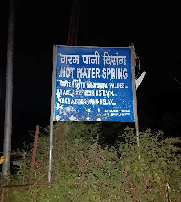
The natural hot water spring in Dirang is a popular tourist attraction in Arunachal Pradesh, India. It is believed that the water of the spring has medicinal properties due to its high sulfur content . The spring can be reached via a series of steps, and there is a pool where visitors can take a bath for a fee .

After a long drive for almost 12 hours , we rode under shining moon light guiding us through the mountain roads , we reached our destination BOMBILDA to a warm welcome by our hosts .

"Bomdila to Kaziranga: A Journey Through the Hills"
Day 8 : Oct 28 , 2023 – Bomdila to Khaziranga – 233 kms NH 13, NH 715 enroute BOMBDILA Monastery , Chilpam Monastery , Nechipu Tunnel , Bhalukpong , Nammeri , Tezpur – Kaziranga . Accomodation : Hotel Hong Thor Altitude: 200 feet
The Stretch of Joy
On the eighth day of our expedition, we embarked on a ride from Bomdila to Kaziranga—a stretch that transcended mere miles. As we descended from the lofty heights of Bomdila, the landscape unfolded like a vibrant canvas. Lush green valleys stretched out before us, their emerald hues punctuated by meandering rivers. The mercury climbed from single digits to double, and the sun danced upon our faces.

Bid Adieu to the Hills
If you’re an adventurous biker looking for a unique cultural experience, consider staying with a Monpa family in Arunachal Pradesh. During our stay, our gracious hosts gave us a warm send-off as we departed, leaving us with memories that will last a lifetime. The Monpas are one of the major tribes in Arunachal Pradesh and are known for their rich culture and traditions. They are also known for their hospitality and welcoming nature, making them the perfect hosts for travelers looking to immerse themselves in local culture .
Our gracious hosts bid us farewell, their smiles etched in our memories. We paid homage to the Bomdila Monastery, its prayer flags fluttering in the mountain breeze. En route, atop a hillock, we stumbled upon another hidden gem,a Buddist temple DUL DUL THARPA LING, a sentinel of serenity against the azure sky.


The Bomdila Monastery is a Buddhist monastery located in Arunachal Pradesh, northeastern India . It was established in the year 1965 and represents the spiritual essence of Buddhism . The monastery is situated close to the Tipi Orchid Research Center in West Kameng district . It is constructed by who was believed to be the 12th reincarnate of Tsona Rinpoche and is a replica of the Tsona Gontse Monastery in Tibet . The monastery belongs to the Mahayana Buddhism and features a huge prayer hall and other attractions such as the Buddhist Temple within its premises .
Shutter Stops and Bamboo Shoots
If you’re an adventurous biker looking for a travel experience that’s off the beaten path, consider exploring the Bhalukpong region in Arunachal Pradesh. You come across a Buddist temple DUL DUL THARPA LING beautifully located on top of a hillock. But there is no info in the net regarding this temple. Here, you’ll find a bridge that beckons you to pause and take in the stunning views of the surrounding landscape.

The Nechipu Tunnel is another must-visit spot, where you can witness the darkness yielding to the light beyond.

The Nechiphu Tunnel is a 500-meter-long “D-shaped, single tube double lane tunnel” on the Balipara-Charduar-Tawang (BCT) Road in West Kameng district of Arunachal Pradesh . It is located at an altitude of 5,700 feet and will accommodate two-way traffic. The tunnel will be equipped with modern lighting and safety facilities


Bamboo Shoots
While in Bhalukpong, don’t miss the chance to try the local delicacy of bamboo pickle. Here, we witnessed the alchemy of bamboo shoots transforming into pickles, a local delicacy that tantalized our taste buds. This unique dish is made from the inner core stem of young bamboo trunks, which are transformed into various food products. The bamboo pickle is particularly famous and can only be found near Bhalukpong on the Arunachal-Assam border. It’s worth noting that the process of making bamboo pickles is a family affair, with all members of the family involved in the process. This adds to the authenticity of the experience and provides a glimpse into the local culture and traditions. So, if you’re looking for a unique culinary adventure, be sure to try the bamboo pickle in Bhalukpong!
Lunch at Tezpur

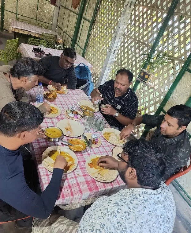
To sum up this region is a hidden gem that’s waiting to be explored. So, pack your bags, hop on your bike, and get ready for an adventure that you’ll never forget!
Gliding on the plains :
After spending almost a week in the rugged mountains of Arunachal Pradesh, we are now embarking on a journey towards the vast and sprawling plains of Assam. The transition from the lofty peaks to the flatlands is a stark contrast, but we are excited to explore the new terrain and discover what it has to offer. From the dense forests to the mighty Brahmaputra river, Assam is a land of diverse landscapes and cultures. We can’t wait to see what adventures await us!
Sunset and moonrise on the Brahmaputra
As we were crossing the 3-kilometer-long Koliabhomora Bridge over the mighty Brahmaputra, we were fortunate enough to witness a full moon rise, we happened to be at the right place at the right moment. The sight of the beautiful moon rising from the river was truly mesmerizing and unforgettable. After a week-long sojourn on the treacherous mountainous roads of Arunachal Pradesh, the smooth ride at 100 kmph on the Asian Highway Project felt like our shackles were taken off. The wind blowing on our faces added to the thrill of the moment.
As the sun dipped low, casting a golden glow upon the water. We stood on the precipice of day and night, our hearts echoing the rhythm of the river. And there it was—the sunset, a fleeting masterpiece painted across the horizon.
Kolia Bhomora Setu, an existing bridge completed in 1987, is a 3.015 km long pre-stressed concrete road bridge on NH-715 over the Brahmaputra River in Tezpur Assam state of India, which connects Tezpur in Sonitpur district on northern bank with Kaliabor in Nagaon District on the south bank. It is named after the Ahom General Kolia Bhomora Phukan. A new Bhomoraguri-Tezpur Bridge 3.040 km long, few meters parallel to the existing Kolia Bhomora Setu, is opened in 2021.

Khaziranga’s Promise
We are now headed towards the Kaziranga Wildlife Sanctuary on our penultimate day, eager to explore the diverse flora and fauna of the region.Finally, weary but exhilarated, we arrived in Khaziranga. The anticipation hung thick in the air—the promise of encounters with the one-horned rhinos. As the night settled around us, we dreamed of wild grasslands and ancient beasts, ready to greet us at dawn. We could easily feel the increase in temperature as we switched on the AC.
“Rhinos and Roaring Highways: A Kaziranga Odyssey”
Day 9 : Oct 29 , 2023 – Khaziranga to Guwahati – 233 kms NH 715 and AI 5
As we reached the end of our long and treacherous trip, we decided to give our bikes some rest and explore the Kaziranga Wildlife Park.
The Rhino Encounter
The dawn in Kaziranga unfurled with the promise of magic—a jeep safari into the heart of the wild. As the sun painted the grasslands gold, we met the majestic rhinos, their prehistoric forms grazing peacefully. Their single-horned crowns held stories of resilience and survival, etched in every wrinkle. This park is the only place in the world where you can find the one-horned rhinoceros, a species that has been poached for its horns and has dwindled in numbers.

The cost of each ride was 4000 and an entry fee of Rs 642 and can accomodate 5 adults . Safari time is roughly 3 hours .

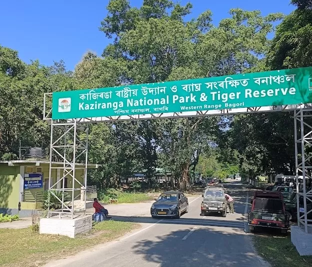

Kaziranga National Park is a UNESCO World Heritage Site and a Tiger Reserve in the state of Assam, India . It is located on the south bank of the Brahmaputra River, about 60 miles west of Jorhat on the main road to Guwahati . The park covers an area of 1,090 square kilometers (420 square miles) and is home to two-thirds of the world’s Indian rhinoceroses . The park also has large breeding populations of elephants, wild water buffalo, and swamp deer . Kaziranga is recognized as an Important Bird Area by BirdLife International for conservation of avifaunal species . The park has a rich biodiversity and a history of conservation efforts .

We were lucky enough to spot a few of these magnificent creatures, along with many other rare birds, marsh deer, and bison.
KAZIRANGA TEA ESTATE RIDE:
After the safari ride, we strolled through the Tea Estates in Kaziranga, which was a bumpy and slippery ride.


Homeward Bound
But all adventures must find their way back home. With a heartfelt farewell, we mounted our bikes, the engines humming in harmony with our memories. Guwahati awaited, a bittersweet destination. The highway stretched before us, a ribbon of asphalt that whispered tales of speed and freedom.
Adrenaline Rush
Mixed feelings swirled among us—anticipation and nostalgia. The penultimate day, a bridge between the extraordinary and the ordinary. Yet, as we throttled up, the highway transformed. On our last day, we took the highway ride to Guwahati, cruising comfortably on the 4-way lane. Our bikes, our loyal companions through jungles and valleys, now craved for more velocity. Triple-digit speeds became our anthem, wind tousling our hair, and the road singing beneath our wheels. Munching the miles at ease true to our groups name, compared to the crawling on the mountains and rough terrain, it was as if our bikes were begging us for more speed. Our trip has given us happiness with lots of adrenaline-pumping rides and beautiful memories to relish. We were able to cover the distance in just below 4hours .
The Night of Farewells
In Guwahati, we returned our bikes, each one gleaming, battle-scarred yet triumphant. The riders, a brotherhood forged by dust and shared sunsets, exchanged nods—a silent pact to ride again. And there, under the star-studded sky, we bid adieu to our guide, Road Captain MR. Anubhav Singh. His wisdom and care had been our compass, and now he rode toward Siliguri, a 500-kilometer journey awaiting him.
“A Farewell to Guwahati: Embracing the North East”
Day 10 : Oct 30 , 2023 Guwahati Rope Car, Kamakya Mandir
Departure, Yet Not Goodbye
As day ten dawned, we stood at the crossroads of departure. Guwahati, our haven of memories, cradled us one last time. The Ropeway gifted us vistas to cherish, the Brahmaputra winding like a silver ribbon below. We visited the Kamakhya Mandir located on a hilltop , stood—a silent sentinel bidding us farewell and to top it up we had a taste of Guwahati Market shopping for Assam tea in the main market and some souvenirs before we boarded our flight back home.


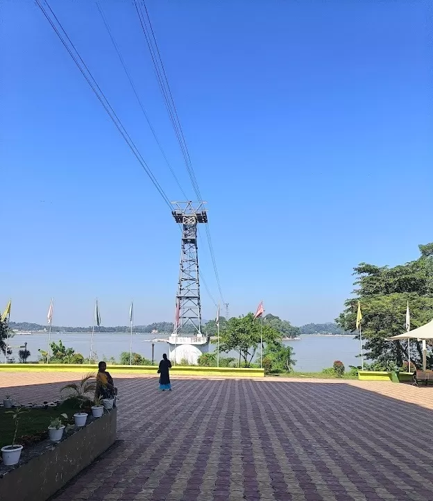
On the last day of our trip, we took a ride on the Guwahati Ropeway to enjoy the breathtaking views of the Brahmaputra River and Guwahati. The cost of the ride was only Rs. 100 for a round trip, making it an affordable and worthwhile experience

The Guwahati Ropeway is a popular tourist attraction in Guwahati, Assam, India. It is India’s longest river ropeway, spanning a distance of almost 2 km . The ropeway connects the main city of Guwahati to the north bank of the Brahmaputra River and offers a mesmerizing aerial view of the river, Umananda Island, and the panoramic view of Guwahati . The ropeway has two terminals: the lower terminal is located at Panbazar in front of Nehru Park, Guwahati Main City, and the upper terminal is located behind Dol Govinda Temple at North Bank of Guwahati . The ropeway has two passenger cabins that can hold up to a maximum of 32 people or 2560 kgs . The cabins are imported from Gangloff Cabin company of Switzerland . The ropeway takes nearly 7-10 minutes to travel from one terminal/station to another station . The ropeway’s cabin travels at the speed of 10-15 km/hour, providing a good aerial view of the Brahmaputra River and its surroundings . The ropeway’s parking facilities have a capacity of parking for 70 cars and 80 bikes at the lower terminal and 100 cars and 80 bikes at the upper terminal.

North East: A Slice of Heaven
Oh, North East, you are a wondrous slice of heaven! Your mist-kissed valleys, your rhododendron-clad hills—they linger in our hearts. Your warmth, like a grandmother’s embrace, and your magic, woven into every prayer flag fluttering in the breeze.
Until We Meet Again
We part ways, but not forever. Our souls carry your beauty—the crimson sunsets, the monsoon-drenched forests, the laughter of children playing by the river. We’ll return, tracing the contours of your mountains, seeking solace in your tea gardens.
It’s about the journey, not the destination….
The Sela Pass to Tawang circuit—a symphony of peaks and valleys. But heed my advice: don’t rush. Pause behind the wheel. Let the wind tousle your hair as you sip chai with a view. Talk to the locals—their stories are the true landmarks. And if you meet a yak, share a nod; they know secrets the mountains whisper.
Arunachal’s Invitation
Arunachal Pradesh is a land of dense forests and untamed rivers that delights travelers who seek more than conquest. It’s a place where you can test your limits, not just on the roads but within your spirit. And when you stand at Tawang, the Himalayas will cradle you—their ancient magic seeping into your bones. Until then, North East, we carry you in our breaths, our dreams, and our wanderlust.
Every rider experiences a paradigm shift during this ride. The remoteness, pristine wilderness, and lack of mainstream motorcycling make Tawang an alluring destination. The North East region, with its Seven Sister States, beckons adventure enthusiasts. Riding a motorcycle in Tawang, nestled in the northeastern state of Arunachal Pradesh, is an exhilarating adventure that takes you through breathtaking landscapes, challenging terrains, and cultural wonders. I had tried to paint a vivid picture of this remarkable journey hoping this will ignite the fire inside you to explore and to indulge in adventure.
There are still many beautiful places to explore in India, and Arunachal has lots more to offer. Hopefully, we will try to cover them in our next rides.
I would like to thank all our friends for their encouragement, support, and for encouraging me to write this short travelogue

Adding one more feather to my cap
Leh, Ladakh, Manali, Gurez Valley, Kashmir, Sikkim and Arunachal...
DRIVE ALONG ..LAST MILE....
“Riding the Witty and Humorous BRO Road”
The Border Roads Organisation (BRO) is a branch of the Indian Army that is responsible for constructing and maintaining roads in India’s border regions. BRO has been instrumental in building and maintaining roads in some of the most challenging terrains in the world, including the Himalayas . BRO’s road signs are not only informative but also witty and humorous. They are designed to catch the attention of drivers and encourage them to drive safely on the treacherous mountain roads .
A few are :
- Better Mr. Late than Late Mr.
- Let your insurance policy mature before you.
- On the bend go slow friend
- Feel the curves / Do not test them
- Darling I like you / but not so fast
- Safety on road / is “safe tea” / at home
- After whisky / driving risky

REACH FOR THE STARS EVEN IF YOU HAVE TO STAND ON A CACTUS

CHECK YOUR NERVES ON MY CURVES
The BRO road signs are a reflection of the organization’s culture and values. They are often written in English and Hindi, and sometimes in the local dialects of the region. The signs are colorful and creative, with catchy slogans and illustrations that make them stand out . Witty and humorous nature of BRO’s road signs, which are a unique feature of India’s mountain roads. It also highlights the challenges of riding on BRO roads, which are constructed and maintained in some of the most challenging terrains in the world, including the Himalayas.

MOUNTAINS ARE PLEASURE IF YOU DRIVE WITH LEISURE

IF YOU ARE MARRIED DIVORCE SPEED

IT IS NOT A RALLY ENJOY THE VALLEY

CHANCE TAKERS ARE ACCIDENT MAKERS

YOUR DESTINATION IS REWARD FOR SAFE DRIVING

YOUR SAFETY OUR CONCERN DRIVE SLOW

FELL THE CURVE DONT HUG THEM

BEAUTIFUL ROADS BEAUTIFUL DESTINATIONS

DRIVE LIKE HELL AND YOU WILL BE THERE

ON THE BEND GO SLOW FRIEND

AFTER WHISKY DRIVING IS RISKY

EXCELLENCE IS A JOURNEY DISCIPLINE IS A VEHICLE

DRIVE WITH REASON THIS HOLIDAY SEASON

LIFE IS SHORT LIVE IT FULLY
These signs are not only informative but also entertaining, making the journey more enjoyable for travellers .In conclusion, BRO’s road signs are a testament to the organisation's commitment to safety and its sense of humour. They are a unique feature of India’s mountain roads and are sure to bring a smile to the face of anyone who sees them.
Tire Marks in our soul. . …. A Journey to reckon with !


Journeys of Gratitude
Traversing the roads of Tawang is an intimate communion with nature, a daring exploration of one’s boundaries, and an enchanting embrace of the Himalayan mystique. Every rider experiences a paradigm shift during this ride. The remoteness, pristine wilderness, and lack of mainstream motorcycling make Tawang an alluring destination. Riding a motorcycle in Tawang, nestled in the northeastern state of Arunachal Pradesh, is an exhilarating adventure that takes you through breathtaking landscapes, challenging terrains, and cultural wonders.
I would like to express my gratitude to my Late Father , My Mother both of whom gave me the go ahead for my trips and blessed with their prayers , My Brother who takes care of my chores and responsibilities in my absence, My wife who supports me in my sojourns and to my enthusiastic kids .
To my co-riders for their exceptional support, patience, and accommodating to difficulties, shortfalls, and challenges we faced.
I would also like to thank our organiser, Mr. Santanu Banerjee, for organising the tour, and our Road Captain, Mr. Anubhav, for taking care of us all for 10 days.
My special thanks to Ms. Neera Singh MD of Devil on Wheels , www.devilsonwheelz.com for organizing our earlier sojourns to Leh Ladakh Manali, Kashmir and Gurez Valley and Sikkim .
Join me in my future vistas and sojourns as we weave more chapters, to sharing more adventures with you where roads merge with memories and the horizon beckons anew.
Yours truly,
Mohamed Ali
Indelible memories ..from the past …
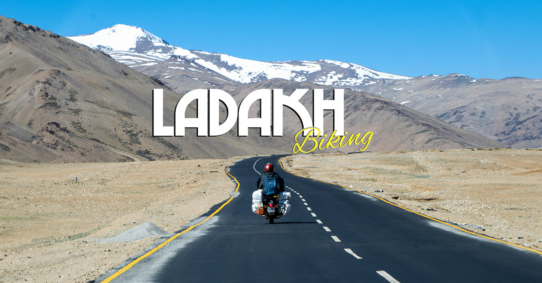
“Leh Ladakh Manali: A Scenic Adventure” 2017


“Biking through the scenic Gurez Valley”. 2021


“Riding through the mist: A biker’s journey in Sikkim 2022”


Prof.Dr.K.Mohamed Ali MBBS.,MD.,MA.,DIH.,Phd.
lkbkma@gmail.com http://www.youtube.com/@knightrider965
Dr. K. Mohamed Ali is a qualified physician and a specialist in Community Medicine. He has published many research studies in International Medical Journals and has occupied many positions in both government and private medical colleges.
He has co authored a book - a commerative biography titled "THE ROAD TO SUCCESS "A Legend Par Excellence" - The Inspiring Life of Dr. L.K.B. https://www.amazon.in/dp/B0C3JKG56Z
He is a partner in LKB Associates, National Pharma Hospital and Research Institute, and group of companies. Dr. Ali is also a Professor in the Department of Community Medicine at Vinayaka Mission’s Medical College, Karaikal.
In addition to his medical profession, he is a bike enthusiast who drives a Suzuki Shogun 1994 model that he bought during his college days and still maintains in pristine condition.

He has a passion for long drives and has recently embarked on a string of adventure rides in the Himalayas, visiting many exotic locations.
Dr. Ali has worked hard to script this travelogue, painstakingly arranging the contents, scripting the travelogue, and arranging photos and videos.
Endorsement Disclaimer:
The views and opinions expressed in this travelogue are solely those of the author and do not necessarily reflect the official policy or position of any agency or organization. The author is not affiliated with, endorsed by, or sponsored by any of the companies, hotels, or individuals mentioned in this travelogue. The author acknowledges and appreciates the services and assistance provided by them during the trip, but does not guarantee or warrant the quality, accuracy, or reliability of their products or services. Any errors or omissions or inaccuracies in this travelogue the author is not responsible.This travelogue is intended for informational purposes only and does not constitute professional advice or endorsement.

