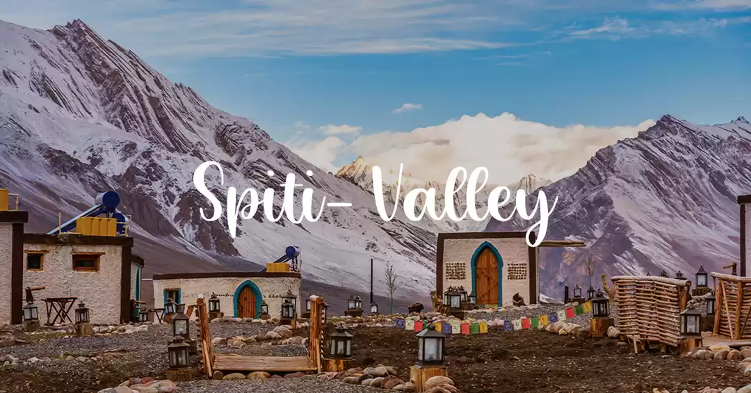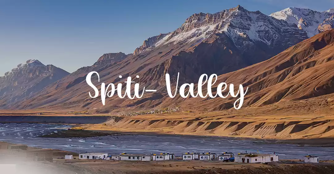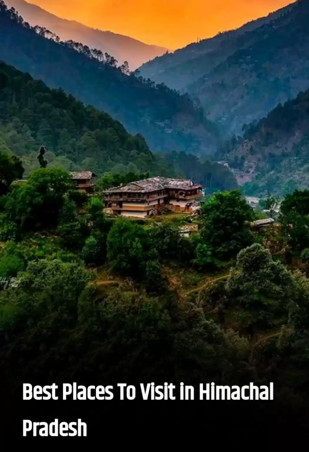
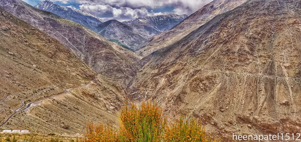
Spiti valley is a cold desert mountain area located at north-east part of the Himachal Pradesh. Meaning of the word SpItI – is “middle land”, as it is situated between Tibet and India.
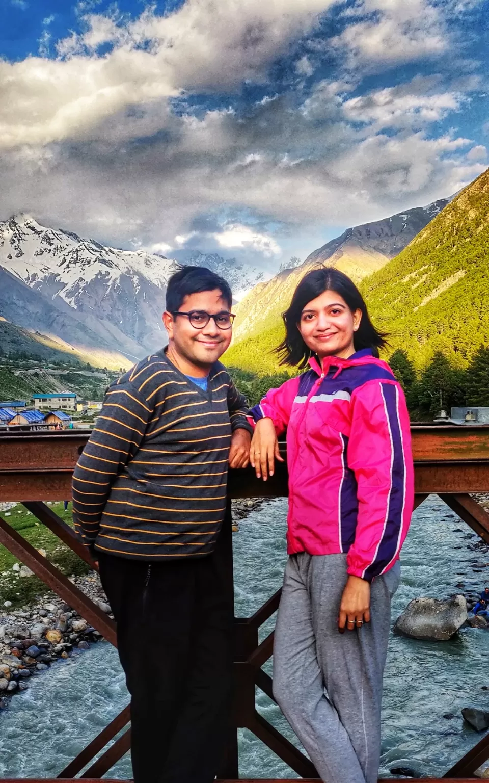
I had my Spiti valley trip in June,2019. It was a self-arranged group tour with friends. Its not about the destination, its about the journey. But in case of Spiti trip, both journey and destinations are beautiful. Its a breath-taking journey through magnificent Himalayan mountains with musical Sutlaj and Spiti river. Such journies become more enjoyable if you have amazing companies of like minded people who are as crazy nature-lovers as you.

We planned this trip in June, because by this time, two important pass of this circuit, Rohtang pass and Kunzum pass, are supposed to be opened. I had got the news of opening of Rohtang pass in first week of June only, but Kunzum pass was not still open. I was having great hope that it would get open by we reach Kaza, on mid June.
Second reason we had choose June, as its summer time there, you can avoid bone moving cold nights. Chances of getting superb views increases, due to clear sky in summers.
We took overnight journey by air from Ahmedabad to Chandigarh with one stop at Delhi. We were able to sleep for 3-4 hours at Delhi airport lounge.
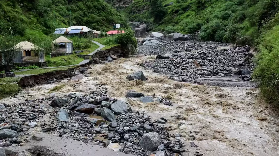
RULE : Its rule in such areas, that early you leave the place in morning, you are supposed to reach your destination earlier safely before the sunset. its not safe to drive in dark after sunset. There are possibilities of land-slides, natural (occasionally) and most of the time, elective anytime anywhere. So better to keep some buffer time also for this factor.
DAY 1 : CHANDIGARH TO NARKANDA, 176 KM, ALMOST 6 HOURS.
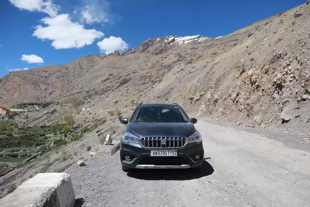
We reached Chandigarh early morning on 8th June, Saturday. Innova cars with drivers were ready to pick up us all. One of our friend wanted to self-drive, so we hired one zoom car also for him. He is pretty experienced in mountain driving, otherwise its not safe idea to self-drive on dangerous roads of Spiti. Plan was to reach Narkanda, by evening. As early you leave Chandigarh in morning, you can reach Narkanda on time in evening.
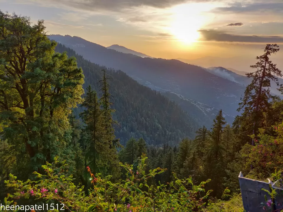
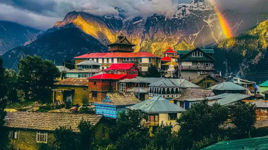
Although, Narkanda is very beautiful village from each and every corner, with dense forested mountains, there are two main attractions there.
HATU PEAK: is the 2nd highest point of Shimla, situated 3400 metre (11.150 ft) above sea levels. It has a small wooden temple called HATU MATA temple. You will get 360 degree view of the surrounding and sunset is just amazing from here. Hatu peak is perfect place to enjoy first sunset of the Spiti trip.
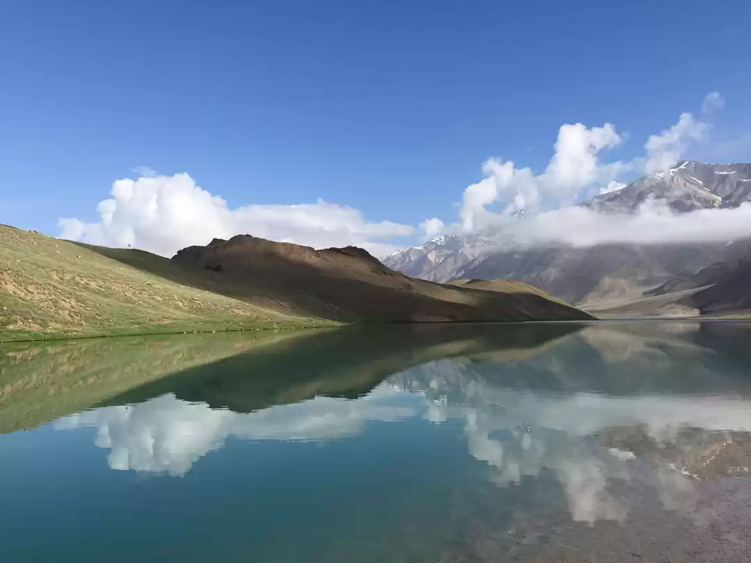
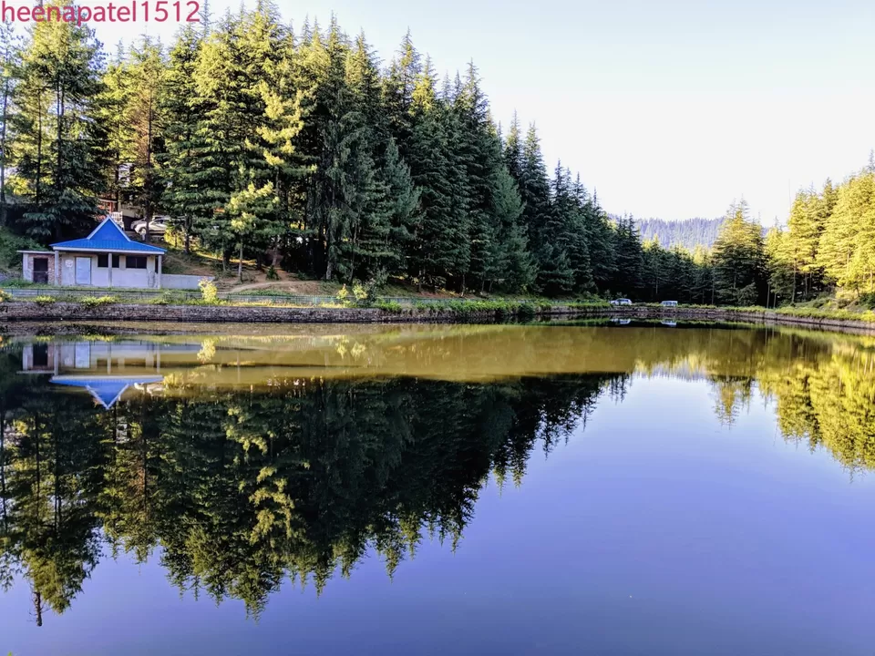
TANNI-JUBBAR LAKE : is a small lake surrounded by dense deodar tree forests, having stagnant water which mirrors the blue sky and green trees. Must visit place for peace, serenity and tranquility. Best time to visit in early morning.
THINGS TO DO : You can visit apple orchards and purchase delicious cherries from the market of Narkanda.
NIGHT-STAY : ZOSTEL-KOTGURH : We had the best accommodation of the whole trip, here. It was a house which was converted into hotel, managed by Atul Pandya, a local person from Shimla only. I quickly completed my dinner and went for sleeping, as I wanted to wake up early for the sunrise. Sharing the glimse of the first sunrise from my room. It was an unforgettable experience.
DAY 2 : NARKANDA TO CHITKUL VIA RAMPUR-BUSHAR,SARAHAN AND SANGLA.
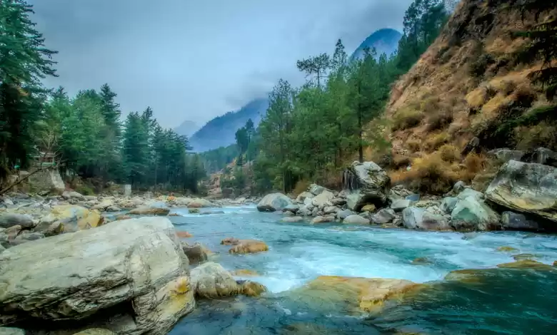
I woke up early at 5 am, enjoyed sunrise, quickly got ready to visit Tanni-Jubbar lake. We returned to zostel again, completed break-fast and left Narkanda by 9:30 am. Road condition is good throughout, except some small stretches here and there. You can see ongoing road repairing works with labourers and JCBs. You can see under-ground hydro-electric project on Sutlej’s tributary Bhaba Khad river on the way. After crossing Sangla and Rakchham village, we reached at Chitkul-last village of India. It is a small heaven on the bank of river Bispa.
THINGS TO DO : Chitkul was my most favourite location of this trip. After reaching Chitkul, you can have a small hike till the river. We spent very quality time on the bank of river, played with freezing cold water. I had went to river again in morning also. Its perfect location for meditation also.
NIGHT STAY : We had booked hostel here on the bank of river. It was very basic. If you want to stay at Chitkul, there are not very good options for accommodation. If you want to have descent stay, then Banzara camp is the option. Its located at Sangla valley, few kilometres from Chitkul. It has very picturesque surrounding with apple orchards, high mountains and flowing river Baspa. Its costly but has deluxe tents, suite rooms and river facing huts with delicious food.
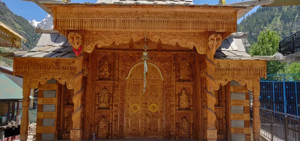
DAY 3 : CHITKUL TO KALPA ( 61 KM ) As its very short journey today, we can explore the local culture of Kinnauri people on the way. we left very leisurely today morning from Chitkul and reached RAKCHHAM – which is very small village, full of picturesque scenery around. We enjoyed its beauty, completed photo shoot and reached at BATSERI village. It has BADRINARAYAN TEMPLE – stunning example of intricate wooden carvings.
Next stop was KAMRU FORT. Fort is built uphills you need to climb up for 800 metre from entrance gate. We met its local people, while climbing the fort. They speak Kinnauri, Hindi and English language. You can have mesmerising view of Sangla valley, from the top of the forte. After spending enough time at fort, we completed our lunch and headed towards Kalpa. 
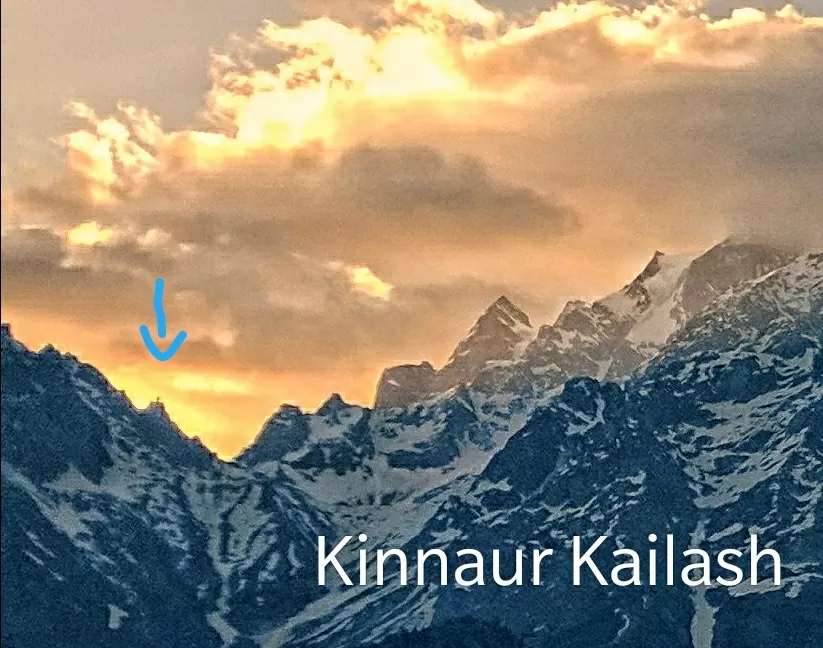
KALPA : is the perfect stop while going Kaza from Shimla. As you reach top of the Kalpa, you can see the amazing view of majestic snow capped Kinnaur Kailash range of Himalayas right in front of you. You can experience the thrill of this cliff, called ROGHI POINT. Be careful from the wind there which can throw you below from the cliff. Some people call it suicide point, also.
Next stop was KAMRU FORT. Fort is built uphills you need to climb up for 800 metre from entrance gate. We met its local people, while climbing the fort. They speak Kinnauri, Hindi and English language. You can have mesmerising view of Sangla valley, from the top of the forte. After spending enough time at fort, we completed our lunch and headed towards Kalpa.
KALPA : is the perfect stop while going Kaza from Shimla. As you reach top of the Kalpa, you can see the amazing view of majestic snow capped Kinnaur Kailash range of Himalayas right in front of you. You can experience the thrill of this cliff, called ROGHI POINT. Be careful from the wind there which can throw you below from the cliff. Some people call it suicide point, also.
KINNAUR KAILASH : This range holds religious significance as it is listed one amongst the five mount Kailash. It has height of 6050 metre, having 79 feet vertical rock (SHIVLING), located at an altitude of 4500 metre. Devotees visit it every year. Its difficult level trekking but nature treat for trekkers.
NIGHT STAY : Good options of hotels are available here.
DAY 4 : KALPA TO TABO VIA NAKO & GUE VILLAGE
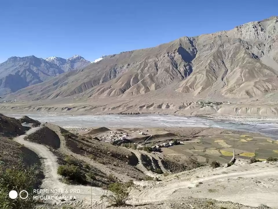
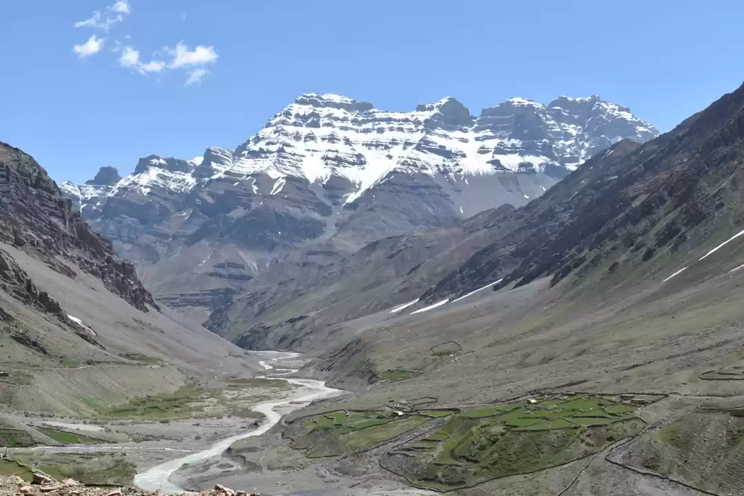
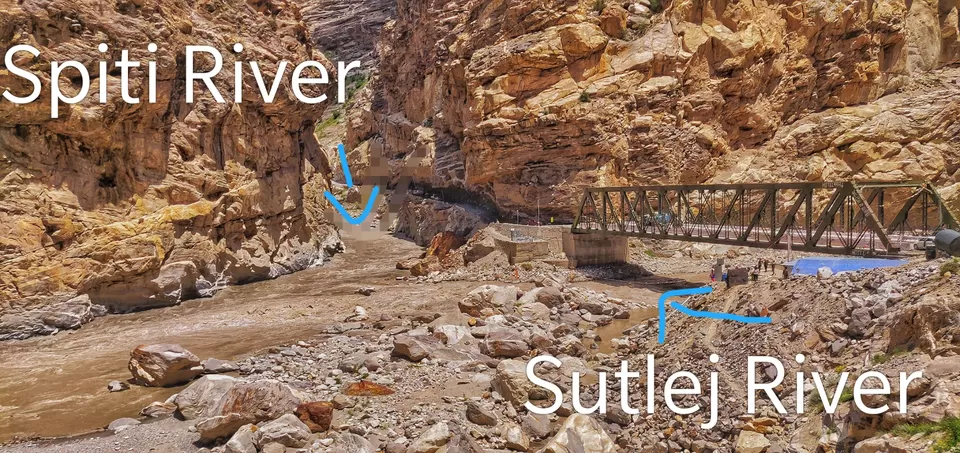
Do try to leave Kalpa early, as you head towards Nako village. After driving for 3 hours, you will reach at KHAB SANGAM – which is the confluence point of SUTLEJ RIVER & SPITI RIVER. This bridge on Sutlej river at khab sangam is the GATEWAY to scenery changes from lush green valleys to barren cold desert mountains of spiti region.
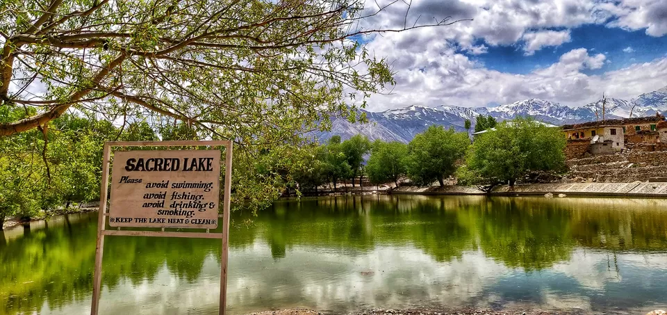
NAKO VILLAGE & LAKE :
is a small hemlet in the lap of Hangrang valley (12,000 ft), very near to Indo-Tibetian border of Kinnaur district. It has man made NAKO LAKE, which is very small but surrounding trees and mountains make it very picturesque. Village has its monastery also. We completed our lunch here and headed towards Gue monastery.
Few kilometres ahead of Nako village, there comes “malling nalla”, which is most prone region for landslides.
GUE MONASTERY : It takes 2-3 hours from Nako village to reach at the Gue village. Its 12 km from Sumdo-the village from where Spiti region of Himachal Pradesh starts. Its road & scenery can steal one’s heart for sure. Must visit undoubtedly. Apart from the beautiful scenery from the Gue monastery, it has approximate 500 years old mummy of Buddhist monk named Sangha Tenzin. The body is naturally mummified by himself for the holy cause in favour of people living there. This fact is scientifically proved by the team of researchers of Oxford University. Locals have much respect for this holy monk. Most of the body parts of mummy are still preserved.
TABO : It takes almost 2 hours to reach from Gue village to Tabo village.
TABO MONASTERY : Do try to reach at monastery at least around 6pm. It has a big shanti “STUPA” which is ceremonial burial mound built for the respect of Buddhist saints as well as Buddha himself. Its very important ritual to do its Pradakshina to get blessings of such holy souls.
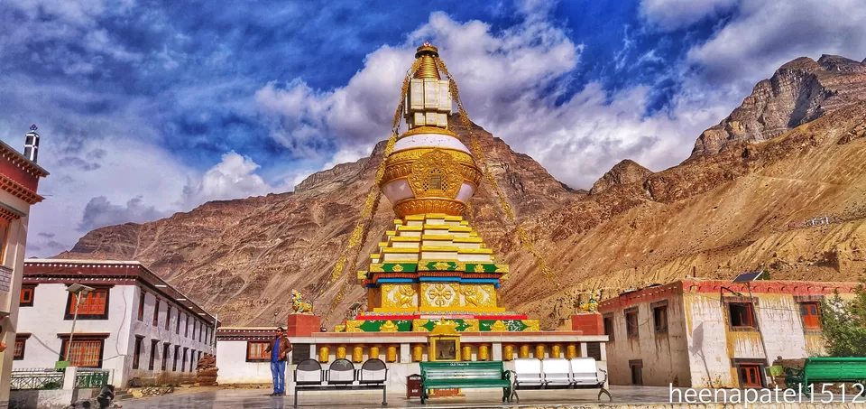
Campus has two monasteries. One is new and another is oldest, continuously operated Buddhist enclave of India. This old monastery is protected by the Archeological survey of India- ASI as a national historic treasure of India. Old monastery.
NIGHT STAY : Metrey regency is best option to stay here. Do book it well advance. Other options are basic.
DAY 5 ; TABO TO DHANKAR TO PIN VALLEY DHANKAR VILLAGE : Is the old capital of Spiti valley at an altitude of 3900 metre. It is situated on the left bank of Spiti river.
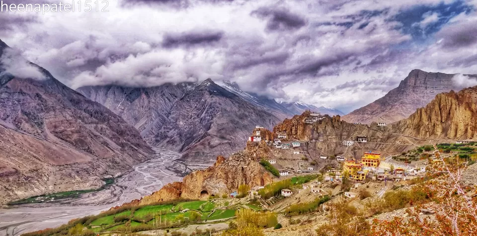
DHANKAR GOMPA: Is the Buddhist temple, built 1000 feet high on a cliff, overlooking the confluence of river Spiti and river Pin.
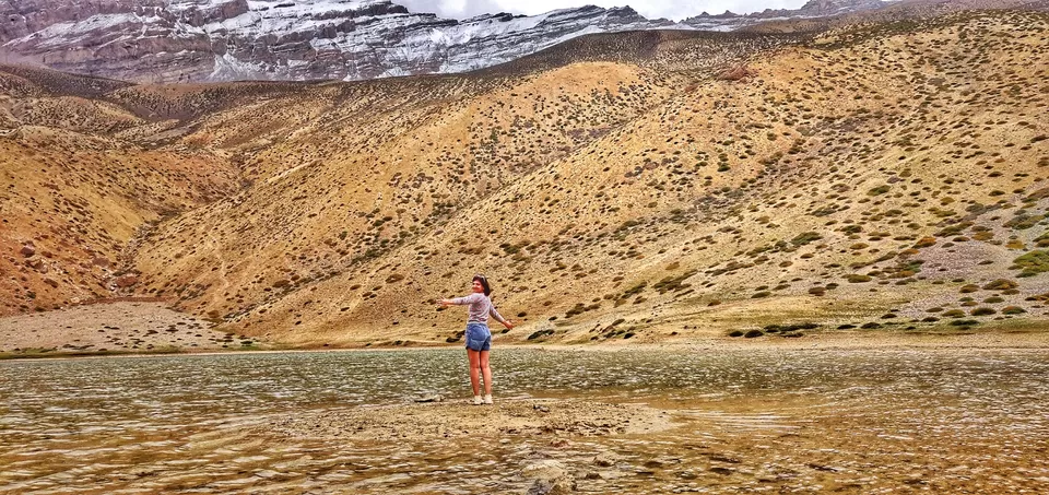
DHANKAR LAKE: Is situated at the height of 14,010 feet from sea level. One has to trek for around 1000 feets from Dhankar monastery. Depending upon your fitness level, It can take 1-2 hour to reach at lake. Good quality hiking shoes are necessary. It is like small adventure. There is a good cafe at the monastery to enjoy Thupka and Maggie like stuff.
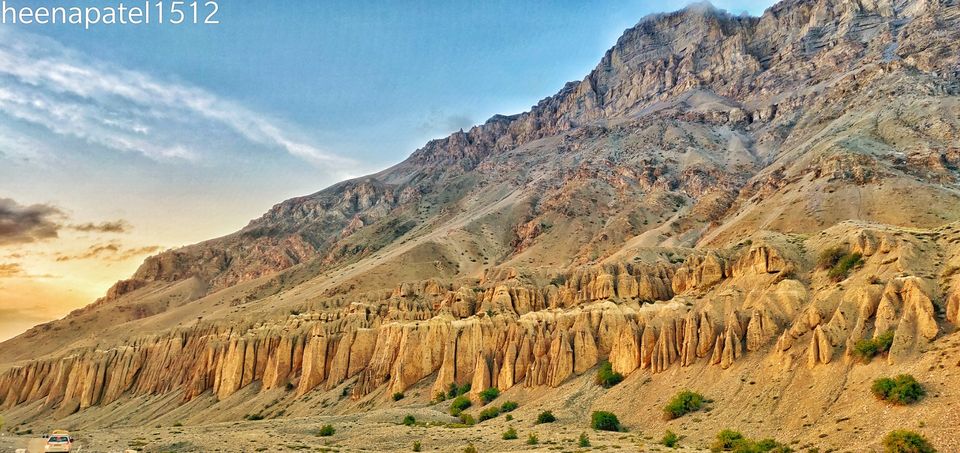
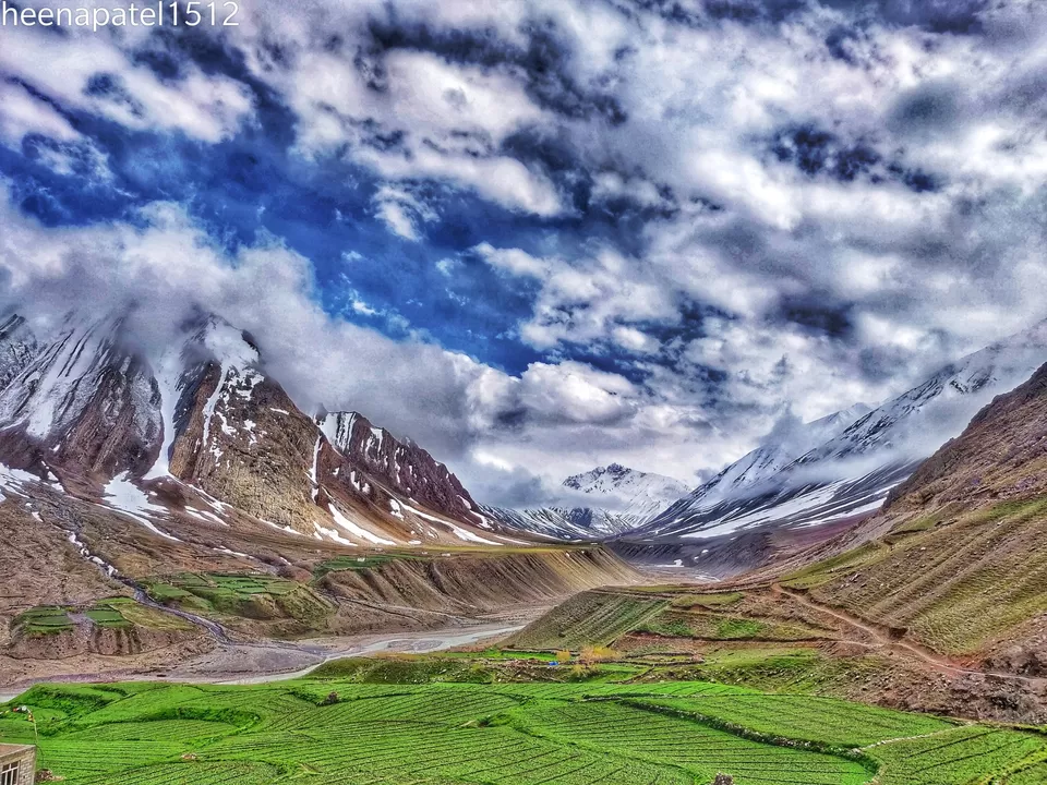
PIN VALLEY (MUD VILLAGE) : Distance from Dhankar village is approx 50 km, doable in 2 hours. If you want to enjoy colourful mountains, Pin valley is the exact place. Words just can’t describe its natural beauty. I hope, my retirement home would be at such place, very close to river,mountain,clouds and green.
NIGHT STAY : Mud village in Pin valley is very small where you can get very basic facilities for accommodation and medical issues. So two options are there, either you can stay here or reach Kaza , as its distance from Mud village is just 50 km. You can get late to reach at Kaza but very good options for accommodation are available there.
DAY 6 : PINVALLEY TO KAZA ( 50 km)
Kaza is the largest town of Spiti valley at an altitude of 12,500 feet from sea level. It’s distance from Kalpa is 200 km, from Shimla is 400 km and from Manali is 200 km.
KEY MONASTERY : Is the largest monastery of the Spiti region on the bank of Spiti river at an altitude of 13,670 feet from sea level. You need to climb adjacent hill to get this magical view.
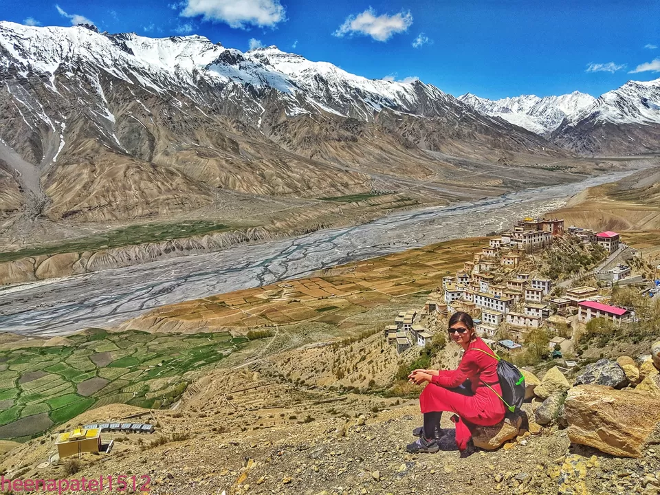
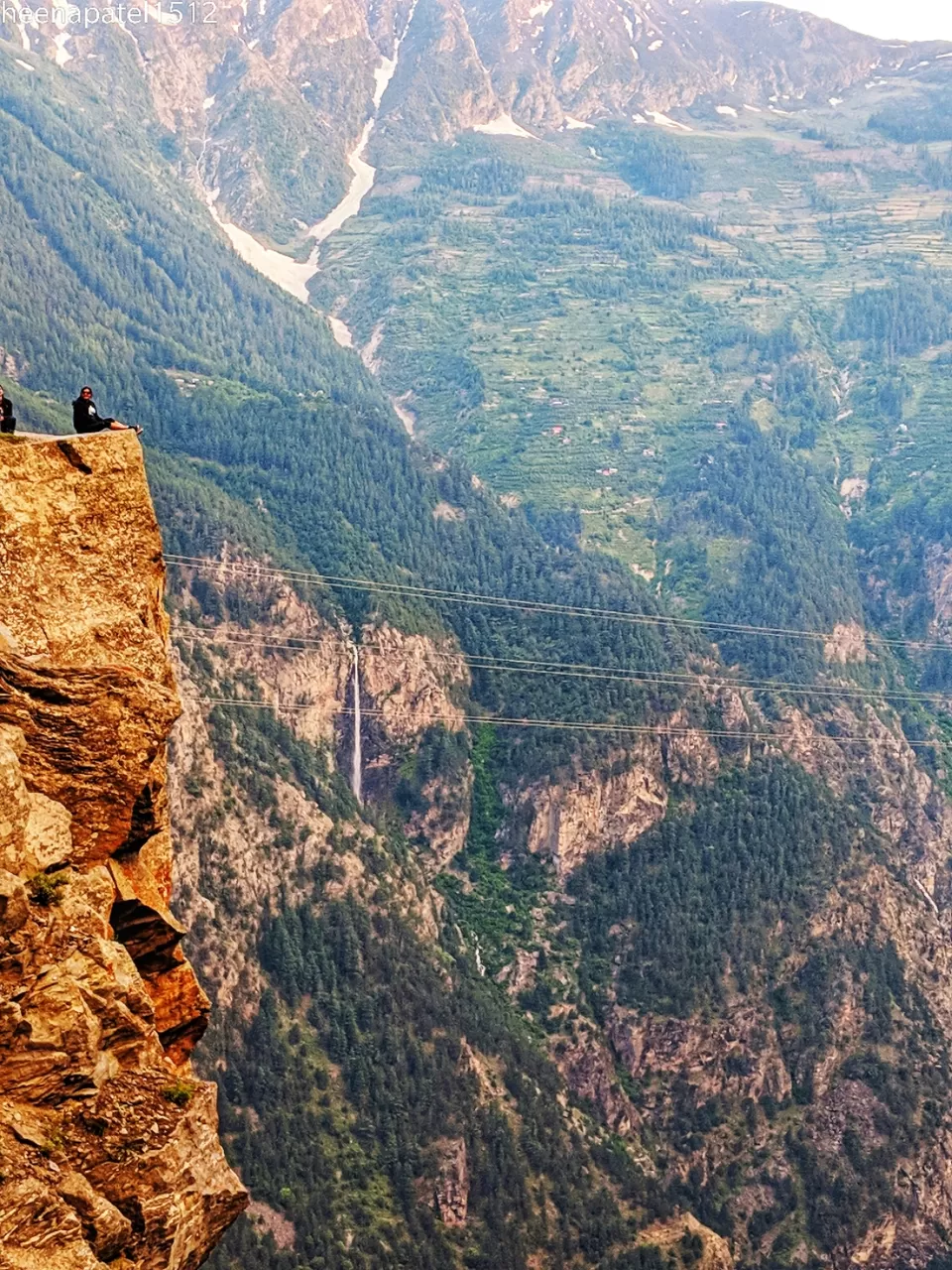
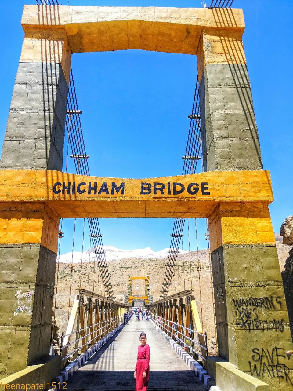
CHICHAM BRIDGE : Is the Asia’s highest bridge, at an altitude of 13,596 feet, on Chicham-Kibber road. View of the bottom from chicham bridge is breath-taking.
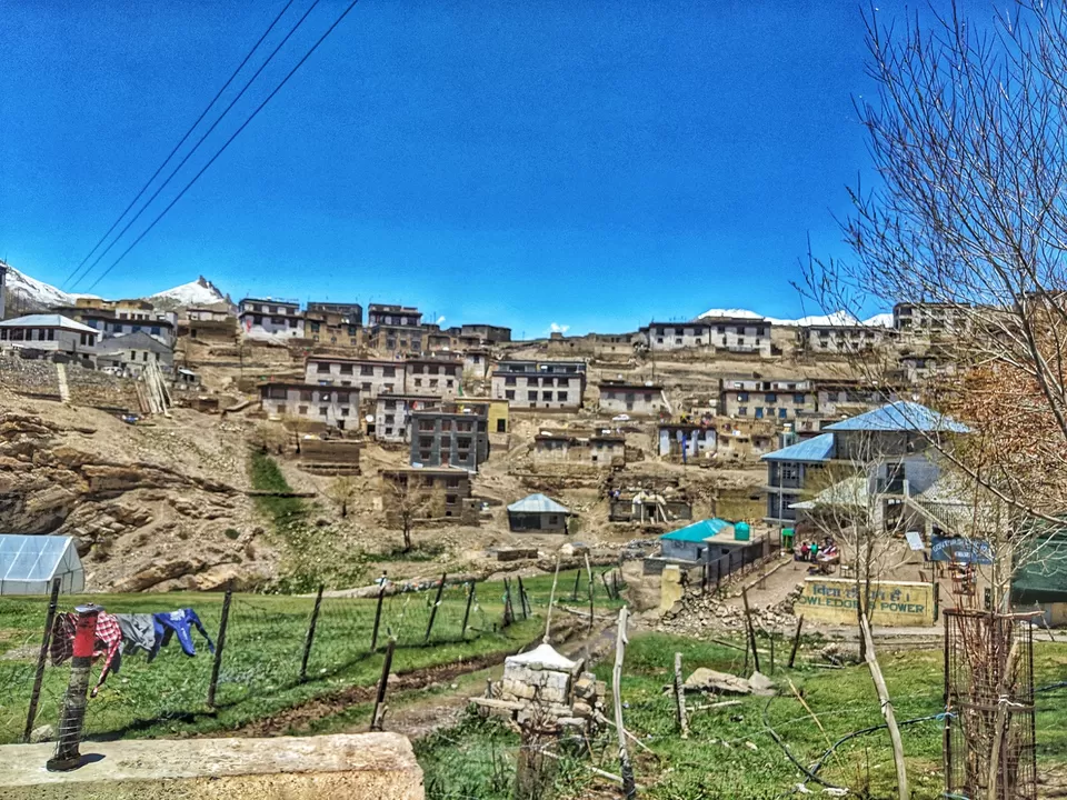
KIBBER VILLAGE : Is a small village located at an altitude of 14,200 feet, 20 km from Kaza town. It has 80. houses. People are kind and helping. Kibber village. in afternoon, we explored Kaza town and its local market. It has good cafes, few with live music like Zomsa, Himalayam cafe etc. Many local shops to buy woolen clothes, jewellery, keychains, gifts etc. I purchased cute woolen cap from Kaza.
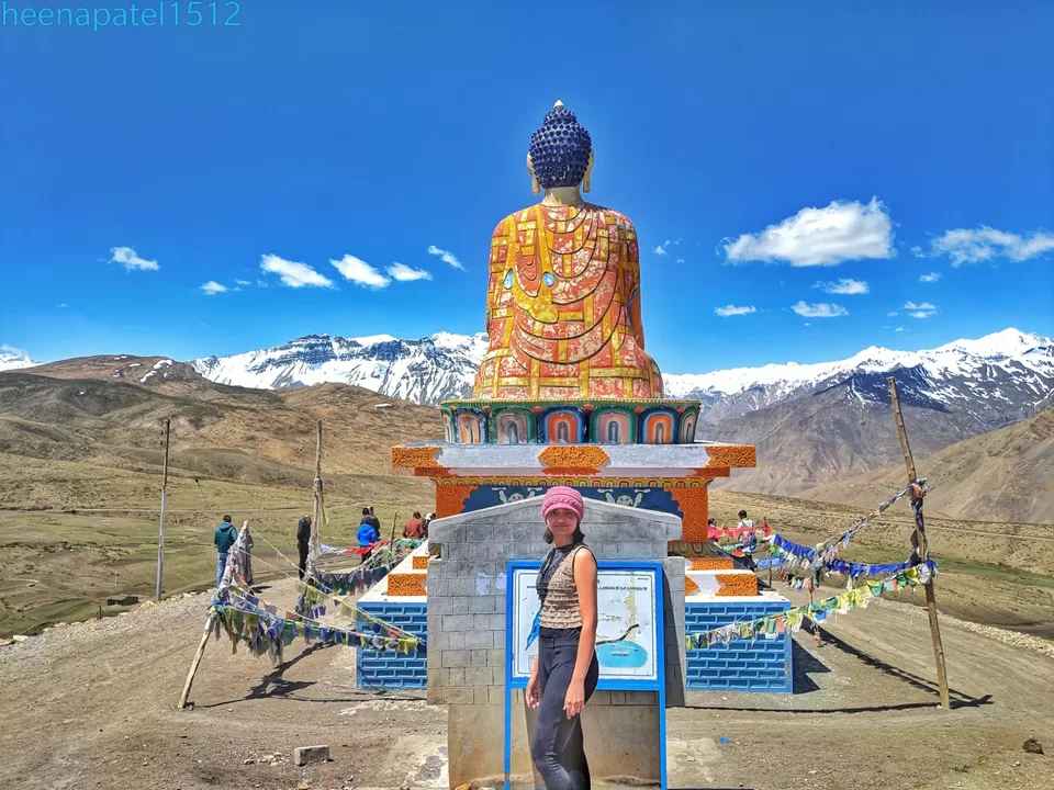
DAY 7 : LANGZA VILLAGE : Is the little heaven in the lap of Spiti valley at an altitute of 14,000 feet. Distance from Kaza town is 16 km, can take 1 hour to reach by car in summers. It gets disconnected in winters due to heavy snow fall. There is big statue of ” LORD BUDDHA ” at this place which is built in the year of 2005.
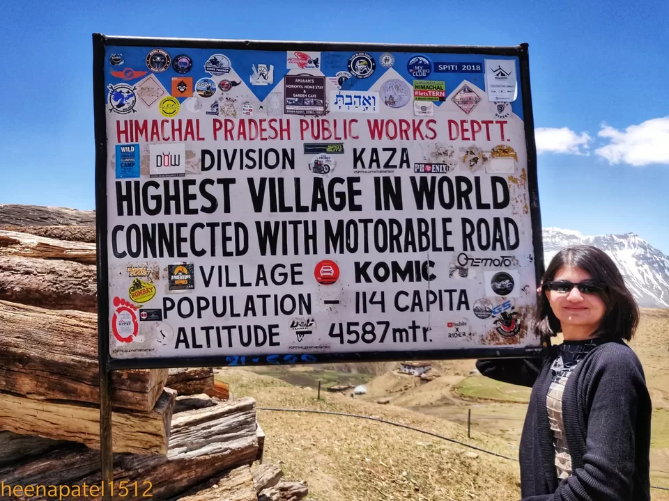
KOMIC VILLAGE : Is the highest village which is connected with motorable road at an altitude of 14,200 feet. It is just 19 km from Kaza and 11 km from Lanza village. Its very scenic. It has very old monastery of Tangyud which has stuffed snow leopard inside it. There is a small cafe also which can offer you some good hot, all types of tea & coffee. 
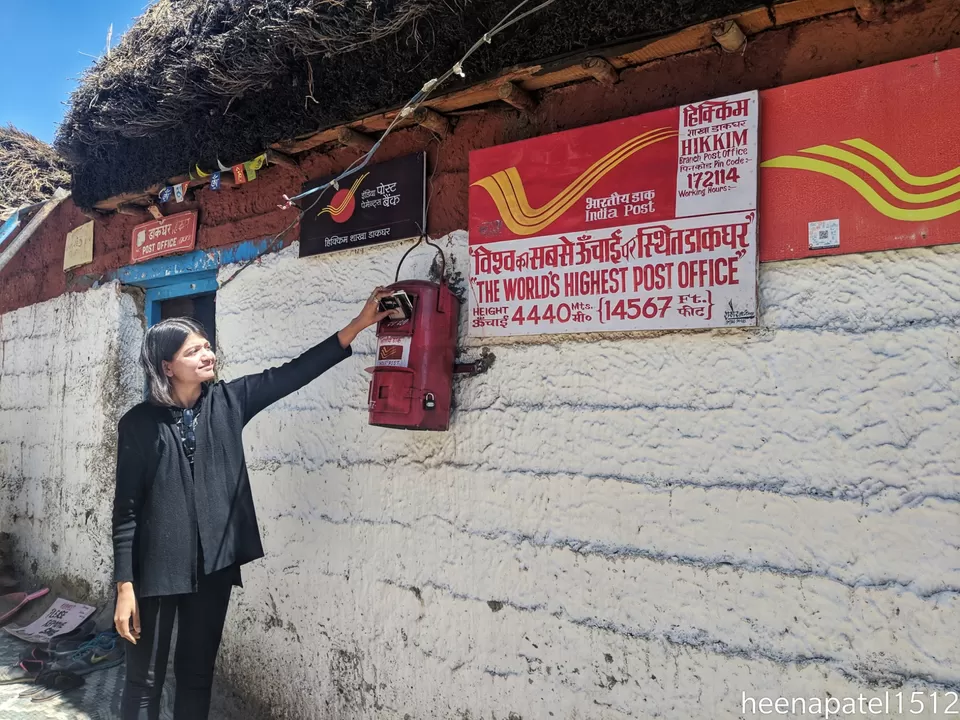
HIKKIM VILLAGE : Which has world’s highestpost office at an altitude of 14,567 feet. We had written postcards to our loved ones from here and almost all got their cards within 10 days, even in foreign country also. It was such a sweet memory.
Then we took our lunch at Zomsa cafe again in Kaza town and left for Tabo, as Kunzum pass was not open yet due to heavy snow fall last winter.
In this case, you can take same route in reverse, from Tabo to Rampur bushier and from Rampur to Chail via Shimla. Chail is also a good tourist centre. We had booked a good resort here and enjoyed much with good food, dance & luxury. On the day 10, we went Chandigarh airport from Chail. If Kunzum pass is open, then further route is like this.
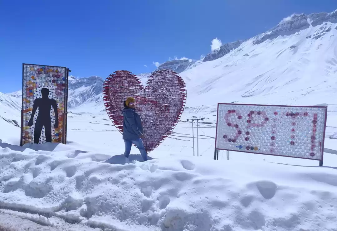
DAY 8 : KAZA TO CHANDRATAL, 120 KM, 4-5 HOURS.
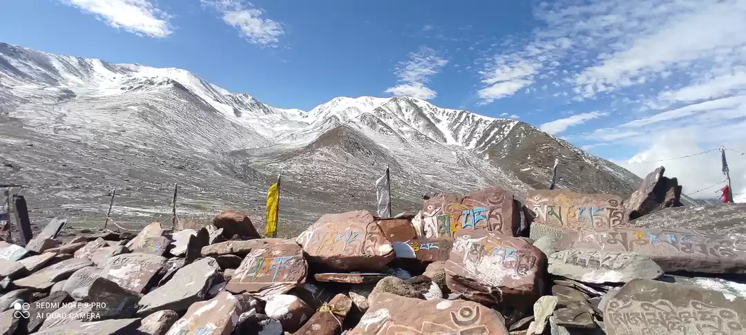
After breakfast, drive to Chandratal via Lohsar (last village of Spiti region), and Kunzum pass. Do have a stop at Kunzum pass, have blessings of Kunzum Devi and go ahead. Do reach at Batal and have detour from Batal to Chandratal. Its just 15 km but very ugly condition of roads, you will have to face.
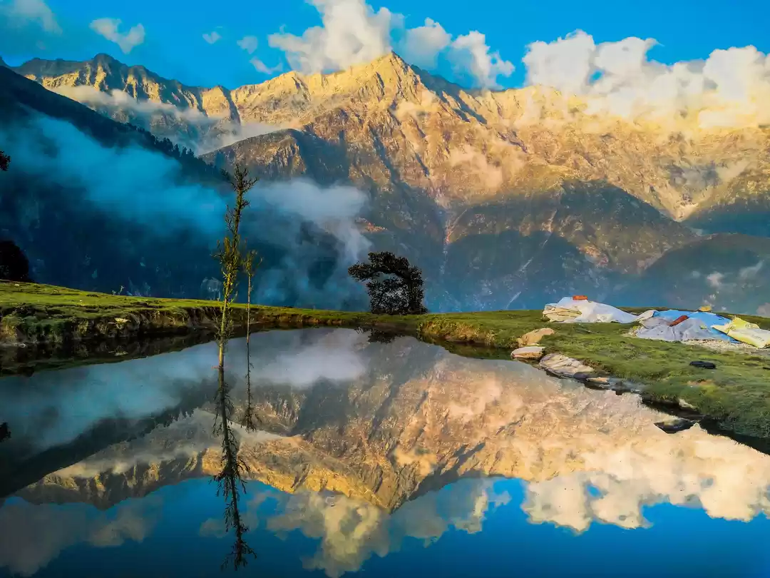
There is a small hike of 1 km to reach at this beautiful lake, in the middle of snow capped mountains. It looks like mini version of Pangong lake.
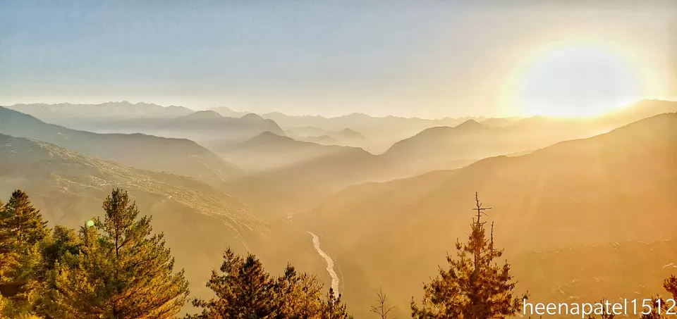
NIGHT STAY : Is in the camps near to Chandratal lake. Food id cooked there only. Br ready for most chilly night of the trip here. Sky looks mesmerising with starts and Milky Way.
DAY 9 : CHANDRATAL TO MANALI VIA CHHATRU & ROHTANG PASS 120 KM
Rohtang pass, manali
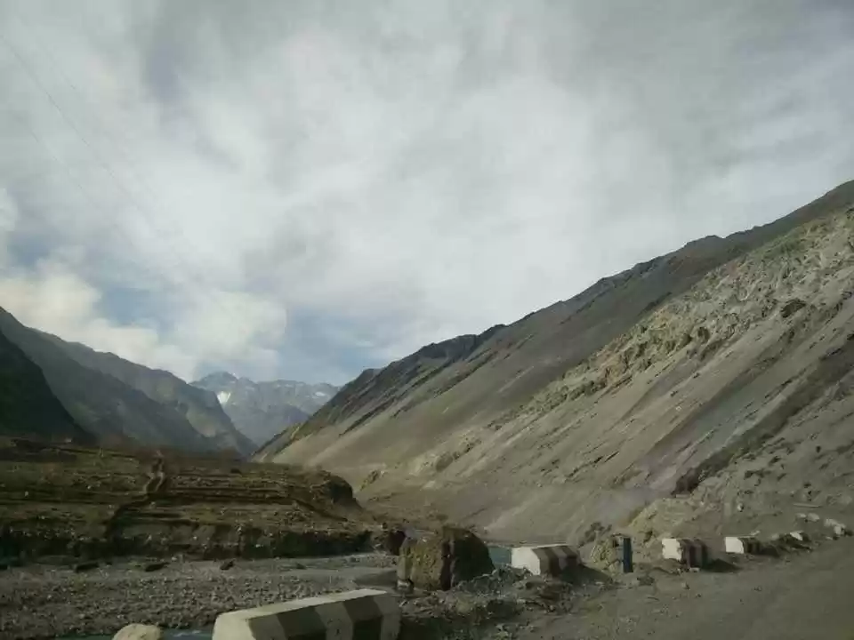
You will have to face some difficulty on this route, as road condition is not good enough. Chances of landslides are more. You have to cross some streams in route, but the beauty of this route is most enchanting with sky high mountains. Do have some break at Rohtang pass, get clicked and reach Manali by evening.
Day 10 : MANALI TO CHANDIGARH
It is advised to go to bed early on previous night, as you have to wake up early in morning and leave for Chandigarh. Book your flight tickets in evening after 4-5 pm. We had our return tickets at 4:30 pm. Most beautiful trip had ended as, we reached Ahmedabad by 8 pm.
I have written Instagram blog of Spiti valley. My I'd is dr.heenapatel. Do follow me for interesting travel and health content.

' fill='%23359391'%3e %3cpath d='M46.1538462%2c43.5714286 L41.5%2c50 L36.8461538%2c43.5714286 L36.8670256%2c43.5714286 C36.3173077%2c42.7142857 36%2c41.6851429 36%2c40.5714286 C36%2c37.4854286 38.4535641%2c35 41.5%2c35 C44.5464359%2c35 47%2c37.4854286 47%2c40.5714286 C47%2c41.6851429 46.6826923%2c42.7142857 46.1329744%2c43.5714286 L46.1538462%2c43.5714286 Z M41.4294872%2c39 C40.6150641%2c39 39.9487179%2c39.675 39.9487179%2c40.5 C39.9487179%2c41.325 40.6150641%2c42 41.4294872%2c42 C42.2439103%2c42 42.9102564%2c41.325 42.9102564%2c40.5 C42.9102564%2c39.675 42.2439103%2c39 41.4294872%2c39 L41.4294872%2c39 Z' id='Location-white'%3e%3c/path%3e %3c/g%3e %3c/svg%3e)