
For more such out of the box travel destinations visit my personal blog www.lonelymusafir.com
The preparations
Spiti has always been to my cards and plan to this exquisite beauty was made all of a sudden. One of my school buddy called me and after three days we were travelling to Manali for a much awaited dream safari.
Travelling to such locations turns you speechless and then turns you into a story teller. Same happened to me. So here I narrate a story nothing less than a fairy tale.
Lahaul-Spiti has a population density of 2 persons per kilometer. It itself reflects the remoteness of this region. The roads, the climate and the topography poses a humongous challenge before the travelers. For such terrain one have to prepare well to avoid unpleasant surprises.
We packed the following in our bags:
1. Bikers jacket with Fleece and hood ( Rainwarm 3 in1 Quechua) that can protect you from cold and rain.
2. Gum boots and ankle length water proof shoes. (Keep an extra Set of shoe and socks)
3. A fleece cap and bandana.
4. Ready to eat packed food of your choice sustainable for 2 days at least. Water bottles and a milton thermos (In case you are tea freaks like us)
5. ORS packets, essential general medicines.
6. A Swiss knife set, camphor blocks, a matchstick & ropes.
7. An Arpenaz double layered tent.
8. Woolens and spare cloths.
The Bikes & Permits

You will get a lot of bike rentals in Manali. I would suggest you to go and personally select your bikes and negotiate for a better price. Avoid advance booking.
We took two almost brand new (Less than 3000km Driven) Royal Enfield Classic 350cc bikes from Manali. Its rental costed us 1500 bucks per day without fuel. But I would recommend a 500cc bike, as the terrain demands more power and we felt power lag at times.
We took tank full of fuel plus a 10l (5+5) in cans as the petrol pumps are distantly located and you don't get a mileage more than 20kmpl on such terrain.
We bought some essential spares like clutch, accelerator wires and a pump.
We took inner line permit to Kaza and that was managed by the bike rental agency with no extra cost.
The Plan
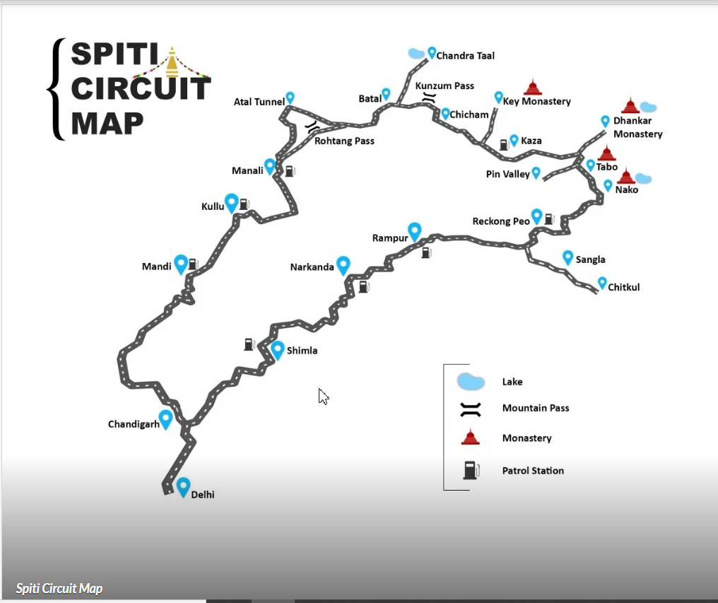
The Route for Spiti-Kinnaur bike trip usually taken, is from shimla to manali or the vice-versa. But as we have to drop bikes back to Manali, so we chose a customized round trip route starting from Manali.
Manali-Chadrataal-Kaza-Tabo-Nako-Kalpa-Rampur Bushahr-Jibhi-Kullu-Manali.

The route from shimla to manali via Rohtang Pass which joins our customized route at Katra near Rampur is supposed to be better in terms of acclimatization. But, the quality of roads get worse as you take shimla to manali route.
So you have to chose between quality of roads and acclimatization.
We chose to start from manali to kaza, so as to add more thrill to the trip.
Day-1 (Manali to Chandrataal via rohtang)
After having breakfast, we loaded the luggage on bikes filled the fuel and started the much awaited safari to Chandrataal at 10.30 am in the morning. The plan was to reach chandra-Taal before sunset and witness the moon-rise in the sacred lake.

It was enthralling to see the snow clad mountains of rohtang pass in a clear blue sky
On the way down the rohtang pass, we missed the road to kaza and drove 3km ahead towards Keylong, where we were stopped by state police which then guided us back towards Kaza . We had a quick brunch with a cup of tea and maggi, before returning back.

The first shock wave

On our way back to the road towards Kaza we all were puzzled. We were wondering as how we could not find the diversion? How everyone can miss the road?
Then to our surprise, when we asked for the way to kaza, a passer-by pointed his finger to a narrow trail downhill. We were abacked to see the road as we could hardly find any road.
There was a silence among us, all the charm of driving on metal roads since morning was lost somewhere. We murmured in an indistinct voice "Kahani to ab shuru hui hai".
The flash of shocks with wet socks
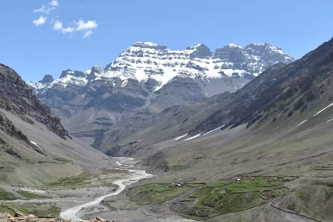
I won't say it was a rough road. It was not a road at all. It was a dried up river with pebbles, cobbles and large boulders. As we progressed the small pimple started growing into an ulcers.

While having maggi at keylong check-post we were asuming that we will reach chandrataal by 3.30 pm or may be by 4pm.
It was 4 pm and we drove only 10 km from where we started. We got splashed with ice cold water streams and our socks got wet.
We Squeezed the socks, wore them back and headed towards next challenge.

The Sign Boards
While driving on such deadly roads you start understanding the importance of a sign board.
A sign board brings hope. A sign board says that there is an end to your pain. Sign boards a so motivating. On such roads you do feel connected to sign boards.
One such sign board was of a village "CHATARU- 10 km". It filled us with motivation. All of us thinking that CHATARU must be a village. If its a village, there will be good road, a tea stall and a rest house at least.
To the most unpleasant surprise to all of us, CHATARU was just a a broken bridge, after reaching which, we got to see nothing but another sign board CHOTA DARA-17km.
Chota Dara meant Bada Danger

The road got even more dangerous to drive, you have to sail through flowing rivers.
The bike silencer and engine which went red hot because of running on first gear since noon, use to make sizzling sound with a sudden outburst of steam every time water gets splashed on it.

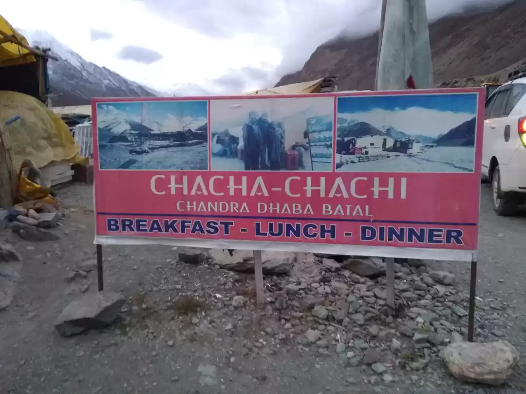
We reached chota dara around 5.30 pm which was again not a village but an abandoned house, which they say is HPPWD Rest house. What motivated us was another sign Board BATAL-14km.
It took us 1 hour 30 mins more to reach Batal. Batal is a camping site set up by some local villagers. It was 7 pm and we were all drained. Few hours back we made our mind to stay at Batal for the night.

But then out of sudden we decided to go ahead and reach Chandra-taal camp which was another 17km from batal.
"It's when the pain crosses the edge of your endurance, your pain becomes your obsession"
We were all squeezed to the extent that nothing mattered but to reach our destination. When we started moving ahead, the sun was about to set and very silently we kept on moving on our way to Chandra-taal.
Crossing two major waterfalls which were on their maximum flow, we reached Chandra-Taal camp at 8.30pm with sodden socks and shoes, it was difficult to walk.
A fear of frostbite was making us more eager to remove the shoes at the earliest. It felt like near zero temperature. Had dinner which turned cold before we ate. Only thing available hot was water. We filled our bottles with hot water and held it below our chilling foot soles. This somehow helped to save ourselves from hypothermia.

This was the first time I slept with a jacket and socks on.
While others thanked "The Monk who saved the Safari".
Day-2 Chandra-taal to Kaza
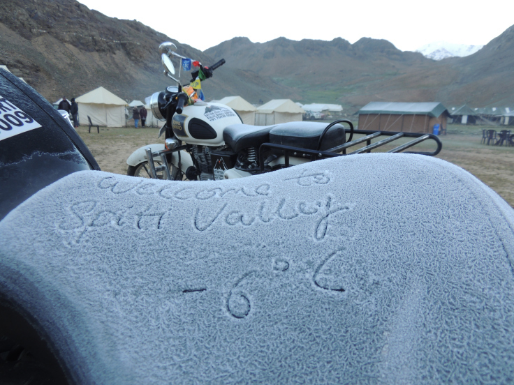
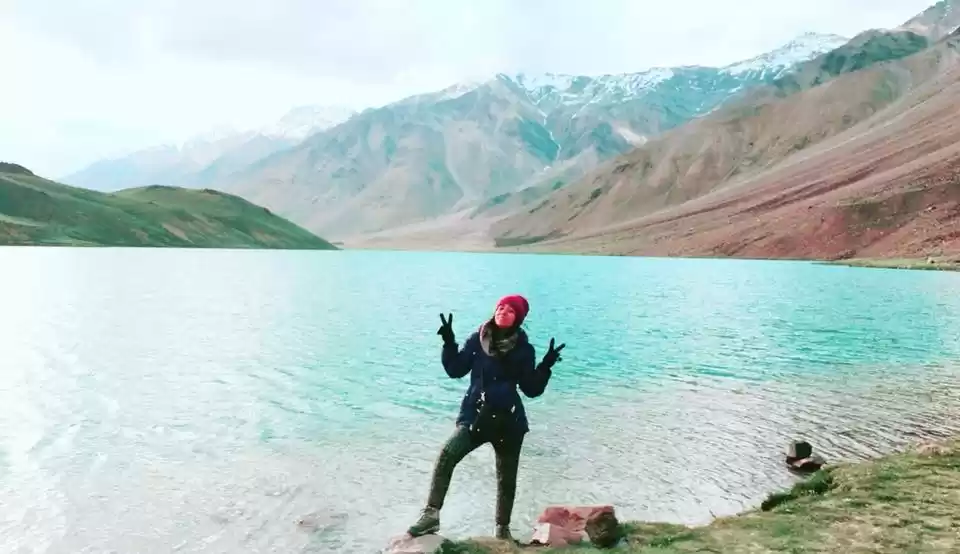
It was a cold night (-6 Degree Centigrade), we woke up at 05.30 am and was feeling refreshed. Though the back was aching but the view around the camp took away all the pain. After a hot tea we drove uphill to reach Chandra-Taal Lake. We dropped bikes at the nearest point and trekked uphill to witness the breath taking beauty of Chandra-taal.
It was a new day, a new beginning. A day which started with the most beautiful sight of our lives. Its was truly miraculous.

"Agar Firdaus Baru-E-Zami ast, Hami asto, Hami asto Hami ast"
They say it for Kashmir valley, I say it for Chandra-taal.
Off to Kaza
After having Breakfast and having packed our bags, we wrapped our feet with polythene bags and wore our frozen shoes to start our journey to Kunzum top .

Having seen the worst, the roads seemed better to us. Kunzum top (4590m- 15060Feet) was a snow clad mountain peak with a Gompa.
Driving down the Kunzum top came some beautiful camping sights. We stayed for few minutes and had a cup of tea recalling all the pains of yesterday and enjoying the beauty it fetched.

Then came the first inhabited village called Losar. Losar is situated at an altitude of 13,400 feet above sea level. The best part about Losar was it had a BSNL tower. We borrowed a mobile from locals and made a call back home. Had ample of water and started the ride further.

We lost our way and took the road to Chicham and traveled around 3 km to stop to an scenic valley. Luckily we checked the map and found ourselves on a wrong route.

We drove to the village called HAL, where we had Maggi for lunch.

There came a village called Rangrik. Rangrik is a small village with a small primary health care center. A rare sight on this part of the world. The children were very fond of bike riders. They stood in a line to give a clap, which seemed to be a pleasant gesture to us.

The road after HAL Village was just awesome. This was the first time we found a metal road since two days. It took us only half an hour to cover 21km distance from HAL to Kaza, Our destination for day-2.
Kaza is a village situated about 12000 Feet above sea level with all required amenities. We checked in to a guest house at Kaza at 5 pm and took rest for 2 hours. Then we took our bikes for preventive maintenance and tighten up the clutches and brakes.
We had a re-freshening drive at Kaza Market.

The evening in Kaza was just awesome. We had samosa and Jalebi in Kaza Market. Bought some snacks and enjoyed the night, shooting the stars of the clear sky at Kaza.

Day-3 Kaza to Spillow
It was lazy morning, The back was aching but we had a plan for this morning. We took our bikes and drove to Kibber village and visited the Key Monastery. It was a beautiful sight this morning. We had to trek on a steep hill in order to get some good shots of this monastery.
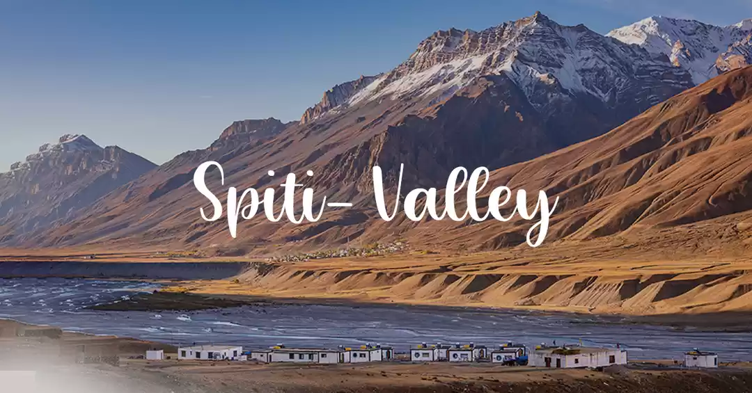
It is the biggest monastery of Spiti Valley and a religious training centre for Lamas.
We then moved to Hikkim to see the world's highest Post office which was located 26 km uphill at an elevation of 14567 feet.
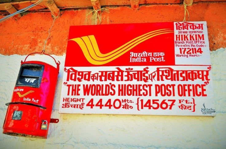
We drove back to Guest House by 09.30 am. Had a spicy Aloo Parantha and got set for the day's trip.
Before starting from Kaza, we re-fueled the empty petrol cans from the World's highest petrol retail outlet at Kaza, situated at 12270 Feet above sea level.

The plan was to reach Tabo, located 50 km from Kaza. The roads on NH-505, after Kaza was just amazing.

Being tea freaks, we always look out for some off road location to sip a cup of tea. The same happened while driving along the river Spiti. We parked the bikes and trekked downhill to reach a small beach on the banks of river Spiti.

On the way to Tabo came a Village called Dhankhar. Dhankhar Gompa is situated in this village on an elevation of 12774 feet. It was also of the same architecture like Key and Thiksey (Leh) like fort monasteries.

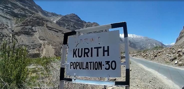
Then came a village named Kurith, with population of 30. It was something unique to see. In northern India, a single family has more members than what this entire village had.
We reached Tabo at 12 noon, covering 50 km in just 2 hours. We kept on going as it was still the entire day available to us. We targeted Nako which was another 60 km from Tabo.
On the way to Nako, falls a village called Gue village, which is said to be an ancient village. It has the 500-year-old mummified remains of the buddhist monk, Sangha Tenzin.
The region being located on Indo-Chinese border has deployment of ITBP whose headquarter is located at Sumdo.

We reached Nako at 03.30 pm. Thanks to the smooth roads we have done a good 110km with about 3 more hours left for the day to drive. We had an awesome lunch served at Moon Lake Restaurant, Reo Purguill Hotel. This is a favorite stop to majority of the bike riding groups.
We visited the Nako lake, with ongoing beautification work. We started our journey to Pooh.
Pooh, also known as Spuwa (altitude 2,662 metres or 8,736 ft), is a small town in Kinnaur district, Himachal Pradesh, India. The approximate population given within a 7 km radius of the town is 1,192.
It was 5.30 pm and we still had some spark left to travel further, which may be due to the quality of ride we had this day. We moved ahead to Spillow another 20 km from Pooh.
Again to the most unpleasant surprise, the road from Pooh to spillow is in real bad shape. With heavy winds, the risk of shooting stones was there. We witness small gravels falling on the way. Thank god we had our helmets on.

This sign board was adding to the fear. But after 1 hour of hectic ride we reached Spillow.
We covered a handsome 180 km on day-3. It was motivating to see that we covered almost half of the circuit at the end of day-3.
The best part about Spillow was it had a small market and network connectivity. It was after three long days that we had access to mobile networks. We made calls at home. Had a heavy hot and spicy dinner and went to sleep at 10 pm.
Day-4 Spillow to Rampur Bushahr
It was a lazy morning. We woke up late and after having the favorite Aloo ka Paratha we started at 11 am towards Rampur Bushahr.
For around 30 km from Spillow the road was in bad shape. The repaired road comes in patches. There was an ongoing road broadening work on this route. Here, I must thank the Boarder Roads Organization, these people really work day and night to make it possible for the travelers like us to reach such far flung areas.

On the way came two beautiful waterfalls. The water was chilling. We sank our Frooti cans in it and had a chilled frooti there.
The day brought a lot of greenery and scenic beauty. The barren mountains of spiti was now replaced by lush green hills of Kinnaur.

On the way to Rampur came JSW Power's Karcham Hydel Power Project with 300+1000MW installed capacity on Satluj river.

Then came the Nathpa-Jhakri Project of Satluj Jal Vidyut Nigam.
We reached Rampur at 5 pm and decided to go further. In no time we were at the diversion point of NH-5 (towards Shimla) and NH-305 (towards Manali).

There was this beautiful hotel located named Hotel Atul Regency. After done 170 km for the day, it way our stay for day-4.
Day-5 Rampur to Jibhi
After a delicious breakfast at Hotel, we started early that day. Having traveled just 10km came the pleasant surprise. "The Rain".
The only experience missing in this trip. We covered the luggage with rain cover and swamped ourselves in rain. We stopped for a hot masala tea, which was one of the best we had in the entire trip so far. May be it was the weather that added to the flavor.
The route ahead was lush green with shades yellow and orange and red. It was full of colors. The aroma from the trees and flowers was making the journey even more enjoyable.

We reached a beautiful camping site called Anni. It appeared like a heaven in this weather. The lush green grass land, with cedar trees and the cloudy sky was making it a picturesque landscape. The best you can get for camping.

We had a short brunch with a cup of tea and maggi here and moved to Jibhi which was another 12 km from here.

Jibhi is situated on the banks of small water streams. The beauty of this place is in its isolation. It is located in a dense forest. We reached the place at 4 pm. Played cricket in the evening and cards till midnight.
The sound of the flowing river was adding to the charm during a cozy sleep at the camp.
Day-5 ended on a relaxing note.
Day-6 Jibhi to Manali
We started at 10 am and covered the distance till Manali in less than 5 hours.
We stopped at another river side parking to feel the freshness.

We reached Manali by 4pm. Checked into the hotel and rested the whole day long.
We bade adieu to Himachal on the very night.
____________________________________________________________________________________________
A trip that started with an unbearably tough challenge on day one, has ended on a pleasant relaxed note. While crossing through Chota-Dara we all were susceptible. We thought "Boht Bada Panga Le liya". But as they say " Dar ke Aage Jeet hai...." things kept on getting better. And on this day when we look back to the journey we went through, makes us feel proud and contented.
The journey was complete in all sense. We witnessed snow, dust and rains. We faced the scarce air, not even enough to breathe to a place full of fragrances and aroma.
It was full of challenges and natural splendor.
I must say
"Spiti is the next level to all those who have been to ladakh for a bike ride" "The Spiti is a sacred beauty, untouched and into its youth"
For more such out of the box travel destinations visit my personal blog www.lonelymusafir.com
____________________________________________________________________________________________
Credits: Akash Shekhawat (For Navigation), Alok Shekhawat (For Photography) & Rahul Bhardwaj (For Sigma)

