Four inches of rain every thousand years, the Atacama desert in Chile is the driest desert in the world. Thanks to the Andes this area hardly receives any rainfall. But, that doesn't mean it is devoid of adventure. The Atacama desert has some of the most picturesque landscapes, lagoons and mountains. Little cultural towns weaved into the majestic sand dunes and mountains characterize this place. This has got to be one of the most interesting places that I have traveled to.
If you are going to the Atacama desert, it is more than probable that you will stop at San Pedro de Atacama, a small, but the main town in the Atacama.
San Pedro de Atacama is located at 2,436 m above sea level in the Second region of Chile in Atacama desert, which is the most arid desert in the world. San Pedro is the so-called archeological capital of Chile located at San Pedro River with the Domeyko Mountain Range to the West and the Andes Mountain Range – Puna de Atacama to the East.
San Pedro de Atacama has a high altitude desert climate with strong winds, big changes of temperature between the day and the night, intense solar radiation and strong evaporation caused by the Sun nears the Tropic of Capricorn. The town is named after its saint, San Pedro and Atacama comes from the word Accatchca in the Cunza language which means Head of the Country. The word changed over the time until the present pronunciation.
Cejar Lagoon is located on the altiplane Andino Del Norte de Chile in the place called Salar de Atacama – Atacama Salt Flat. The lagoon was formed by the progressive accumulation of salts precipitated from an old salt lake. The beautiful blue waters amidst the salt flats makes for an oil painting. All the lagoons here appeared slowly – they are of volcanic origin. The water there is from the rain and, partly, the subterranean water. You can see some flamingos, ducks or if you are lucky, a fox as well. With the Sun, the Cejar and Piedra lagoon change their color to turquoise blue. In between the lagoons in the back, you can find healing mud and use it for your body to get a smoother skin like I did.
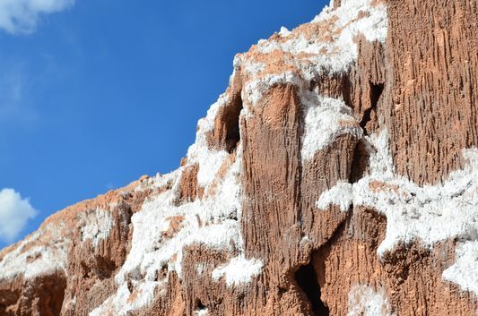
Valle de la Luna in Atacama desert – the Moon Valley forms part of the Cordillera de la Sal – Salt Mountain Range which lies between Domeyko Range and the Andes, just 19 km from San Pedro de Atacama. This place will take your breath away. No vegetation, no animal life, no humidity and yet so beautiful! It was declared a Nature Sanctuary and no wonder why. We explored the Cordillera de la Sal - Salt Mountain Range with caves, white salty surface on the ground, grayish sand and huge, reddish rocks forming the canyon all around.
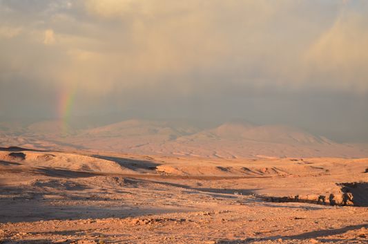
The Death Valley is located just 4 km West of San Pedro de Atacama and it was an emerged lake where the old horizontal layers of sediment and rock were pushed and folded, 23 million years ago, leaving some layers in a vertical position. With time, rain and wind made enormous mineral structures in the valley that we can see nowadays. It is possible to do Sandboarding at 120 meters long dunes of the Death Valley.
For me, Valle de la Muerte was a place with really strong winds, a stunning rainbow and the best view ever.
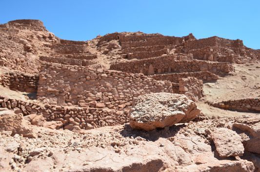
Being a great fan of archaeological sites, I decided to explore Pukara De Quitor. Behind the ruins, the view of the San Pedro river was just stunning, and down the ruins there were the Andes on the horizon. Pukara de Quitor has been a national monument since 1982 located just 3 km Northeast from San Pedro de Atacama. It is situated on the slope of Cordillera de la Sal overlooking San Pedro river.
Pukara is from Quechua and means fortress. The name comes from a pre-Hispanic agricultural group Ayllu de Quitor whose fields start at the base of Pucara. It is a pre-Inca construction made on a hill from the hill, i.e. from the stones of the hill. The rocks are connected to the other ones by using mud. Pukara de Quitor ruins look like a fort with defensive walls. It did have defensive and strategic purposes, but it was also inhabited as parts of bedrooms and kitchens were found.
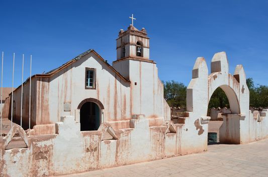
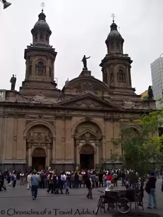
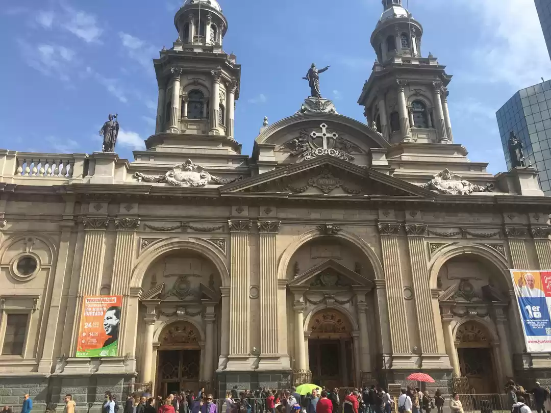
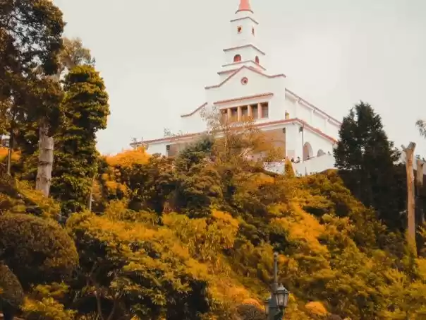
In the vast Atacama Desert lies the interesting little town of San Pedro De Atacama. The church here is one of the most interesting churches I’ve ever seen. We are not sure about the exact year of its construction, but since 1641 it has served as a parish and it was declared a National Monument in 1951. The white walls are made of adobe and the ceiling of clay, locust tree, Chañar tree and cactus wood. I really enjoyed this church, it has some magic. Like from a different world! On the 28th and 29th June the celebration of the patrons of the town, Saint Peter and Saint Paul, takes place in the church.
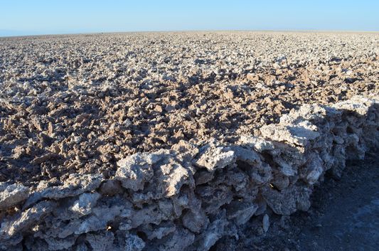
Salar de Atacama – Atacama Salt Flat at 2,300 m above sea level has a surface of approx. 320,000 hectares. The salt crystals are produced by the underground water evaporation by heavy saline load. The water comes from the Andes. Salar consists of different salt crusts, such as plane dry sulfate crusts, up to 70 cm high chloride tough crusts, chloride polygonal structures and even charcoal stones. Salar de Atacama is different from any other salt flat in the world. It is not just made out of salt crusts, but it also has some vegetation and diverse fauna and flora.
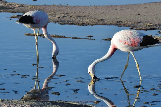
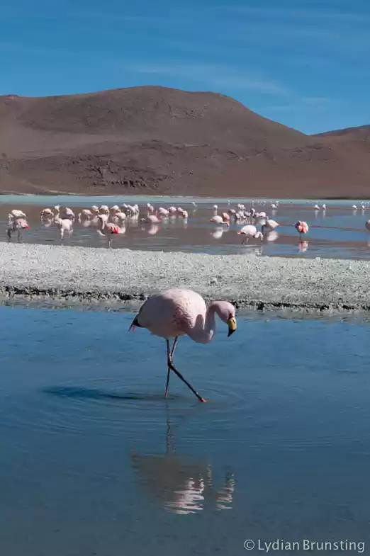
Laguna Chaxa is a muddy, shallow lagoon. Being a part of the National Reserve Los Flamencos, Chaxa is a protected area. Its incredible scenery and geological conformation are home to pink flamingos and many other birds. Mostly home to Flamenco Andino – Andean Flamingo, but sometimes Flamenco Chileno – Chilean Flamingo and smaller Flamenco de James – James’ Flamingo can be seen. In 2011 there were 1,788 specimens of Andean Flamingo counted in Laguna Chaxa but the majority of them leave the lake during reproduction as they need privacy and not people staring at them. The interesting fact is that if the flamingos don’t reproduce nor sleep, they eat the rest of the time.
Socaire is the last Eastern Chilean town before Argentina border. It is exactly the place where we can see both big invasions at the same place. First, the Inca one, which is agriculture and cattle, and second, the Spanish one and its catholic church just next to the Inca vegetable and fruit terraces. Socaire is one of the best examples of Atacameña culture (culture of the Atacama people in Atacama desert) of the so called Lican Antay people who changed their traditional nomadic way of life once they settled in Aldea Tulor. These people of the Cunza culture now all speak Spanish language and not the original Cunza one anymore, which was another result of the Spanish invasion. Nowadays there are around 400 people living in Socaire whose main source of work is agriculture and non-metal mining. In the past Socaire used to be an important village because of its gold mines.
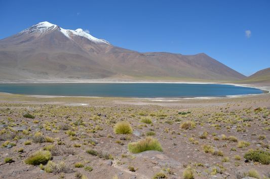
Laguna Miscanti used to be just one lake/river with the water going freely to the Salar de Atacama. But the volcano Miñiques after one eruption left a lot of lava stones, which divided the lake into two (with Miscanti on the left and Miñiques on the right – when you come by car; or a bigger Miscanti in the North and Miñiques more in the South). The blue color of both lakes with the white coasts shine in the brownish and grayish nature surrounded by the snowed peaks of the mountains. It is prohibited to walk out of the designated path to protect the biological habitat along the lakes where the vicuñas pass. In the winter, the surface of the lakes get frozen as the temperatures get to 30 Celsius degrees below zero.
There is a fully-equipped cabaña at Miscanti lake for 3 people if you would like to stay overnight – 20,000 pesos per person per night.
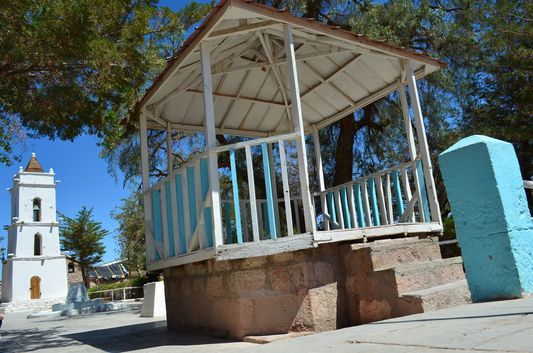
Toconao, a traditional village, so called Hidden Valley, located at 2,485 m above sea level is characterized by its liparita buildings (white soft stone of volcanic origin.) Its first inhabitants came here approx. 11,000 years BC. Nowadays, around 700 inhabitants live in Toconao and they practice ancient traditions and customs and many activities to stay connected with the environment that surrounds them (mountains, animals, water, earth, sun, vegetation). The nicest parts of the town are its square, church and San Lucas bell tower built of stone and mud in 1750.
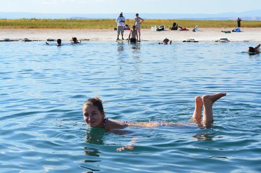
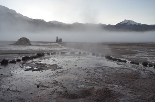
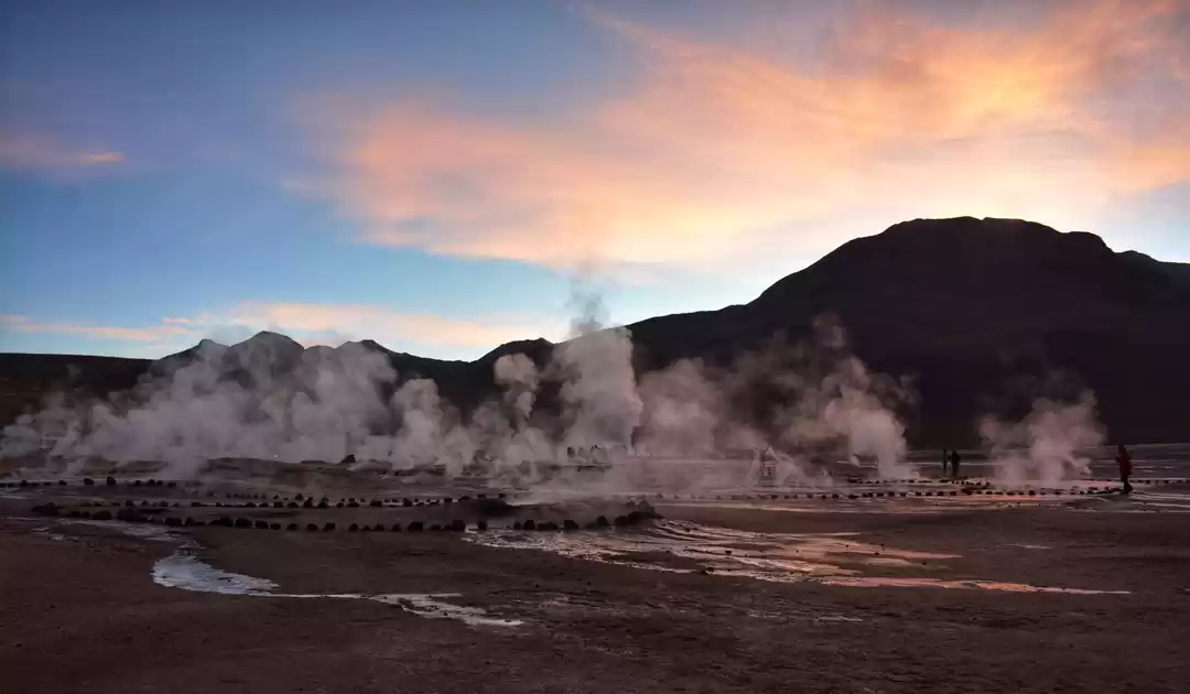
I was looking forward to visiting the geysers at El Tatio. Walking around, we learned from our cute Inca guide that the Tatio Geysers reach the temperature of 85°C and that this geothermic field of volcanic origin is a mysterious place with 40 geysers, 60 hot springs and 70 fumarolas extended over 3 square kilometers. After freezing our asses off walking around the geysers, the sun started to come up and we could get rid of the gloves and the hats and the jackets. It was not below zero any more and it was exactly the time when we reached the hot spring. Surrounded by the colorful mountains, the brave among us stripped off to bathing suits and soaked in the hot spring. Some parts were not as hot as I thought they would be, some were too hot to stay there for longer. It is actually not healthy to bath in there for longer than 20 minutes.