My journey starts from Kolkata, India. However, this 9 days comprises of starting the trek from Salleri/ Phaplu and ending at Lukla.
26th March, 2023
What a day! Mesmerising view. Excellent weather.
We left early at 6:30. It was a beautiful terrain with blue sky.
Phaplu, at the elevation of 8,035 ft, is one of the iconic airstrips of Nepal which features vibrant terrain, constantly changing weather, and aggressive wind factor jointly inviting harsh circumstances for flight operations.
The airport completes the majority of flights by early morning due to the wind becoming challenging later in the day. There are no regular flight, only 2 times in a week. The adverse weather conditions at Lukla airport sometimes lead to diverting of flights to Phaplu.
From Phaplu one can comfortably trek up to the Namche bazzar, experience with the lower Everest part Sherpa culture and less touristic traffic areas: Phaplu, Nunthala, Kharikhola, Surkhe. Then join the regular traffic places Phakding, Dudhkoshi river valley.
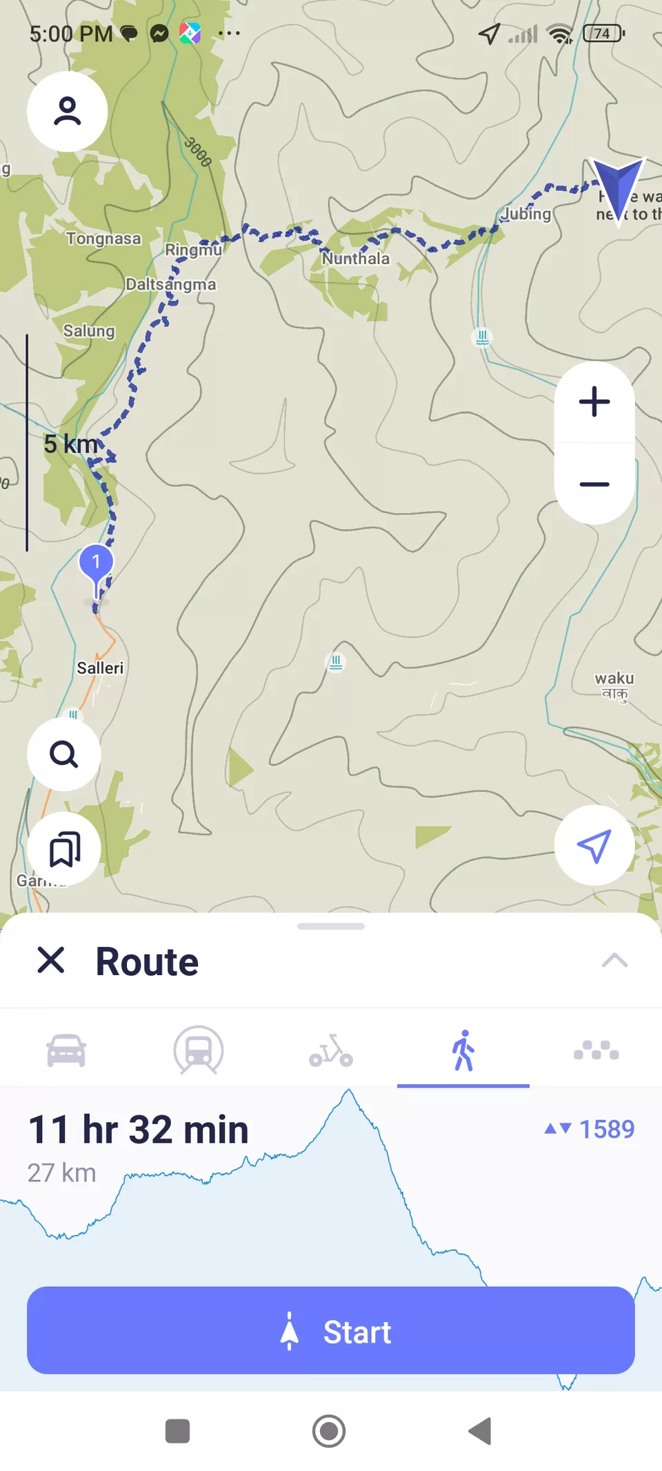
There are vehicles to Thamdara. But i say, you will miss the actual beauty of the mountains if you go by vehicle. Better to trek through the jungle and Sherpa villages. The trail is well marked with lucrative shortcuts. Vehicle road is a totally different trail from Salleri to Thamdara.
There is a gentle ascent all the way to Ringmo, Nunthala, Juving and in the end arrive in Kharikhola. The trek goes down to the Dudh Koshi River passing thru farming terrace land and small Rai and Sherpa settlements. This basic trekking route from Phaplu to Everest Base Camp Trek is spectacular. It pass through Buddhist Monastery at Taksindhu La, 11000ft, thru rhododendron and oak forest.
There is a nice stream just before entering Nunthala. How can i miss that. The stream was chilling. Took a nice shower in the stream. All pains gone. Full of energy.
Reached Nunthala at 12:00. Had sumptuous lunch. Dal bhat.
Started again after lunch. It's going down down and never ending steep down.
Reached a cable bridge. Now after crossing the bridge it's the climb and distance left is 5.7km. It was a killer climb. The never ending climb ended at Kharikhola. 7150ft. But all stress, all pain just gone away with the beautiful Kharikhola.
Today it was a walk of around 30kms with ups and down ...as down as 3000ft and as up as 12000ft.
Flight from KTM to PPL: 5590INR
Hotel with dinner at Phaplu: 1000 NPR
Vehicle from Salleri to Thamdara: 2200NPR. (walking is preferable)
Lunch at N: 650 NPR
Ncell is active in Phaplu and throughout the trek to Kharikhola.
Indians can get a genuine Ncell SIM on his/her own name by showing Addhar card, in no time.
Porter: 2500NPR/ day
Horse back: $100/day


27 th March 2023.
Good hiking day. By the way, crossed Lukla on the way.
As usual, started early at 6:40 am. Muscles were speaking. The body needs a warm-up.
Kharikhola (named after the river) is actually one of my favorite villages along the trek. Its houses and lodges were very typical of Sherpa architecture: neat two-story buildings of hand-hewn stone, with copious windows, brightly-colored wood trim, and a front door that opens directly onto the main trail -- sometimes with a flagstone patio, and perhaps a prayer pole. Vegetable gardens, marigolds, roses, cosmos, and banana trees filled the green spaces around the houses.
This day is probably the hardest -- the ups and downs were difficult, and the morning sun was relentless. By evening, it had started to cloud up, a weather pattern that would recur every day throughout the trek. Reached the crest of the Khari La pass, I stopped for a breather.
Reached Bupsha at 9. I had some dry fruits. Giving a lot of energy. However, before reaching Bupsha you have to cross the Kharikhola river . Then a steep climb. You climb, climb and cross Bupsha, cross Kare until you reach Kari La (10200ft).
After crossing Kari La, met some local guides going to Lukla from their villages They were quite fast. Laxmi ji, my porter, was a bit slow. Instead of taking the normal route, they took a shortcut. you have to climb through a muddy jungle. I tell u, they are serious shortcuts. Sometimes climbs are more than 60°. Don't know if I have gained distance or not, but it was exciting.
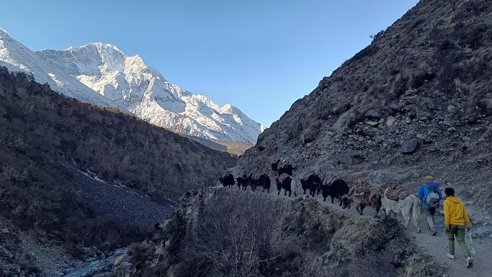
Seems it rained yesterday. It was very slippery. I fell a number of times. It was muddy filled with horse and cow dung. The mules and yaks to the EBC trail goes from these surrounding villages.
Meanwhile, Laxmi ji who was far behind me thought that i got lost in the jungle. He went up and down in different trails looking for me. I was really sorry.
When i reached Puiya, I heard blasting of dynamites. It was on the opposite hill of Puiya , but i was there a hour back. No earlier intimation. Infact the local guides also felt themselves safe and smiled. They were constructing roads.
Had lunch at Puiya. It was 11:30. Moved further towards Surke crossing Chotuk La.
After Chutok La it was a dangerous descent, within bolders and muddy path. Legs are just gone.
Reached Surke. From Surke it's climb but decent climb... Very enchanting view, down we can see Dudhkoshi river. Surke was once believed to be a lake. Surke is a town built upon a fertile land and damp environment. Surke is situated on the bottom of the hill in a river bank.
Reached Chaurikhara, it's 3 and it started drizzling. We plan to stop at 4. Now the path is very beautiful. Full of calm and quiet guest houses at every 10 to 20 m.
Nice to walk through the downtown in Cheplung. This is the village from where we can go to Lukla airport.
Today the distance covered is 20 km Time taken 8 hrs
Hotel with dinner at Kharikhola: 1000NPR
Wifi: 200NPR (as Ncell tower was not there in Kharikhola)
Sherpa tea: 120NPR [this tea is salty, made of sattu (a mixture of roasted ground pulses and cereals)and butter]
Lunch at Puiya: 300NPR
Porter: 2500NPR


From my room at Cheplung

28th March 2023.
It was a chilling morning. It rained last night.
Started early in the morning at 06:30. Destination Namche.
Initially it was a level trail. Passing through beautiful villages. Nurning Ghat was the best in beauty. Toc Toc has some breathtaking water falls and streams. It was morning so I couldn't take a shower in one of these falls.
Two permits: one at Toc Toc.... The municipality's tax and the other Sagarmatha forest permit at Mojo.
No, a guide/ porter is not a must. I asked them specifically... even for the solo travellers.
But i took a porter, and still now I can feel his importance. You walk your own way and he will just support you.
After crossing Phakding, it was a busy road. You have to dribble through other people if you want to go fast. The importance of your own guide comes here. If you follow someone, he will be either too fast or too slow. You miss your pace.
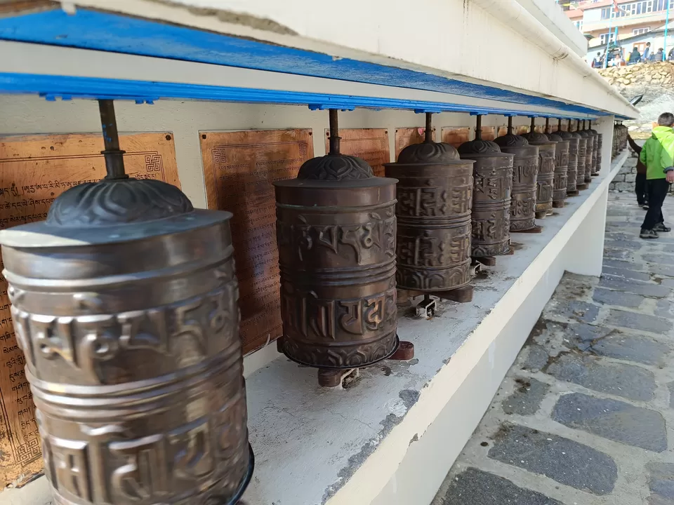
After crossing Mojo, it is of steep descent to Jorsalle. At Jorsalle, we had lunch. I was hungry and the lunch was awesome. After Jorsalle it's pure climb through the forest. Here we can see the double cable bridge. Along the way you can notice several Monesteries, Chortens and prayer wheels. Observe the scenery of beautiful Sagarmatha National Park. I didn't see any animal, but this National Park has red pandas. You will cross several suspension bridges clad with prayer flags.
The weather is too good. It was a serious climb. Good time to reach. Booked a cozy room with a great view. Namche is a Himalayan town with interesting shops, fabulous foods, stunning view and culture. Namche bazar is a traditional trading hub that paves your way further up to the ancient monasteries in Tangboche and Dingboche
My initial plan was to spend another day at Namche for acclimatisation. I reached quite early. Reached Namche at 1:30pm. I roamed about Namche in the evening. It was an awesome feeling. So plan to move on to Tengboche tomorrow morning.
Hotel with dinner at Cheplung: 1100NPR
Lunch: 400NPR
Pass:(1500+2000)NPR
Porter: 2500NPR



29 th March, 2023
A very beautiful day. I started early in the morning at 6 am.
After Namche, it's a steep climb. The first glimpse of Mt Everest appears after this climb. But huge Amla Dublam seems touch-able. The path is breathtaking.
After 1 hr from Namche, the beautiful Khumjum village is located. What a view from Khumjum. If you reach Namche early, it's better to stay a Khumjum than to stay at Namche.
The path now goes downhill goes to Phunki Thanga. Picturesque path. Be very careful, there is chance of slipping on the trail. It's filled with boulders. Throughout my trek I didnt have breakfast. I start the morning session with my packs of mixed dry fruits. I had 200 gm packet each day. This provides lot of energy. As this trek is quite commercial type, leaving early is very important. You cannot wait for the breakfast, instead you can start early morning. Have some dry fruits. On the way have some fresh lunch. Normally, they cook after you order. So food is always fresh throughout the trail. You are always ahead of the crowd. Easy to get hotels at your destination if it is not pre-booked. AT Phunki Thanga there is a check post to check the permits. After the checkpost, there is a steep climb uptill Tangboche
Tengboche itself is very beautiful. It snowed yesterday. Monastery is on the left side. After Tengboche, the path goes down to Deboche. Due to melting snow and continuous movement of trekkers and yaks, the path has become muddy and in some places icy. Icy places are very risky. You will slip at no warning.
Reached Deboche at 11. Had lunch. Now Laxmi ji started revolting. If you do so quickly, what will happen to my earning. You please see for any other guide, I am not going. I offered him 50% more than Initially fixed. He was happy.
I want to trek on my own rhythm. Whatever my body suits.
However, I reached Pengboche at 1:30. The last stretch was a steep climb and after having lunch it was more difficult.
Today 13km was covered. And now I am above the 10000ft barrier.
Tomorrow it will be Dingboche
Hotel with dinner at Namche: 1000NPR
MOMO: 500NPR
Lunch at Deboche: 850NPR
Porter: 2500NPR




30th March 2023
What a day!
Destination Dingboche
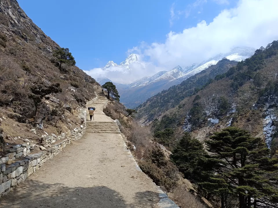
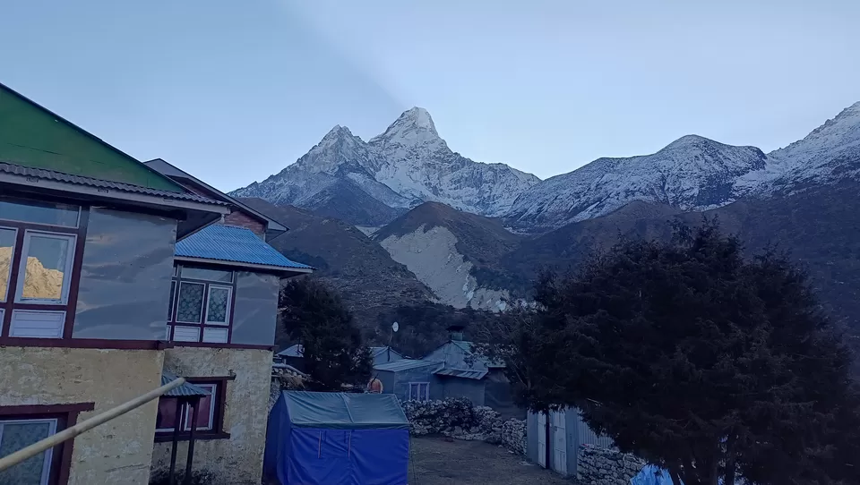
It's a 3hrs walk. The morning was very bright. 360° view of snow peaked mountains. We are on the left side of Ama Dablam.
It was steep climb to Dingboche. Reached Dingboche at 9:30am. Ordered some dal bhat. Had a great brunch. Nuru Sherpa, owner of the hotel is very friendly. It was great to listen all his stories. He use to take climbers to the peak four-five years back. Climbers normally carry 12 kg load, whereas they carry 15 kg, taking account of the extra oxygen bottle for the climbers. What they ate? What they drank? How tough is the life in different camps? They stay at different camps. However, their total stay is for 72 days. They are paid quite good.
Dingboche was an acclimatisation station. Earlier plan is to stay for 2 nights . It's at 14500ft. But I reached so early. Plan change. I plan to do the Dingboche view point today itself. It's a tuff 3hrs climb to 15500ft, get some splendid view of Ama Dablam. Glaciers on the other side towards Lobuche.
What a great view. Reached on top at around 1:15pm. It was very windy. It was chilling at the top. Spend some half an hour behind some rock. Came down quickly in an hour.
Met a very nice person on the way. He was Nepali coming from Canada. We had good coffee at the cafe. It was a warm environment in the cafe. Seems like sitting in some cafe on some busy downtown.
Throughout this trail, one thing is very common in every hotel. The dinning hall. Well furnished. In the middle of the the dinning hall there is an iron chamber which has got a chimney. Wood and dried yak dung are burnt inside the chamber. Its very cozy and warm inside the dinning hall. You can order any menu. Menus are continental, Chinese, Japanese, Korean and even pop corn. Alcohol is also available. All the sojourners of tonight join here. Everyone has his/her own story. But I tell you its so warm that after few hours you cannot sit near the iron chamber. Its warm even if its snowing outside. The hotel owner will light the chamber, even if there is only one person at the dinning hall.
However, today it was good hike of 7 hrs from Pengboche to Dingboche. From there to view point and back. Means everything above 14000ft.
Seems acclimatised. Ready for Lobuche tomorrow.
Hotel with dinner at Pangboche: 900NPR
Hot drinking water at Pangboche: Free (It is hotel Juvine. owhere it is free in the whole trail)
Porter: 3500NPR


Achieved. EBC conquered.
Today the plan is to reach Lobuche. 8kms of rise.
Left Dingboche at 06:30 as there was no need of any acclimatisation. Reached Thukla at 9:00. Had my lunch there itself. Pretty costly.
After Thukla, there is a steep climb to the memorial area. Prayer flags flapping, little Buddhist stupas everywhere (smaller stones stacked perfectly), with plaques and small shrines dedicated to the fearless climbers who have lost their lives on the mountains around us. Scott Fischer’s memorial particularly stands out in my mind, a symbol of accomplishment, inspiration, and a reminder of the great devastation these mountains have caused. He was on Mt. Everest and K2 (both without oxygen). Scott climbed not only for personal reward, but also to help others. Fischer was known as Mr. Rescue for his assistance in numerous high-altitude rescues. A sombre feeling swept across my mind for the rest of the hike. My mind was occupied with thoughts about the daring souls who so boldly climb these white beasts, their dedication to the sport they love, and the mountains unyielding dangers.
Reached Lobuche at 11 am. How can i finish my day at just 11. Continued walking and reached Gorakshep at 1:30.
Now Gorakshep is the costliest place in the EBC trail. You will have to buy drinking water. It's like 500 for 1liter. And water is a very essential item in trekking. Without water you can suffer mountain sickness.
However, plan is not to stay for two nights here. Throughout the day it was sunny with scattered clouds. But when I reached Gorakshep, it became cloudy. Wasting no time. I kept my baggage at a hotel and moved on for Everest Base Camp. It is a climb of 3hrs and return in 1.5 hrs.
After climbing for 1.5 hrs snowfall started. Initially it was light but later on it became dense. How can i return coming so close. No no no .... I kept on walking in the snow. All people were returning and i was moving fwd. I noticed one peculiarity in snow fall. They never fall vertically. They come horizontally on your face, into your eyes, inside your nose and are very sticky.
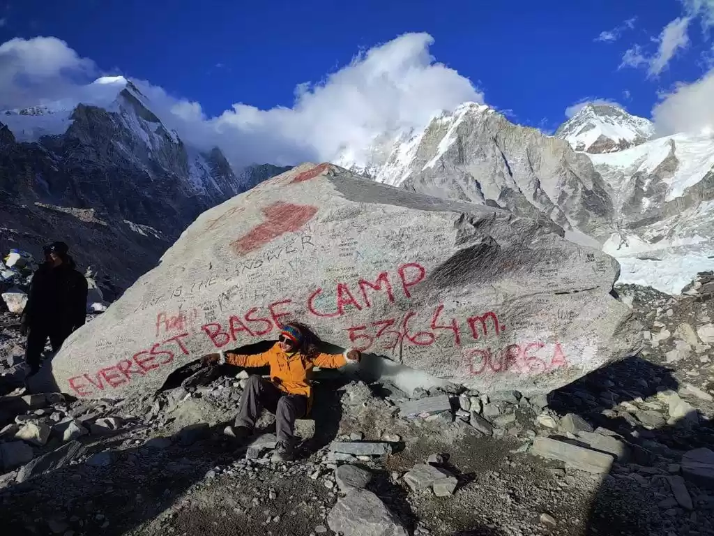
At last I reached. I reached. I reached my dream destination. Oh! What a feeling. Literally I cried. All tiredness gone. What an excitement. Felt like not returning. But my guide insisted that it is already getting dark and snow is falling very heavily. It will be very difficult and slippery while returning. The designated EBC is symbolised by a rock. It is at 200-400m lower than the campsite on the Khumbu glacier is rapidly melting and thinning out, which makes it unsafe for the trekkers.
At last the day ends with 11hrs of walking above 1000ft barrier. A total of 19 kms.
It will snow throughout the night. Tomorrow my destination is Dzonglha covering Kala pathar.
Hotel with lunch and dinner at Dingboche: 2000NPR
2 cups hot water: 400NPR
Lunch at Thukla: 800NPR
One cup hot water at Thukla: 100NPR
Porter: 3500NPR


1 st April 2023
Ghar wapsi.
When I woke up in the morning, outside the window it was totally white and foggy. It was extremely cold. Even the water in the buckets of the toilet has frozen.
The night was a wakeful night. One of the symptoms of mountain sickness is that you forget to breathe while sleeping. In the middle of the night when you wake up you feel like a lack of oxygen and start breathing faster.
Mountain sickness is such a symptom that, if you mentally feel that you are in mountain sickness, it engulfs you more and you are more into it. And this is fatal. Symptoms happen when your body tries to adjust to the lower air pressure and lower oxygen levels at high altitudes. Since your body isn’t used to higher altitudes, you have a greater risk for symptoms. It is said that higher than 10,000 feet, 75% of people will get mild symptoms . Symptoms, such as mild headache and fatigue, don’t interfere with your normal activity. Severe headache, nausea and difficulty with coordination. You’ll need to descend to start to feel better. You may feel short of breath, even at rest. It can be difficult to walk. You need to descend immediately to a lower altitude and seek medical care. HAPE and HACE are serious life threatening altitude illness.
HAPE (High-altitude pulmonary edema) produces excess fluid on the lungs, causing breathlessness, even when resting. You feel very fatigued and weak and may feel like you’re suffocating. HACE (High-altitude cerebral edema) involves excess fluid on the brain, causing brain swelling. You may experience confusion, lack of coordination and possibly violent behavior.
Today there are a number of decisions to be made :
- Go to Kala pathar for the best view of mount Everest.
- Go to Zonghla for Chola Pass or
Return back.
The morning weather with snow everywhere, dense fog and strong wind made me cancel the Kala pathar trip.
I didn't want to stay at Gorakhshep another day. It's not a place to stay for two nights. Had to leave Gorakhshep. The path to Chola pass is the same up to Lobuche. So i planned to walk up to Lobuche and then decide. Had a costly dal bhat at Lobuche, but i couldn't eat much. Maybe due to last night's bad sleep.
At Lobuche, the sky was totally cloudy, though it was not snowing. The hotel owner and number of other guides said that in this weather, the Chola pass is not safe. Wait for another three or four days.
So i decided to return back.
Followed a different route of return. Through Pheriche, bypassing Dingboche. This path is a picturesque, in the valley with a small stream flowing along. The place is full of birds.
When I reached Pengboche at around 2 , it started snowing. Entered into the same hotel I stayed at while going.
Had the weather been good, I planned to go to Tengboche.
Today I did some 18 kms
Hotel with dinner at Gorakshep: 1500NPR
1 L water: 500NPR
Lunch at Lobuche: 900NPR


02 April, 2023
The sky is crystal clear. It snowed heavily yesterday night. It's white everywhere. Started early morning for Namche. It's 7hrs journey.
It was snow everywhere. With the people and horses started thier day, the path has already become slippery. The crampons helped me on the way.
What a picturesque, the path has become. Trees have become white.
Had a good breakfast at Tengboche. The plan is to stay today at Namche so I was walking slowly enjoying the snow.
But when I reached Namche at 12:45, hotels in Namche are totally full. Started walking again. There were thousands of people on the way to Namche.
Reached Monjo at 15:00 hrs. Got a nice cosy hotel. It started raining after entering the hotel. Good luck.
Wow! The map shows 18km and time 14hrs. Strenuous day in the snow.
It was my most beautiful day in the full trail. The last night snow made the path picturesque. The bright sun light was dazzling with the snow. It was like sailing through a fairy land. The crackling sound of ice breaking, which is still not slippery, at every step, makes you feel you are in heaven.
Hotel at Pangboche with dinner: 850NPR (Pangboche was the cheapest. Hotel JUVINE )
Lunch at Tangboche: 650NPR
Porter: 3500NPR


03 April, 2023
to
All good things must come to an end. Today I will be catching a flight from Lukla, the most dangerous airport in the world.
Had to reach in the first half. Normally there are no flights in the evenings. I walked like a superfast train and reached Lukla airport within 4 hours. (14kms)
There is no flight to Kathmandu nowadays. Instead, flights go to Ramechhap. From Ramechhap it's a four hour journey by road to Kathmandu.
The trails were buzzing with fresh-faced tourists – eagerly making their way through the first stretch of their adventure. Some were meditating. Some busy with there morning stretching. Some clicking photos. All with bright faces, still lot of uncertainty. I remember seeing the returning flush-faced trekkers and thinking to myself that they looked a bit worse for wear. It felt like the new arrivals were looking at me to get an indication of what they were about to experience. How was it? Will it get tougher? Did you make it all the way? How’s the weather? While I don’t feel I looked as beaten as some of those I initially saw, it was clear my face was telling a story.
The last climb to Lukla airport is a never ending. The airport is surrounded on all sides by steep, mountainous terrain. The short runway is perched on little more than a mountain shelf (like bird nest). At one end there’s a wall and at the other a steep drop into the valley below. So short is Lukla’s runway that it slopes uphill with a gradient to assist planes in slowing down in time. There are no go-around procedures. Once an aircraft starts its approach, it must touch down. Given these factors, only helicopters and small fixed-wing propeller planes are permitted to land.
I got the ticket to Ramechap. I was the only passenger. As it is the start of the season, most people are coming to Lukla for the EBC trek. It was a chartered flight for me. Moreover, tour operators start from Lukla and during return, they prefer trekking down to Salleri or Ziri
The flight took off the moment I boarded the flight. Though there were few bumps in flight through the clouds, it was a spectacular journey through the mountains.
It was a smooth landing in Ramechap. On requesting to see the cockpit, the captain was very courteous. He explained to me that the aircraft is an L- 410 with GE engines. The L-410 is a Czech-built turboprop. Designed to operate under harsh conditions and extreme weather. The L-410 Turoblet works where most aircraft cannot, in rugged mountains and jungles, often landing on gravel or grass runways.
It is like a great day today. It was the fastest day, yet so beautiful.
That ends my dream trip to the EBC. The memories will remain till the end of my life.
Hotel with dinner at Monjo: 1700NPR
Flight Lukla to Ramechhap: 12225 NPR
Porter: 3500+5000 NPR


